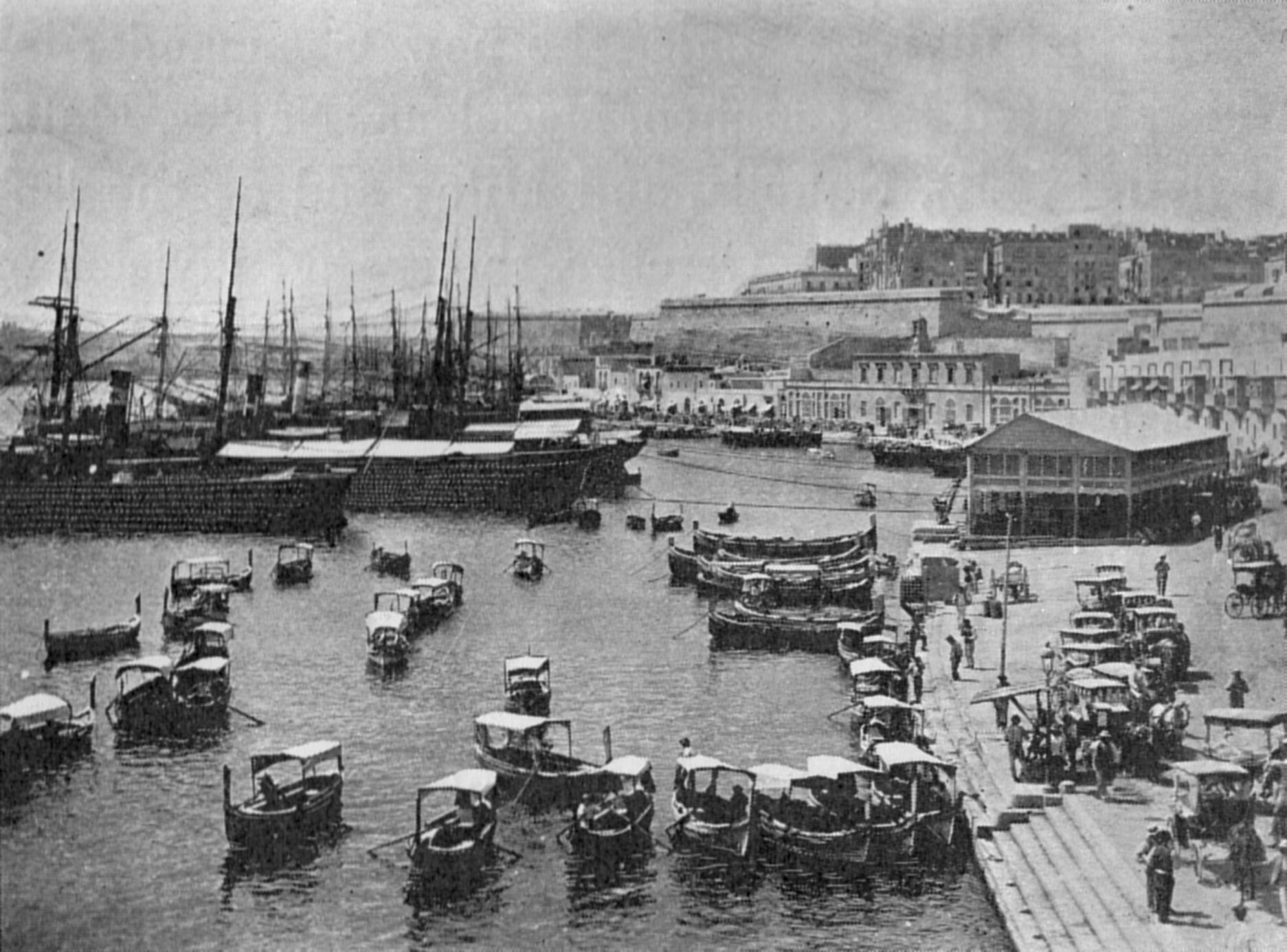
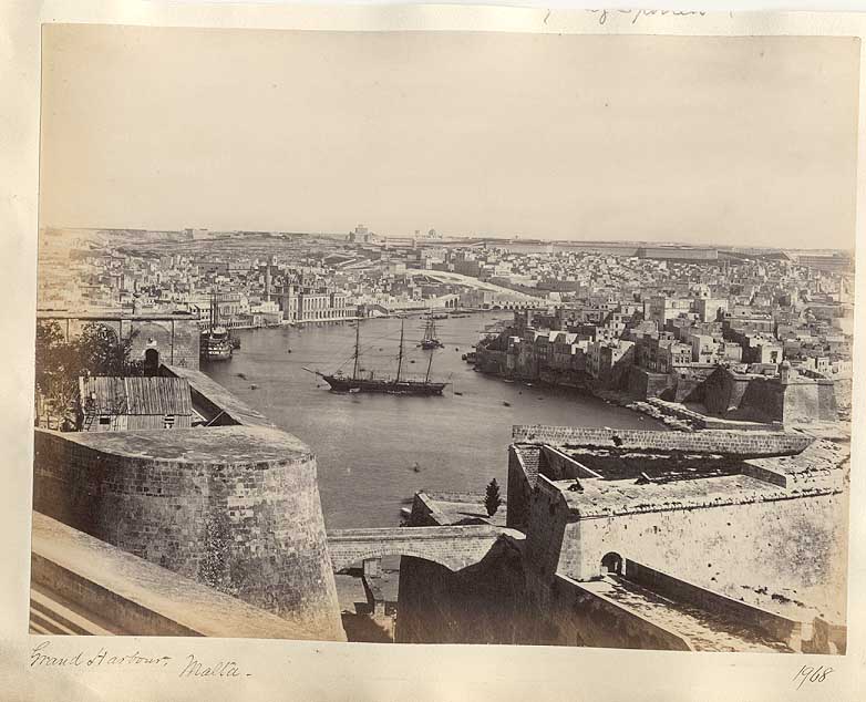
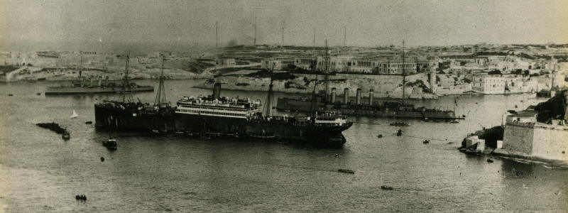
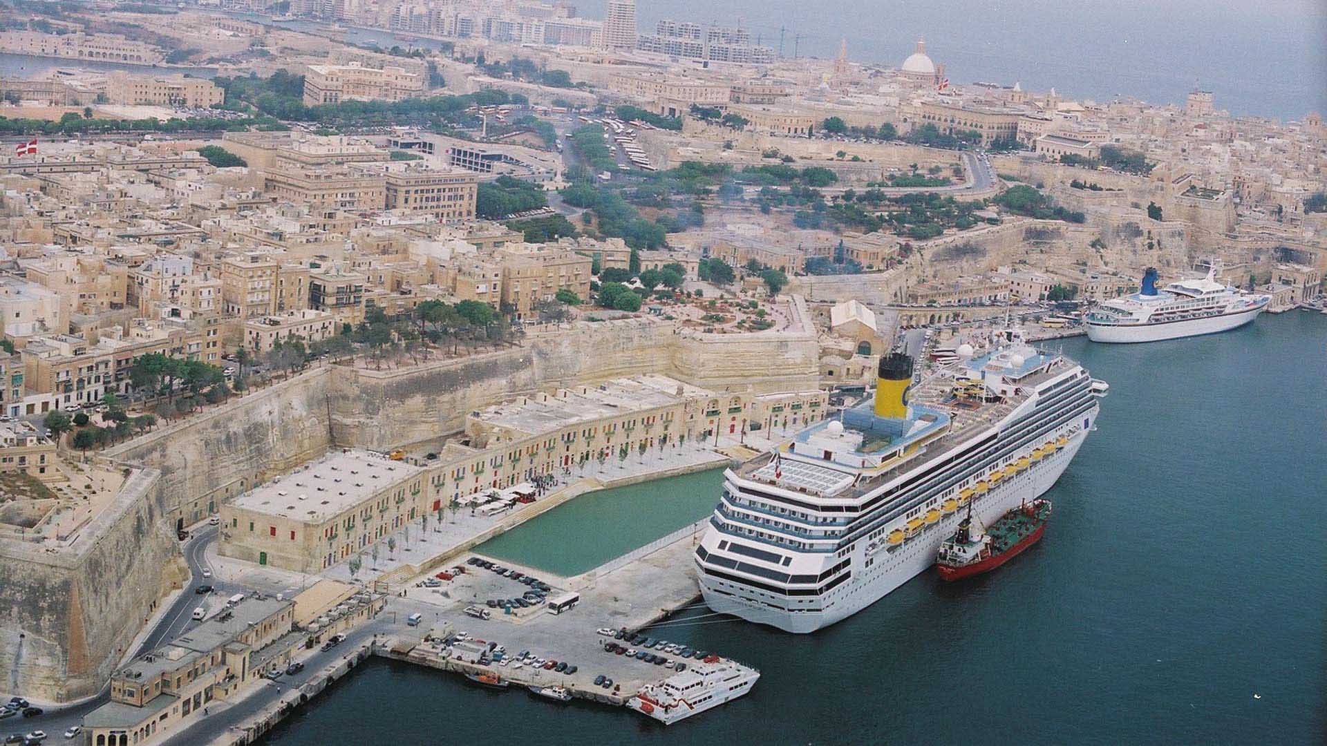
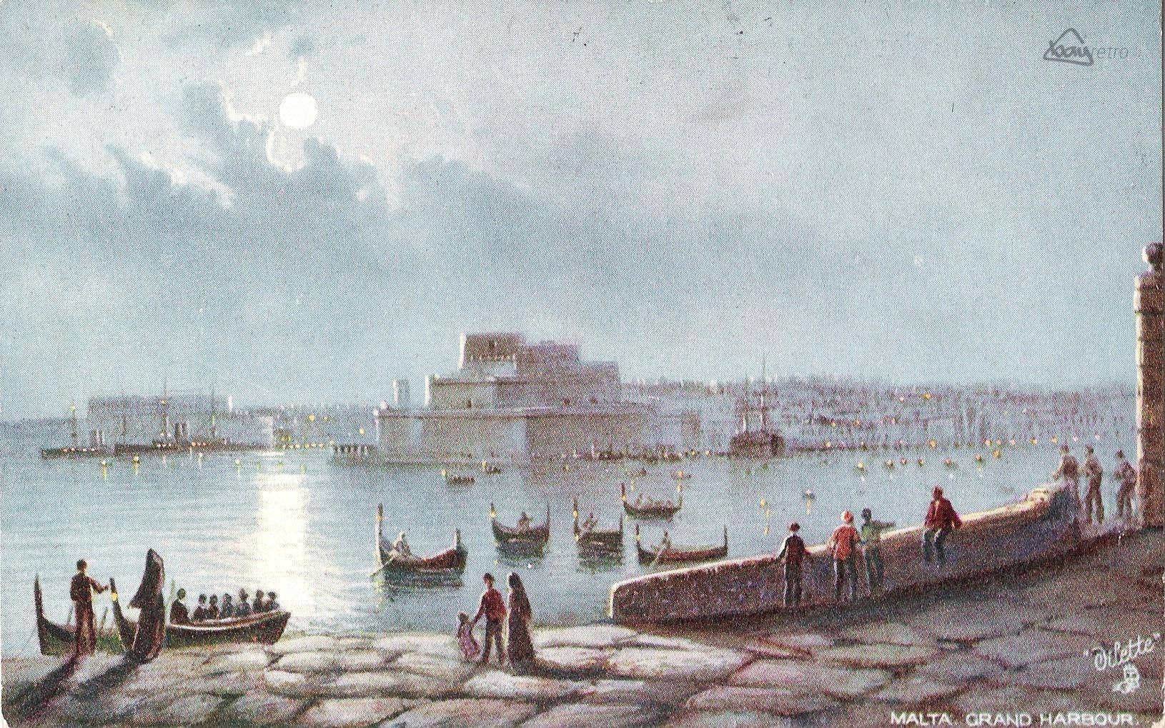
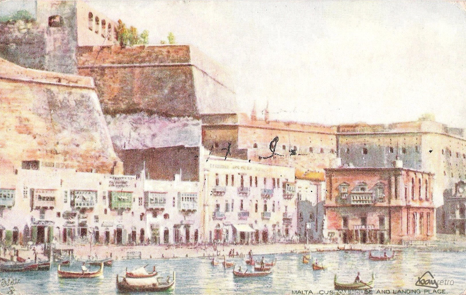
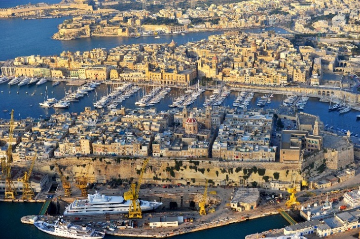
Grand Harbour (in Maltese: Il-Port il-Kbir) is a natural harbour. It has been used as a harbour since at least Phoenician times. The natural harbour has been greatly improved with extensive docks and wharves, and has been massively fortified. 
Description
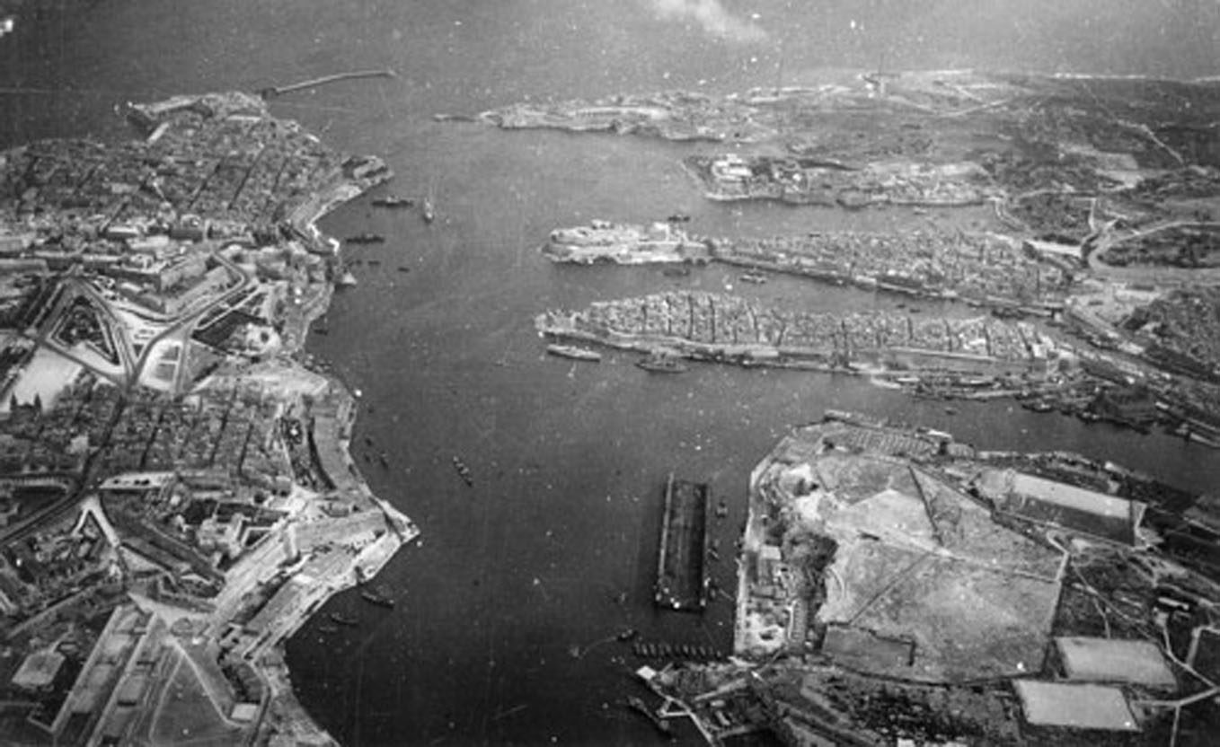
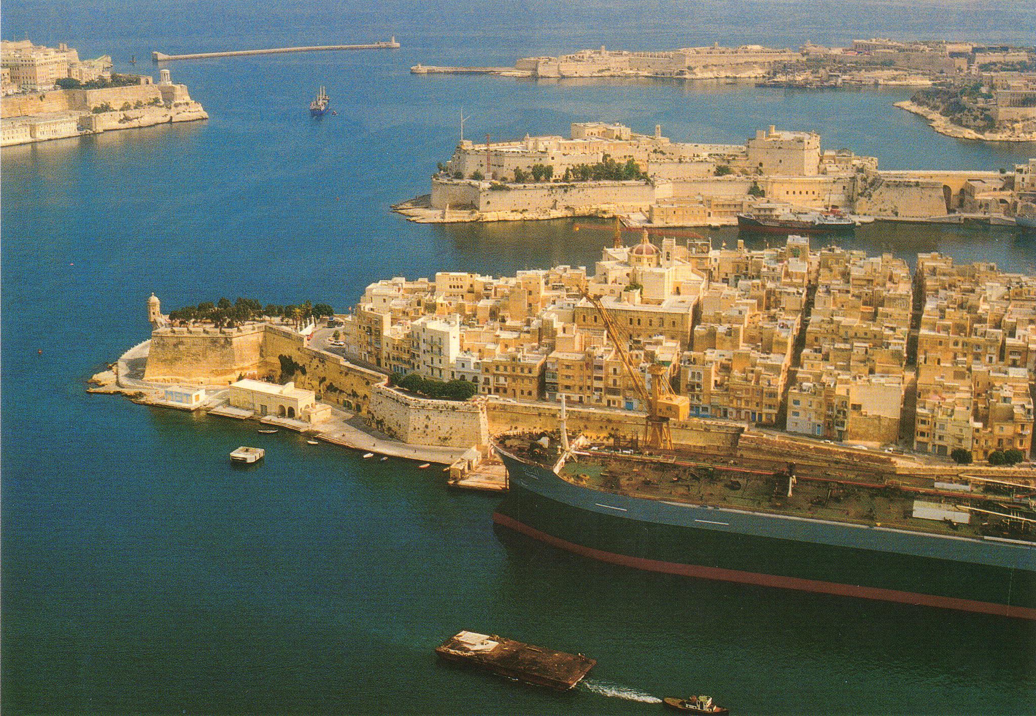
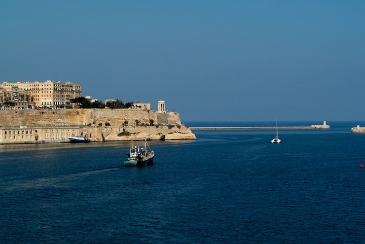
The harbour mouth faces north east and is bounded to the north by St Elmo’s Point and further sheltered by an isolated breakwater and is bounded to the south by Ricasoli Point. Its north west shore is formed by the Scebarras peninsula, which is largely covered by the city of Valletta and its suburb Floriana. This peninsula also divides Grand Harbour from a second parallel natural harbour, Marsamxett Harbour.
The main waterway of Grand Harbour continues inland almost to Marsa. The south eastern shore of the harbour is formed by a number of inlets and headlands, principally Rinella Creek, Kalkara Creek, Dockyard Creek, and French Creek, which are covered by Kalkara and the Three Cities: Cospicua, Vittoriosa, and Senglea. With its partner harbour of Marsamxett, Grand Harbour lies at the centre of gently rising ground.
Development has grown up all around the twin harbours and up the slopes so that the whole bowl is effectively one large conurbation. Much of Malta’s population lives within a three kilometer radius of Floriana. This is now one of the most densely populated areas in Europe.
History
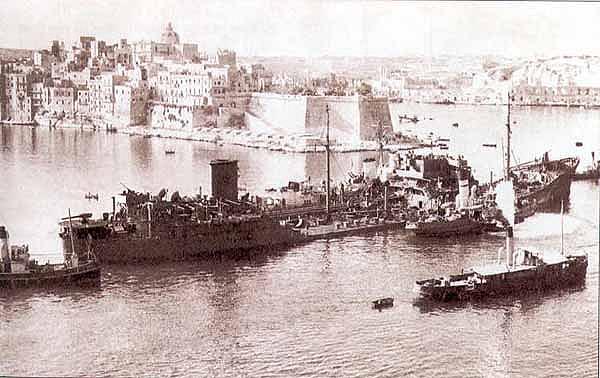
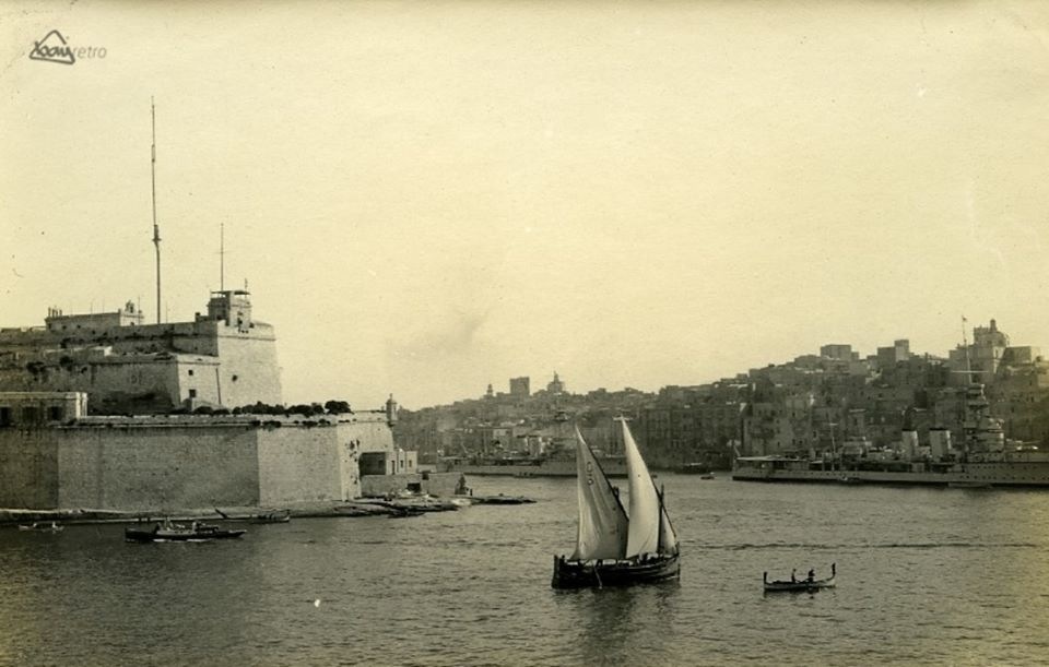
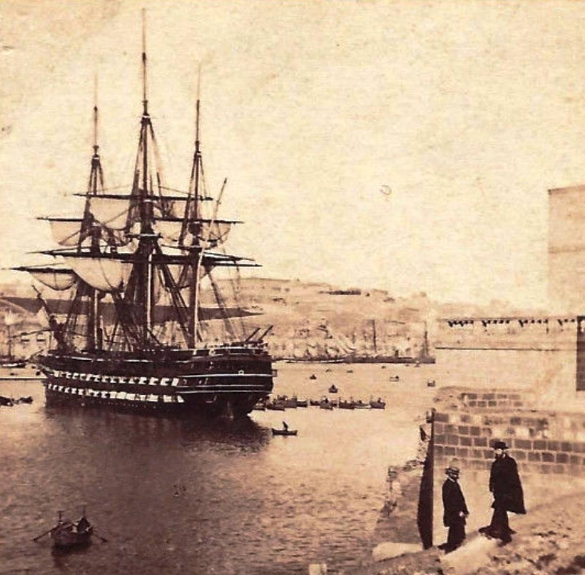
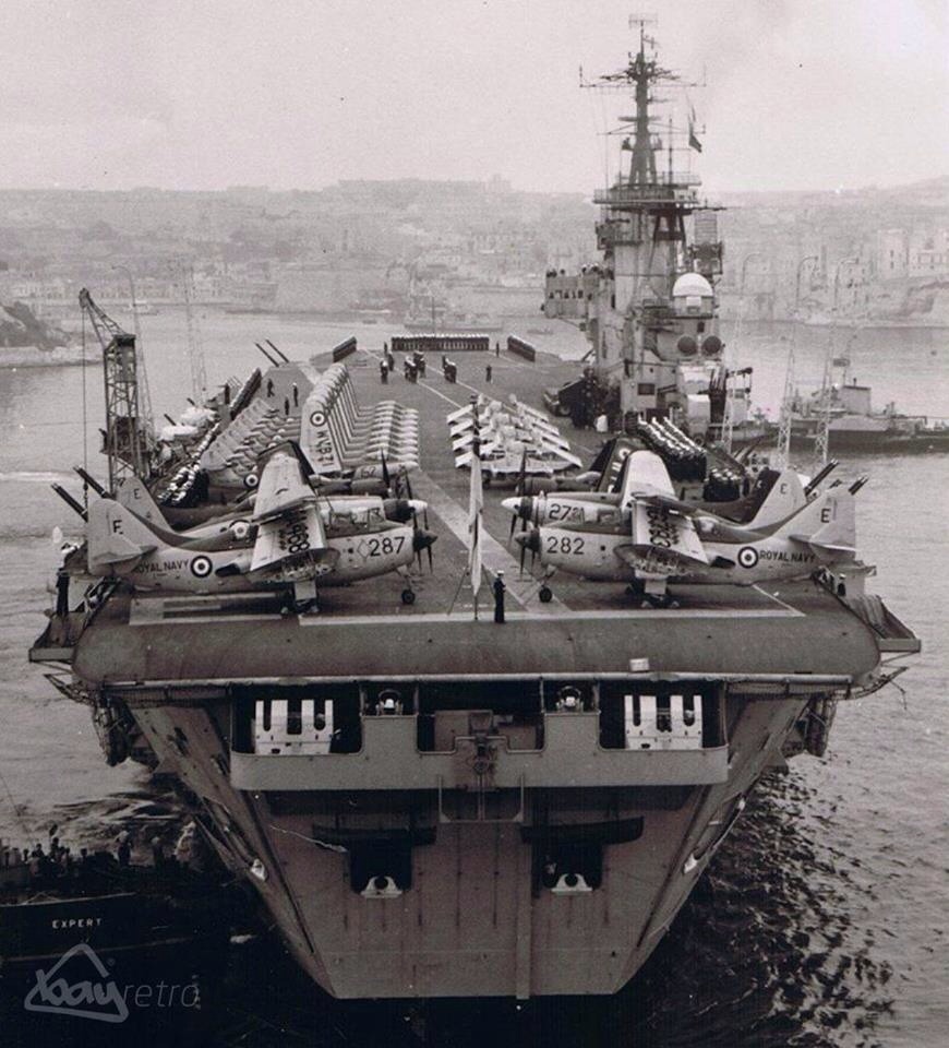
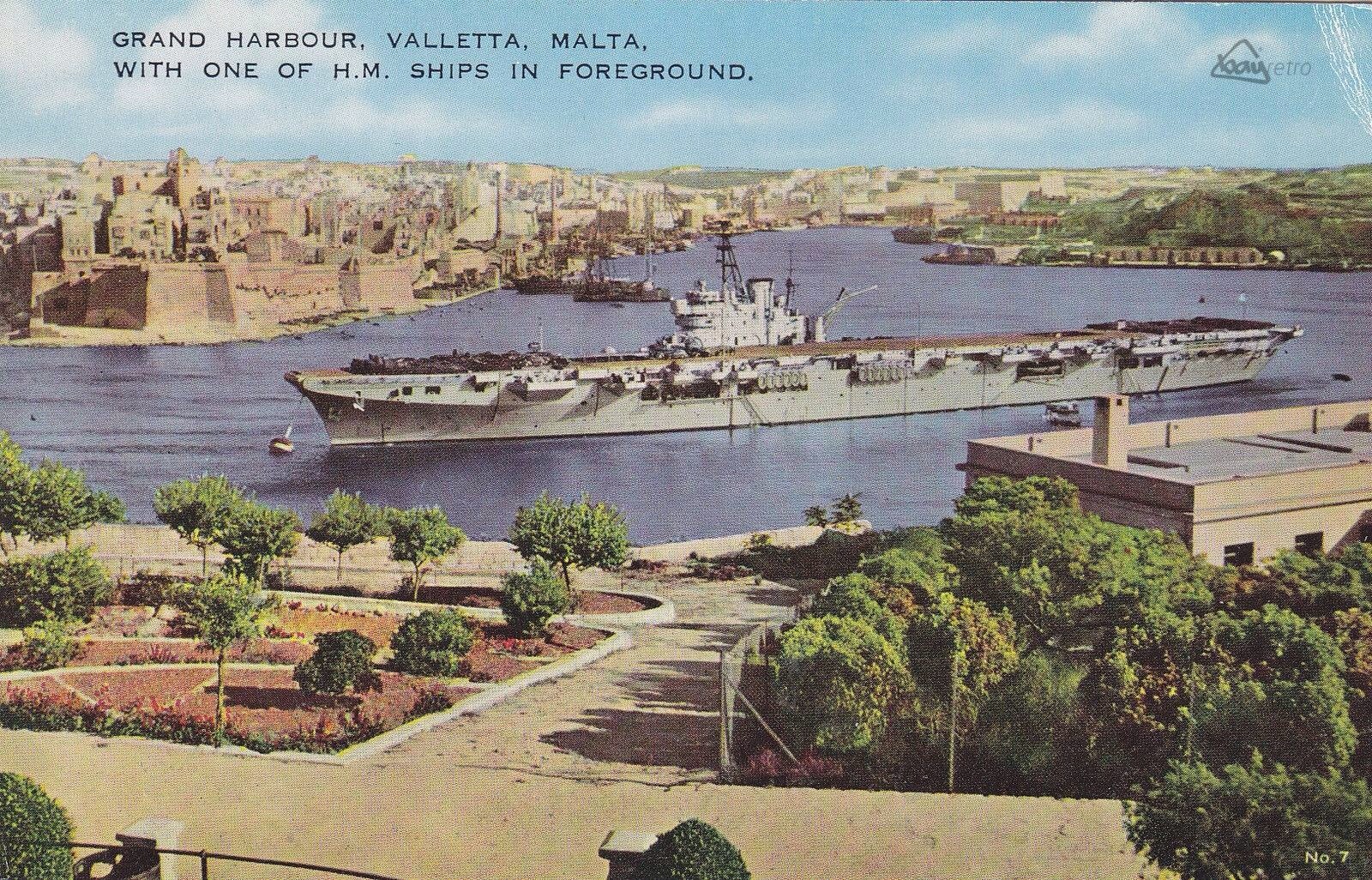
The Grand Harbour was the base for the Knights of St John for 268 years, and after their departure became a strategic base for the British for a further 170 years. It was the site in the late 16th century of a devastating tornado that killed 600 people and destroyed a shipping armada.
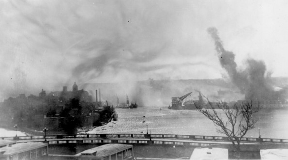
The area was the scene of much of the fighting in the Great Siege of Malta when the Turks attempted to eject the Knights of St John. The whole area was savagely bombed during the Second Siege of Malta during World War II, as the docks and military installations around the port were legitimate targets for Axis bombers. However collateral damage wrecked much of Valletta and The Three Cities, and caused large numbers of civilian casualties.
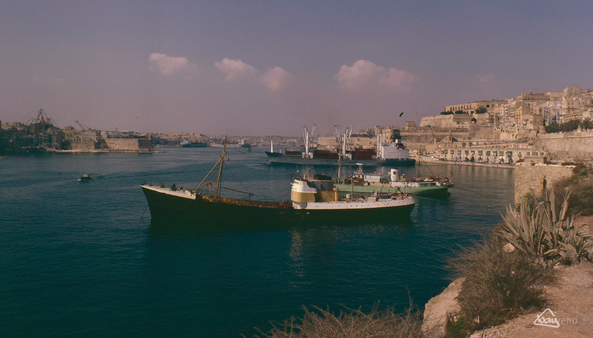
The harbours and docks are still active but with the departure of the British Military the harbour lost much of its military significance. A considerable part of Malta’s commercial shipping is now handled by the new free port at Kalafrana, so the harbour is much quieter than it was in the first half of the 20th century. 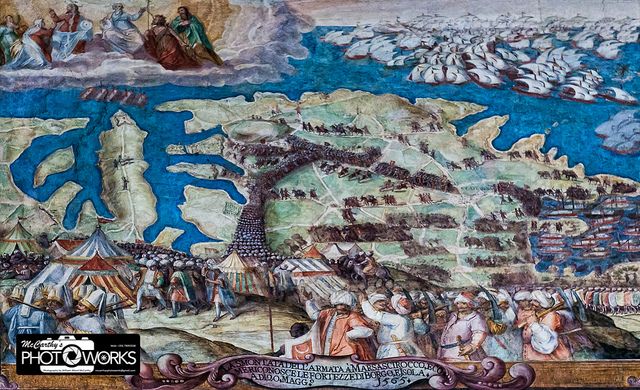
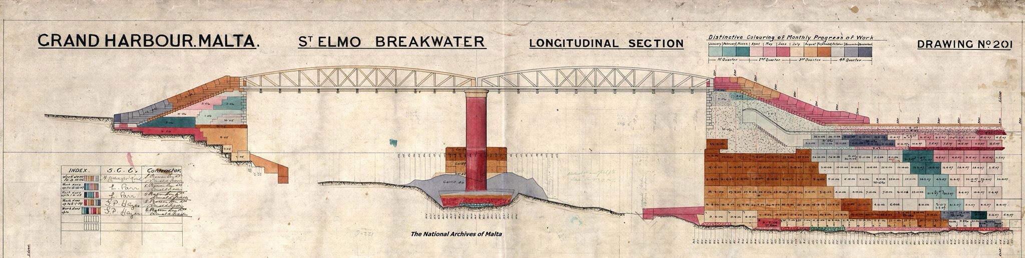
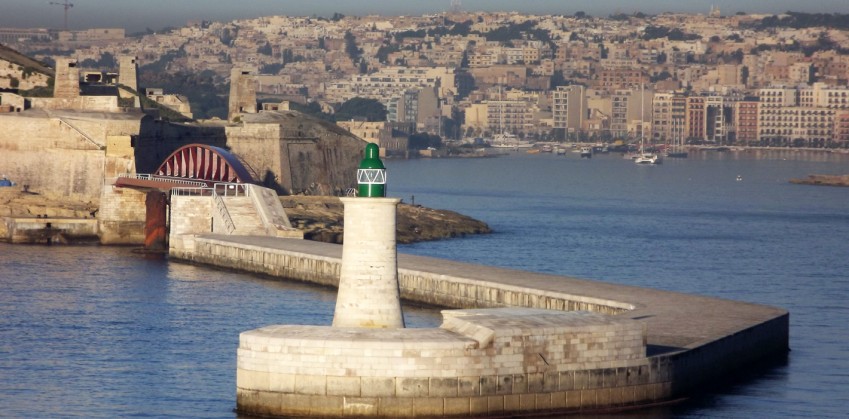
Breakwater
The foundation stone of the breakwater in the Grand Harbour was laid by King Edward VII on the 20th April 1903 when Malta was under the British rule. Traditionally, in earlier times, the wide entrance to Grand Harbour was protected by a heavy chain which ran across the mouth of the harbour from Fort Saint Elmo to Fort Ricasoli, and which served to keep enemy ships out of harbour.
However, by the turn of the twentieth century, better protection was deemed necessary by the British Admirality – not only from intruders and torpedo attacks, but also from the rough seas which could cause havoc within the harbour, especially when a strong North-Easterly wind Grigalata) was blowing. A strong wind blowing from this direction also made it very difficult for ships to negotiate the entrance to the harbour. In 1900, the British Admirality commissioned plans for the building of a new breakwater across the mouth of the harbour.
Tenders were issued by 1902, with one of the conditions placed being that any artefacts found during the dredging of the sea-bed and its excavation be handed over to the Admirality. The estimated cost at the time was to amount to £1,000,000.
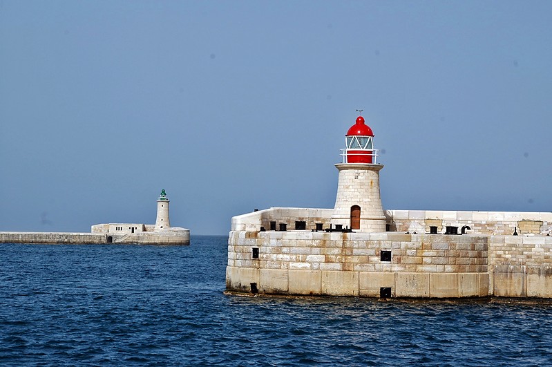
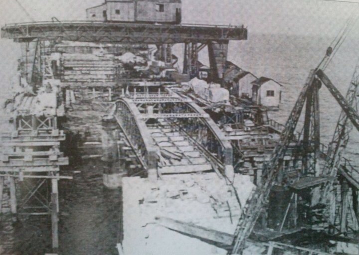
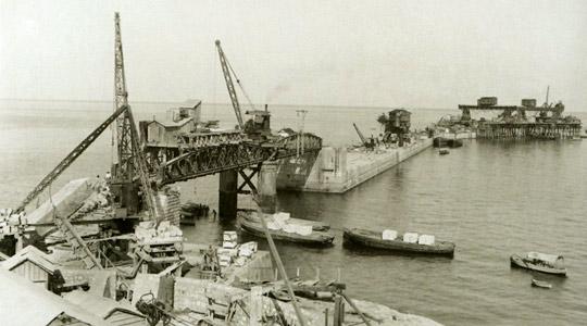
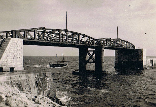
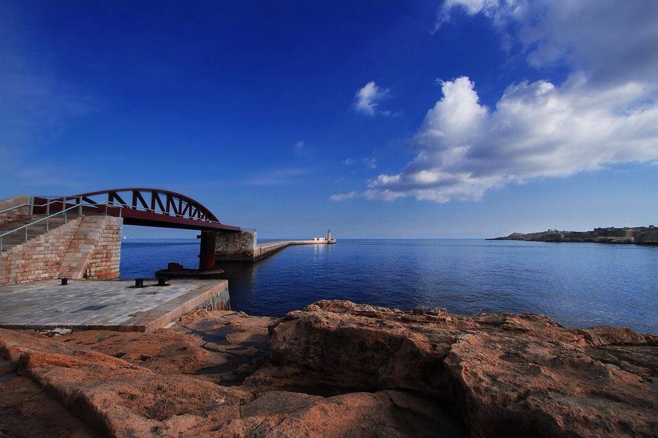
To avoid stagnation of the water inside Grand Harbour, the larger (West) arm of the breakwater – that is the one extending from Saint Elmo Point – was to be separated by 70 meters from the fore-shore by a steel foot-bridge.
The planned two-span bridge would then enable anyone walking onto the breakwater from its Valletta side to reach the small light-house at the end of the arm. The tower on the St Elmo arms was to be 14m high, and was completed by 1908.
Construction works of the Breakwater in the Grand Harbour started in 1903. It was built by the English firm of S. PEARSON & SON. The bridge, connecting Fort St Elmo with the breakwater, was completed in 1906. It was destroyed in 1941 in an attack by the Italian navy. The original pillars are still standing and are scheduled. It was officially opened in 1910.
The tender was awarded to S. Pearson and Son who employed close to 500 men in the building of the breakwater, and these included those working at the Gozo quarries and at Mistra. The underwater work was obviously carried out by divers using standard diving suits or carrying out the work in diving bells. They were supplied with air from the surface, which was pumped to them using a manually operated pump. The ‑first blocks in the building of the breakwater were laid in 1905.
From a socio-economic point of view the building of the breakwater was very important for Malta, as it created jobs at a time when there was massive unemployment and when poverty was threatening the livelihood of many Maltese families. The project did not only provide jobs for the Maltese, but also for skilled workers from neighbouring countries – mainly coming from Sicily, Italy and Spain.
The British Admiralty declared the work on the breakwater complete in 1910.
During World War II the foot-bridge on the Valletta side of the breakwater was destroyed when, at dawn on the 26th July 1941, the E-boat unit of the Italian Regia Marina attacked the breakwater in a savage, but futile, attempt to gain access into the harbour. The Italians paid a heavy price, as all the attacking vessels were destroyed in the counter-attack which involved guns on Fort Saint Elmo and Fort Ricasoli, as well as those further afield.
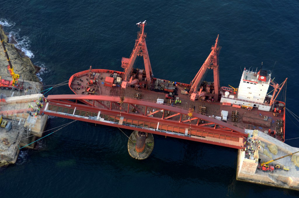
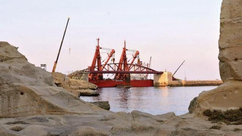
Following the upward trend of cruise liners visiting Malta, the plan was to regenerate the Valletta Grand Harbour. The St. Elmo Bridge was part of this plan and a tender was issued on 18 September 2009 for “The Design, Fabrication and Erection of a Steel Foot Bridge”.
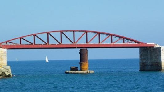
This project was expected to cost €2.8 million and was to be fi‑nanced by the Malta Maritime Authority. The bridge, a 190-ton and 70m long structure was fabricated in La Coruna, Northern Spain. It was shipped to Malta on board the Storman Asia as a whole structure to be placed on site.
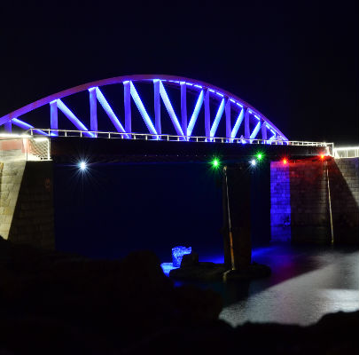
The local contractors Vassallo Builders and Bezzina & Cole Architects, were entrusted with the erection of the bridge. The new structure, similar to the old one but formed of a single span instead of two, was inaugurated on 23 July 2012.


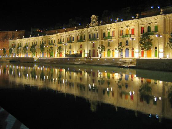
Valletta Waterfront
The Valletta Waterfront, in Floriana, is the baroque wharf built by Manuel Pinto de Fonseca in the 18th century. It has been thoroughly renovated by a private consortium who run the Waterfront and offer management overseeing for Malta’s cruise liner business.
It is also being used as a venue with a concentration of bars, retail outlets and restaurants, as well as for concerts and events, including the Malta Jazz Festival, the Malta Fireworks Festival, the Perfect Wedding Fair and other themed events. A part of the movie World War Z was shot at the Magazino.
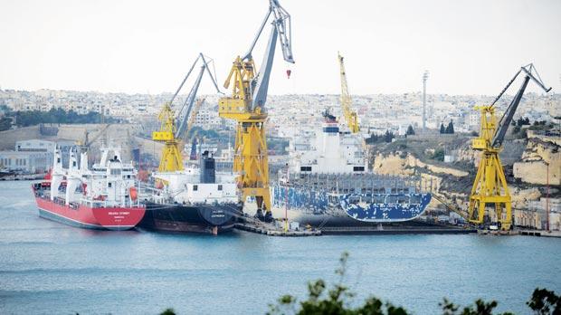
Shipyards
Malta has provided shipyard services in the commercial sector since the mid 1960s. Malta Shipyards Ltd. was made up of the Cospicua Site (formerly Malta Drydocks), the Marsa Site (formerly Malta Shipbuilding Company Limited), Manoel Island Yacht Yard Limited, and the Malta Shipyards Tank Cleaning Station.
The Shipyards was one of the largest employers in Malta. Malta Shipyards offered a substantial range of products to the general maritime ship repair, offshore/energy, liner, yachting and conversion sectors from one of the largest facilities in the Mediterranean.
General ship repair was a core activity, however the diversification into other sectors created a stronger more focused company. In 2012 the Cospicua Yard was privatised. Palumbo shipyards now operate the Malta Shipyards. At the Marsa end there is the Cassar Shipyard – a private Yard operated by the Cassar family. 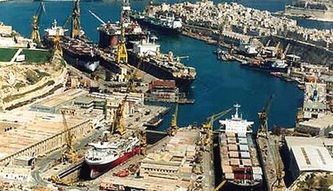
Around the Grand Harbour from Fort Ricasoli to Fort St. Elmo
- Fort Ricasoli
- Rinella Bay
- Bighi
- Kalkara Creek Marina Road, Kalkara
- Kalkara Strand, Kalkara
- Mandraġġ Strand, Birgu
- Fort St. Angelo
- Dockyard Creek or Cottonera Marina St. Angelo Strand, Birgu
- Xatt il-Forn, Birgu
- Xatt ir-Risq, Birgu
- Xatt San Lawrenz, Birgu
- Dock No. 1, Bormla
- Xatt Juan B. Azzopardi, Senglea
- Fort Saint Michael
- French Creek Dock No. 2
- Ghajn Dwieli Road
- Corradino
- Dock No. 6
- Ras Ħanżir Point
- New Port Shipwrights Wharf, Paola
- Dock No. 7
- Xatt il-Mollijiet, Albert Town
- Church Wharf, Marsa
- Il-Menqa Bridge Wharf, Marsa
- Braken Wharf, Marsa
- Il-Moll tal-Ħatab, Marsa
- Moll iċ-Ċangatura, Marsa
- Xatt l-Għassara ta’ l-Għeneb, Marsa
- Valletta Waterfront or Pinto Wharf, Floriana
- Lascaris Wharf, Valletta
- Xatt il-Barriera, Valletta