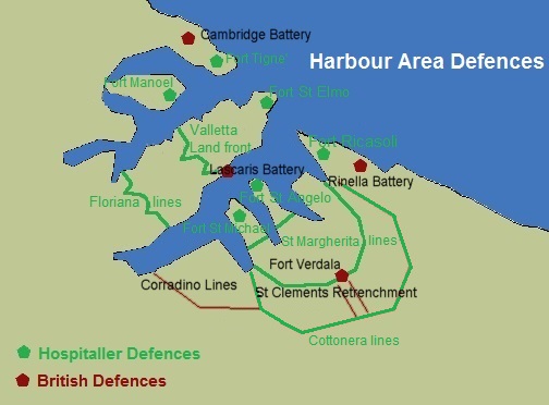
Malta has often been called the ‘Fortress Island’ due to the great mass of military architecture that can be seen everywhere. This is a legacy of the islands’ history which saw them being fought over, time and again, due to their strategic location and deep, safe harbours.
The fortifications that can be seen today come from two distinct periods: those of the Knights and those of the British era. These imposing reminders of the islands’ wartime past fascinate not only because they are a feat of military engineering, but also because they are reminiscent of an age of chivalry, crusading, heroism and legendary battles.
Wherever you go in Malta you will find remnants of war, from 17th century coastal forts and watch towers to WWII pillboxes.
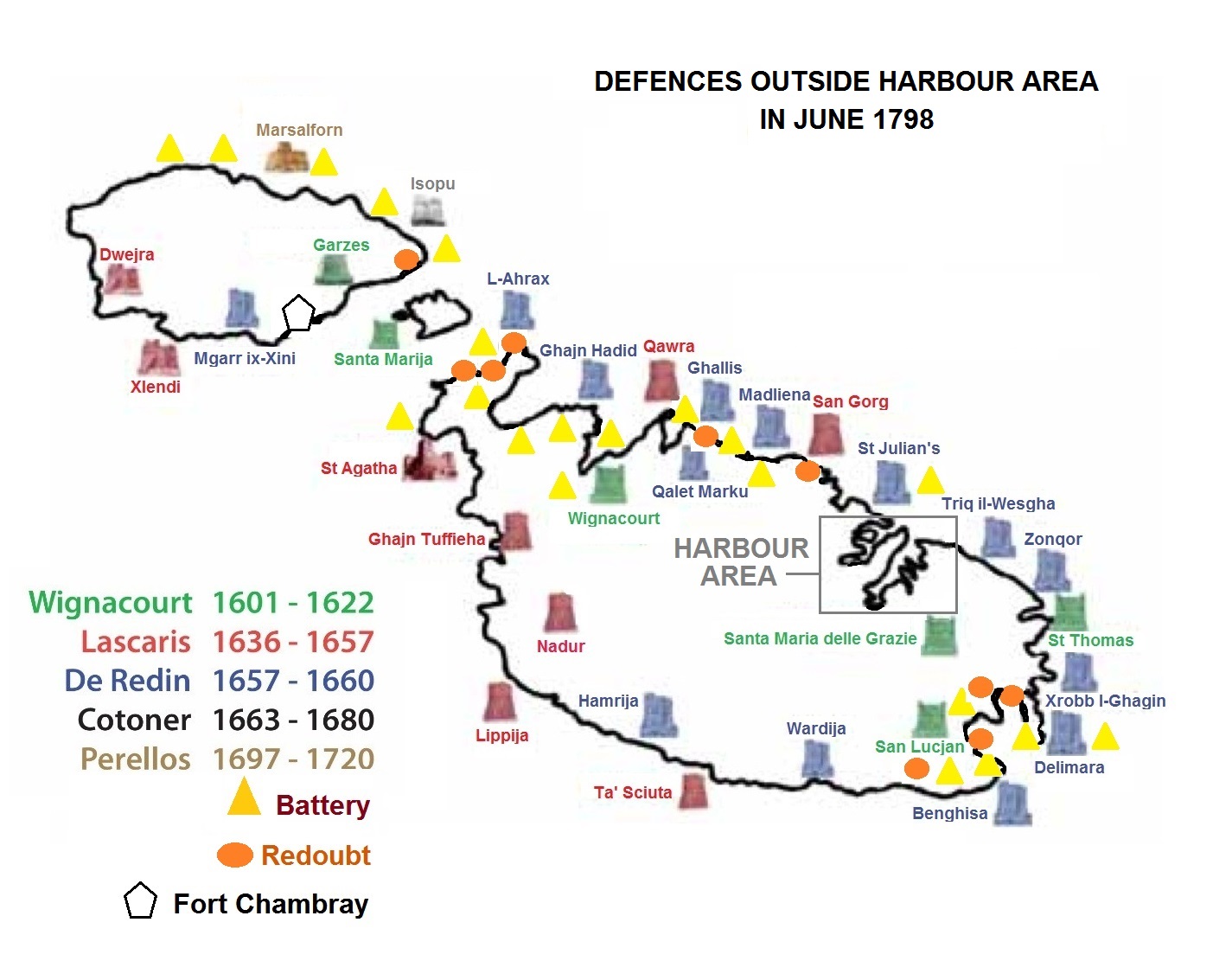
ORDER OF ST JOHN PERIOD
Some Fortifications and Batteries
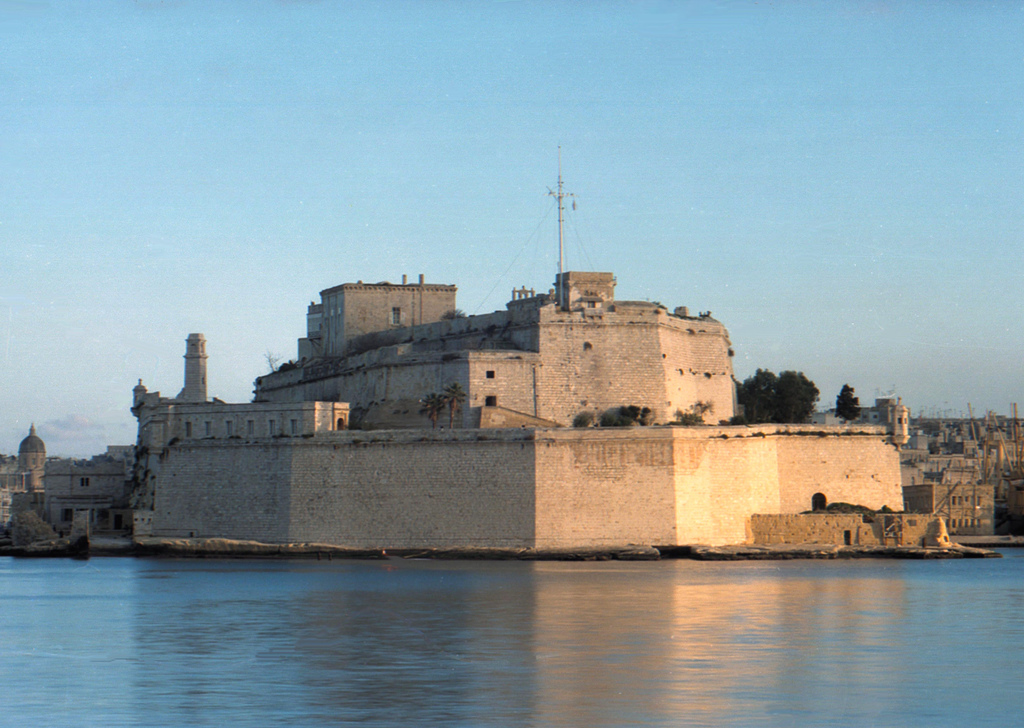
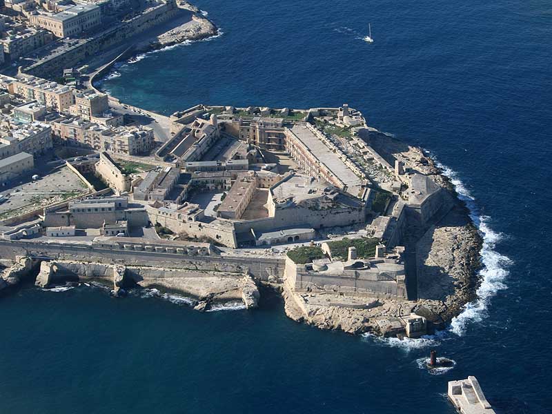
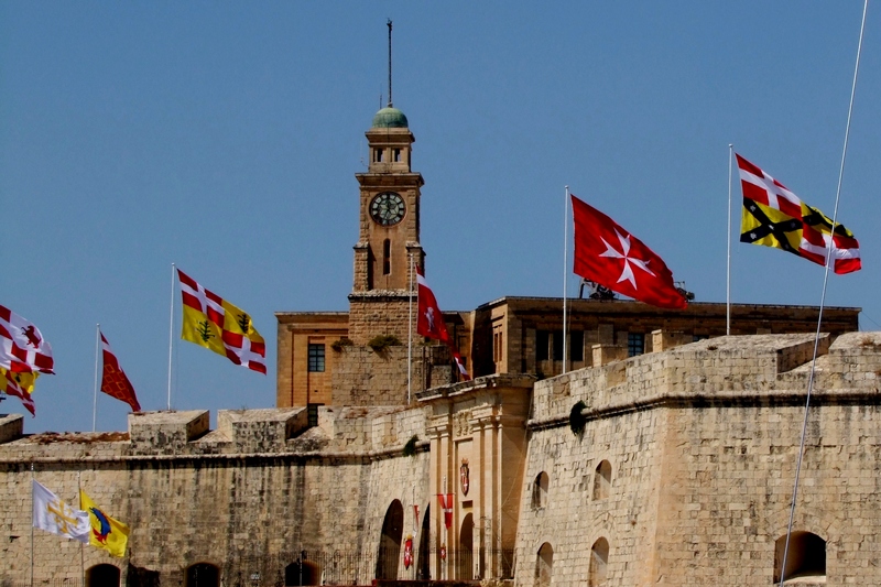
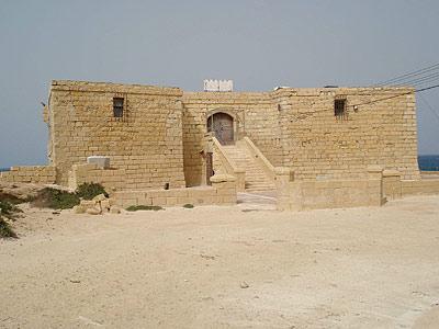
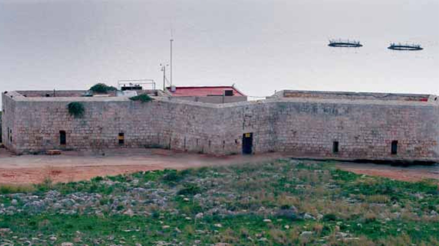
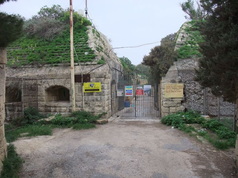
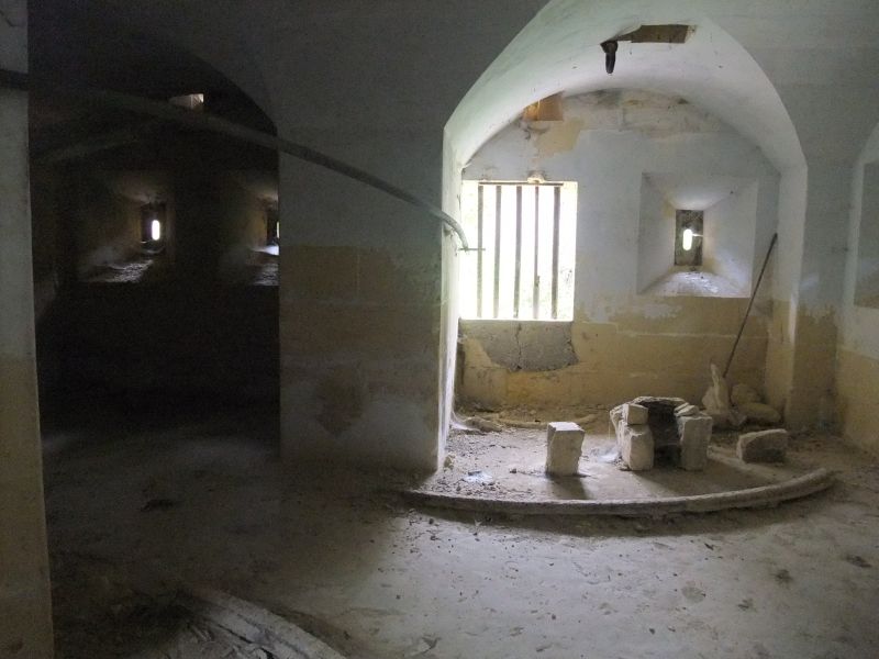
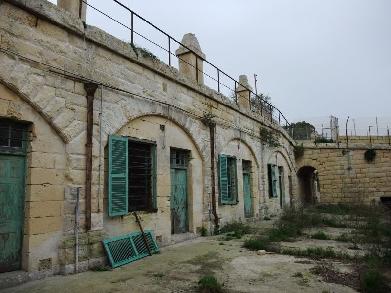
Fort St Angelo
Fort St Angelo is a large fortification in Birgu, right at the centre of Grand Harbour.
History
Medieval Times
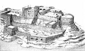 The date of its original construction is unknown. However, there are claims of prehistoric or classical buildings near the site, due to some large ashlar blocks and an Egyptian pink granite column at the top part of the fort. There is also the mentioning in Roman texts of a temple dedicated to Juno/Astarte, probably in the vicinity of the fort. There is also the popular attribute to its foundation to the Arabs, c. 870 AD, but nothing is concrete although al-Himyarī mentions that the Arabs dismantled a hisn (fortress), but there is no actual reference if this ‘fortress’ was in Vittoriosa. It probably started as a fortification in the high/late medieval period. In fact, in 1220 Hohenstaufen Emperor Frederick II started to appoint his own Castellani for Malta who needed a place to live and secure the interests of the crown. The remains of a tower that may date back to the 12th century can be traced among the more recent works. The first mention of Castrum Maris (“Castle by the sea”) is to be found in documents from the 1240s when Paulinus of Malta was the Lord of the island and later when Giliberto Abate made a census of the islands. Another reference to the castle is from the short Angevin rule (1266–83) where documents list it again as Castrum Maris and list a garrison of 150 men together with several weapons. It seems also that by 1274 the castle already had two chapels which are still there today. From the same year exists also a detailed inventory of weapons and supplies in the castle. From 1283 the Maltese islands were under Aragonese rule (although the castle withstood for some time in Angevin rule while the rest of Malta was already in Aragonese hands) and the fortification was mainly used by Castellani (like the de Nava family) who were there to safeguard the interests of the Aragonese crown. In fact the Castellans did not have any jurisdiction outside the ditch of the fort.
Knights’ Period
 When the Knights of St John arrived in Malta in 1530, they chose to settle in Birgu and Fort St Angelo became the seat of the Grand Master, which included the refurbishing of the Castellan’s House and St. Anne’s Chapel. The Knights made this their primary fortification and substantially reinforced and remodelled it, including the cutting of the dry ditch to make it a moat and the D’Homedes Bastion built by 1536. By 1547, a large cavalier designed by Ferramolino was built behind the D’Homedes bastion and also the construction of the De Guirial battery right at the tip of the fort by sea level to protect the entrance to Dockyard Creek. These works transformed the fort into a gunpowder fortification. Fort St Angelo withstood the Turks during the Great Siege of Malta during which it succeeded to withstand a sea attack by the Turks on Senglea on 15 August 1565. In the aftermath of that siege the Knights built the fortified city of Valletta on Mount Sciberras on the other side of the Grand Harbour and the administrative centre for the knights moved there. It was not until the 1690s that the fort again underwent major repairs. Today’s layout of the fort is attributed to these works which were designed by Carlos de Grunenburgh, who also paid for the construction of four gun batteries on the side of the fort facing the entrance to Grand Harbour. As a result, one can still see his coat of arms above the main gate of the fort. By the arrival of the French in 1798, therefore, the fort became a very powerful fortification including some 80 guns, 48 of which pointed towards the entrance of the port. During the short two-year period of French occupation, the Fort served as headquarters of the French Army.
The British Period
 With the coming of the British to Malta the fort retained its importance as a military installation, first in use by the Army. In fact, in 1800, two battalions of the 35th Regiment were resident in the fort. However, at the start of the 20th century, the fort was taken over by the Navy and it was listed as a ship, originally in 1912 as HMS Egremont, when it became a base for the Royal Navy in the Mediterranean, but in 1933 renamed as HMS St Angelo. The British did not make many modifications to the fort, although they built a casemated battery for three nine-inch RML guns in the 19th century and also a cinema and a water distillation plant in the early 20th century. During World War II, the fort again stood for siege with an armament of 3 Bofors guns (manned by the Royal Marines and later by the Royal Malta Artillery). In total, the fort suffered 69 direct hits between 1940 and 1943. When the Royal Navy left Malta in 1979 the Fort was handed to the Maltese government and since then parts of the Fort have fallen into a state of disrepair, mostly after a project to transform it into a hotel during the 1980s.
Present and future
Use of the fort has been granted to the Order of Malta. Other parts are leased to the Cottonera Waterfront Group, a private consortium. On 5 March 2012, the government of Malta announced that the European Regional Development Fund is to allocate €13.4 million for the restoration of the fort. The restoration is being managed by Heritage Malta.
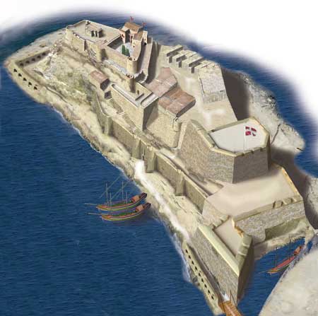
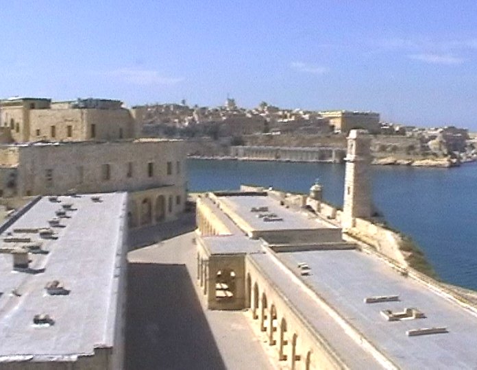
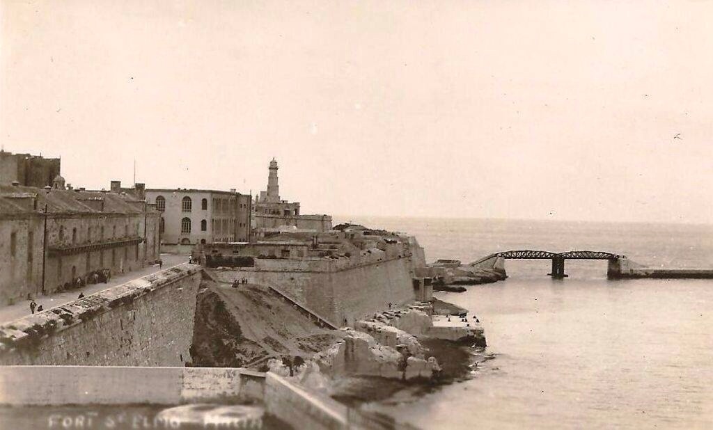
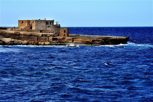
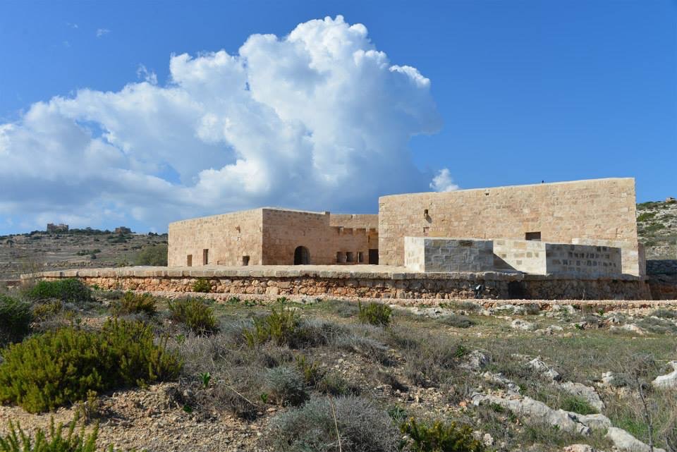
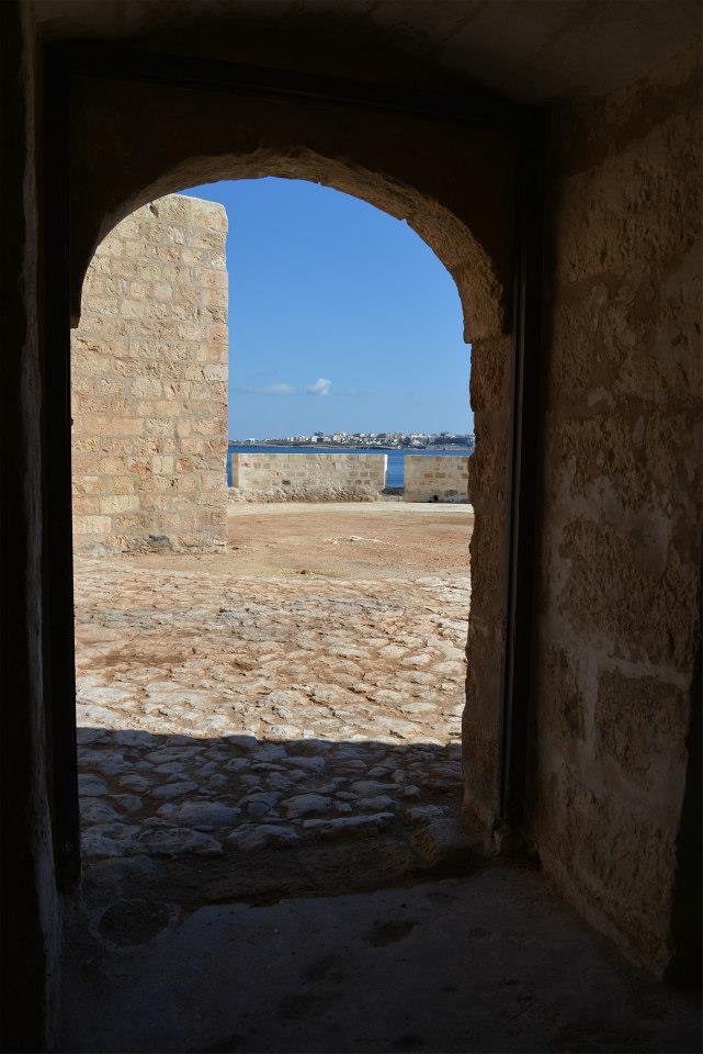
Fort St Elmo
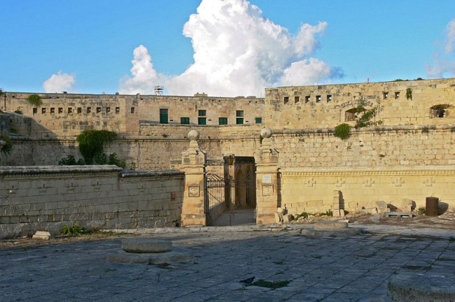
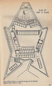 Fort Saint Elmo is a fortification in Valletta. It stands on the seaward shore of the Sciberras Peninsula that divides Marsamxett Harbour from Grand Harbour, and commands the entrances to both harbours.
History
Prior to the arrival of the Knights of Malta in 1530, a watchtower existed on this point. Reinforcement of this strategic site commenced in 1533.
When the Knights of the Order of St. John arrived in Malta in 1530 they set up their base in the maritime town of Birgu and Fort St. Angelo. However from a strategic military point of view it soon became apparent that any defence of the Grand Harbour and Marsamxett necessitated a Fort at the tip of the Sceberras peninsula.
The Order was however in a dire financial situation and the first of a series of proposals to build a Fort on Mount Sciberras was made to the Grand Master De Homedes by Antonio Ferrandino da Bergamo in 1541. It was mainly due to the efforts of the Italian Knight, Fra Leone Strozzi, that Fort St. Elmo was finally constructed on the barren rock at the tip of Mount Sceberras.
In 1551 after a scathing attack by the Turks when they had pillaged and ransacked the island with hardly an opposition, Strozzi made a case for the immediate need to built a strong Fort to strengthen the harbour defences. On 8th January 1552, Grand Master Juan de Homedes instructed Fra Leone Strozzi together with Fra George Bombast, Fra Louis Lastic and Pietro Prato to design and supervise the construction of Fort St. Elmo. The designers of the Fort were only given six months, up till June, to complete its construction. The original chapel of St. Elmo was retained within the walls of the Fort.
.
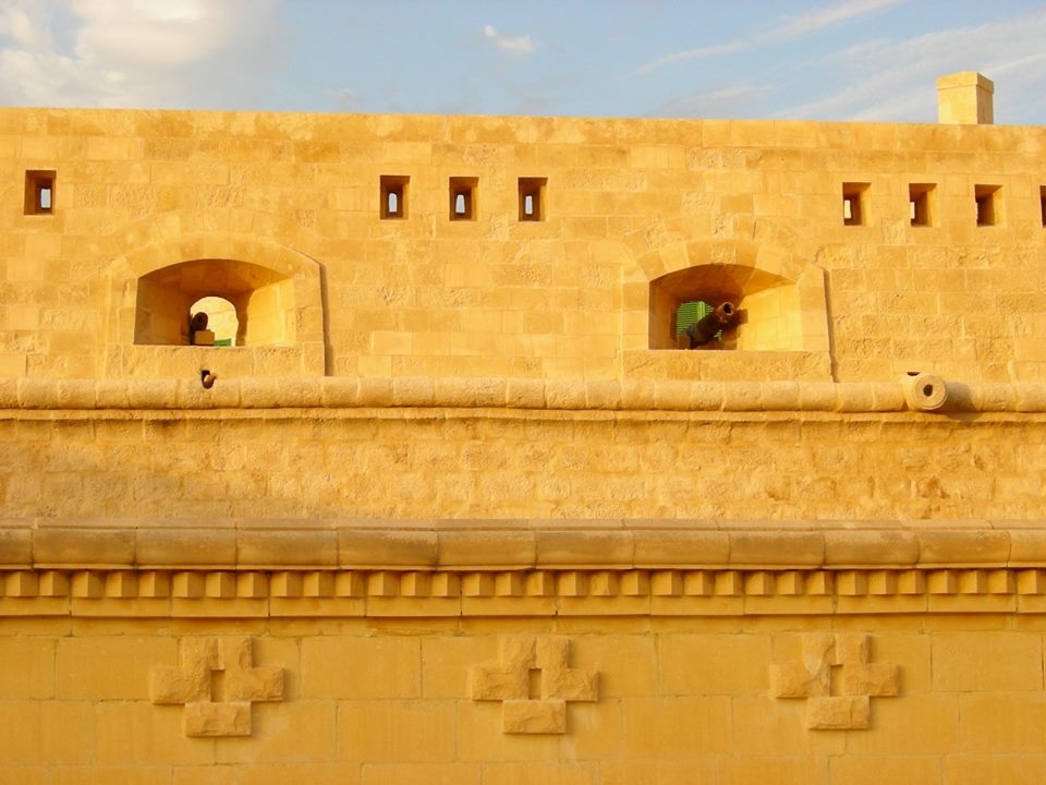
The Fort was a small star-shaped design with angled bastions. The walls were relatively thin and they were no higher than the level of the ground behind the Fort. The Fort lacked any outworks as is normally the case and its purpose was to defend against any invaders from the sea and it afforded no protection from any land invasion.
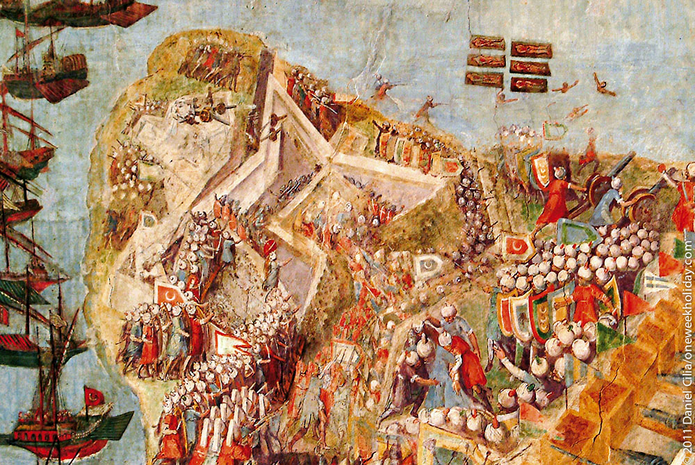
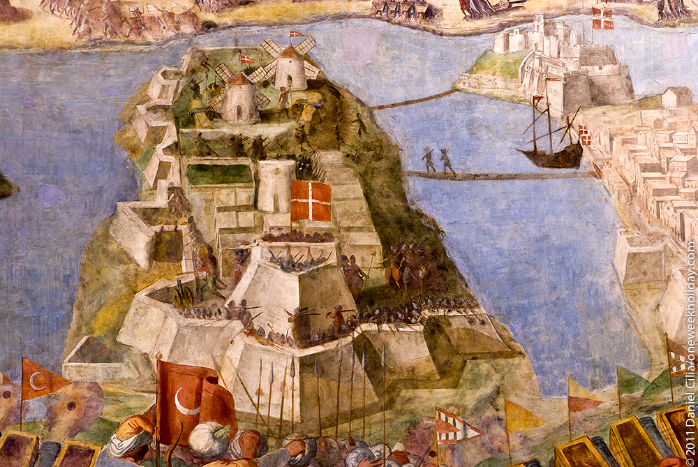
Undeniably, the most fascinating aspect of Fort St Elmo’s long and chequered history is the heroic role it played during the Great Siege of 1565. Fort Saint Elmo was the scene of some of the most intense fighting of the 1565 siege, and it withstood massive bombardment from Turkish cannon deployed on Mount Sciberras that overlooked the fort and from batteries on the north arm of Marsamextt Harbour, the present site of Fort Tigne. The initial garrison of the fort was around one hundred knights and seven hundred soldiers, including around four hundred Italian troops and sixty armed galley slaves. The garrison could be reinforced by boat from the forts across the Grand Harbour at Birgu and Senglea.
All other episodes in the fort’s saga pale in comparison. Yet, whilst the story of Fort St. Elmo’s epic resistance against the might of the Ottoman war machine is well known, the same cannot be said about many aspects of the structural and architectural elements that made up the very work of fortification itself. The fact of the matter remains that very little has actually survived, above ground, of the fabric of the original fort that took on the might of the Turkish onslaught during the initial stages of the Great Siege.
There are only but a handful of elements throughout the present enclosure that can be securely dated to 1565. In simple terms, few of the present day features actually witnessed the events of 1565. Work on Fort St Elmo began in 1552, following a Turkish razzia in 1551, and by the time of the Turkish investment in 1565, the fort had acquired a cavalier, a covertway, a tenaille and a ravelin, the last having been very hastily built in the months before the siege. Although the present day fort occupies much of the same footprint as the original structure, most of the 1552 fort and its outworks disappeared over the course of subsequent centuries. This was not only the result of the heavy Turkish bombardment, which pulverized whole sections of the revetments, scarps, and cavalier, but also the direct consequence of Francesco Laparelli’s rebuilding efforts in 1566 and, more radically, because of the heavy and significant alterations and additions that were made to enlarge and adapt Fort St Elmo in the course of the seventeenth, eighteenth, nineteenth and twentieth centuries, which interventions produced the present layout and feel of the place.
Most of our information on the original 1552 fort, therefore, has come to us from documentary sources – a few laconic entries in the Order’s records, a couple of plans in the Simancas archives, Matteo Perez D’Aleccio’s colourful and artistic representations of the fort in his palace frescoes and prints, and Francesco Laparelli’s critical report prepared immediately after the siege
After valiantly holding out for more than a month during the Great Siege of 1565, Fort St. Elmo was completely destroyed.
During the bombardment of the fort, a cannon shot from Fort St Angelo across the Grand Harbour struck the ground close to the Turkish battery. Debris from the impact mortally injured the corsair and Ottoman admiral Dragut Reis, one of the most competent of the Ottoman commanders. The fort withstood the siege for over a month, falling to the Turks on 23 June 1565. None of the defending knights survived, and only nine of the Maltese defenders survived by swimming across to Fort St. Angelo on the other side of the Grand Harbour after Fort St Elmo fell.
Plans for rebuilding the Fort were taken in hand immediately after the Siege by the Italian military Francesco Laparelli. Laparelli designed the grid-iron street plan for a new city Valletta which was to be built on the Sceberras peninsula. The new Fort St. Elmo was one of the first structures to be completed. The original design in the form of a star was retained but with stronger walls and deeper ditches.
In 1689 a new series of Fortifications known as the Carafa bastions were designed by Don Carlos de Gruninberg and built under the supervision of the Order’s French military engineer, Mederico Blondel.
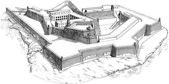
During the course of the eighteenth century various barracks were built around the internal piazza within the Fort. During the long reign of Grand Master Pinto (1741 – 1773), nineteen large vaulted magazines on three floors were constructed in the outworks along the Carafa Bastions. These structures were intended for the storage of food and as a shelter for women and children in the event of a siege.
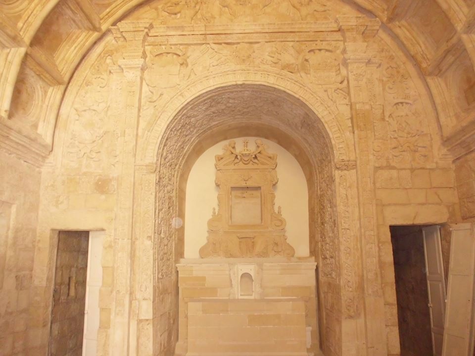
Within the precincts of Fort St. Elmo are two religious buildings. The old chapel which had existed since 1488 was incorporated near the gate to the Fort, referred to as ‘del Soccorso’. The chapel was re-dedicated to St. Anne in the mid-sixteenth century. The church although of modest dimensions is embellished with ornate stone carvings that date to the seventeenth century. Another church also dedicated to St. Anne and which has an early eighteenth century Baroque facade overlooking the piazza was desecrated during the British period and its interior was completely remodelled.
During the early British Period a continuous musketry parapet was built, fitted with loopholes, continuing onto the adjacent Vendome battery. Between 1866 and 1877, the defensive outworks were strengthened by the construction of a series of gun emplacements and embrasures on the spurs of the Cavaliers facing the harbour.
In 1855 the polverista within Vendome Bastion was converted into a permanent armoury for the reception of small arms removed from the Palace Armoury. It was the outer ring of bastions and the cavalier which housed most of the heavy armament of Fort St. Elmo. Works were done on Abercrombie’s Bastion in the early 1870s.
During the inter-war period (1919-39) a number of gun emplacements were constructed to house the new twin 6-pdr QF guns.
It is important to say that during the first Italian attacks of 11 June 1940, six Maltese Royal Malta Artillery gunners lost their lives. However, the fort played an important part in the defeat of the Italian seaborne attack of 26 July 1941 on the Grand Harbour.
Within the bastion walls of Fort St. Elmo are buried two distinguished British officers who are General Sir Ralph Abercrombie and the first British Governor of the Malta, Sir Alexander Ball.
A circular stone light-house some 56 feet in height and a total of 206 feet above sea-level used to dominate the skyline of Fort St. Elmo and served as a guiding beacon to incoming ships. This lighthouse was demolished in 1940 for security reasons as it could have served as a landmark for the enemy aircraft World War II.
The ditch of the Fort used to house the Botanical Gardens which provided a source of medicinal plants for the School of Anatomy of the Order. These gardens were later transferred to Floriana by Sir Alexander Ball in the early nineteenth century.
Between 1988 and 2013 the Police Academy was accommodated within the precincts of Fort St. Elmo
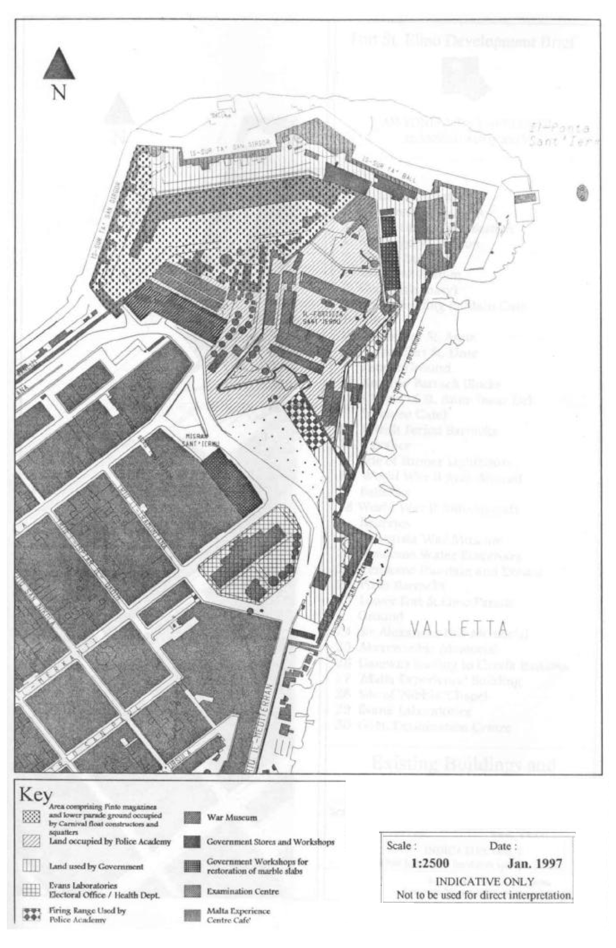 The land-uses of the whole Fort St. Elmo complex and its environs in 2012
Present day
The World Monuments Fund placed the fort on its 2008 Watch List of the 100 Most Endangered Sites in the world because of its significant deterioration due to factors such as lack of maintenance and security, natural aging, and exposure to the elements.
In 2012 Heritage Malta started restoration and conservation works on Fort St Elmo.
Works at Fort St Elmo aimed at transforming the historical gem into an outstanding tourist attraction. The €15.5 million project, implemented by the Grand Harbour Regeneration Corporation in collaboration with Heritage Malta, was funded (85 per cent) by the European Regional Development Fund.
What is commonly referred to as Fort St Elmo actually consists of the fort, Carafa Enceinte (the outer parts of the fort) and Lower St Elmo (where parts of the 1978 film Midnight Express were filmed). The project incorporated Fort St Elmo and Carafa Enceinte. The fort, which was in an extreme state of deterioration, now includes a military history museum and a Valletta people’s museum. While the fort was being restored, some archaeological excavations were made and various elements of the original pre-1565 fort were uncovered. This was an important find because very little remains of the original fort exist, mainly since most of it was rebuilt by Laparelli in 1566 and it underwent a lot of renovation between the 17th and 19th centuries.
The military history museum spans from prehistory to present times and is located in various buildings throughout the fort. It also comprises a research centre and office and conference facilities. The Valletta people’s museum focuses on the sociological aspect of the city and is located in the Vendome Bastion. These two museums fall under the auspices of Heritage Malta.
A third attraction, termed “Rampart’s Walk”, is free of charge. This is a walk along the Enceinte and features an interpretation of historic structures and spectacular views of both harbours. The fort is dotted by a number of barcodes which people may scan with their smartphones or tablets to obtain instant information on the particular site or historical feature.
The fort’s ample spaces are also used for outdoor exhibitions, performances and re-enactments.
The project which was expected to be completed by September 2014 was officially opened on 8 May 2015.
In popular culture
Fort Saint Elmo was used as a film location for the Turkish jail in Midnight Express.
Popular Maltese folk band Etnika gave three concerts on 31 July, 1 and 2 August 2003 named Bumbum, that drew thousands of revellers to listen to modern Maltese folk music.
In the popular real time strategy game, Age of Empires III, the first level’s task is defend a fort on Malta against the Ottomans, which appears to be Fort St. Elmo.


Fort Saint Michael
 Fort St Michael is a fortification which is now destroyed except for the outer bastions which can still be seen to this day.
The fort was built by the Order of Saint John after the 1551 attack, on the peninsula then known as Isola di San Michele formed by Dockyard Creek and French Creek in Grand Harbour. The fortified city of Senglea which was later built around the fort is still known locally as l-Isla.
The original fort was begun in 1551, initially under the patronage of Grand Master Juan d’Homedes, to a design by the military engineer Pedro Pardo d’Andrera, and extended to a fortified city by Grand Master Claude de la Sengle during the Knights’ preparations for the Siege of Malta.
The fort’s design in very similar to that of Fort St. Elmo on the Sciberras Peninsula, with the exception of a bastioned front and a ravelin.
Fort St Michael was one of three forts defending the Knights stronghold in Grand Harbour during the siege, along with Fort St Elmo and Fort St Angelo. Fort St Elmo fell, but Fort St Michael withstood the siege, though massively damaged, the scene of some of the most desperate fighting of the siege. It withstood 10 assaults from the Ottoman Turkish attackers.
The rebuilding and development of the fortified city of Senglea after the siege continued until 1581. The name Fort St Michael became associated with the landward bastion of Senglea, also known as the St Michael Battery, or the St. Michael’s cavalier. This was largely dismantled during extensions to the dockyard area at the end of the 19th century and construction of a new primary school in the 1920s. The remainder was badly damaged by aerial bombing during the Siege of Malta during the Second World War. After the war the ruins were dismantled and the site made into a public garden.
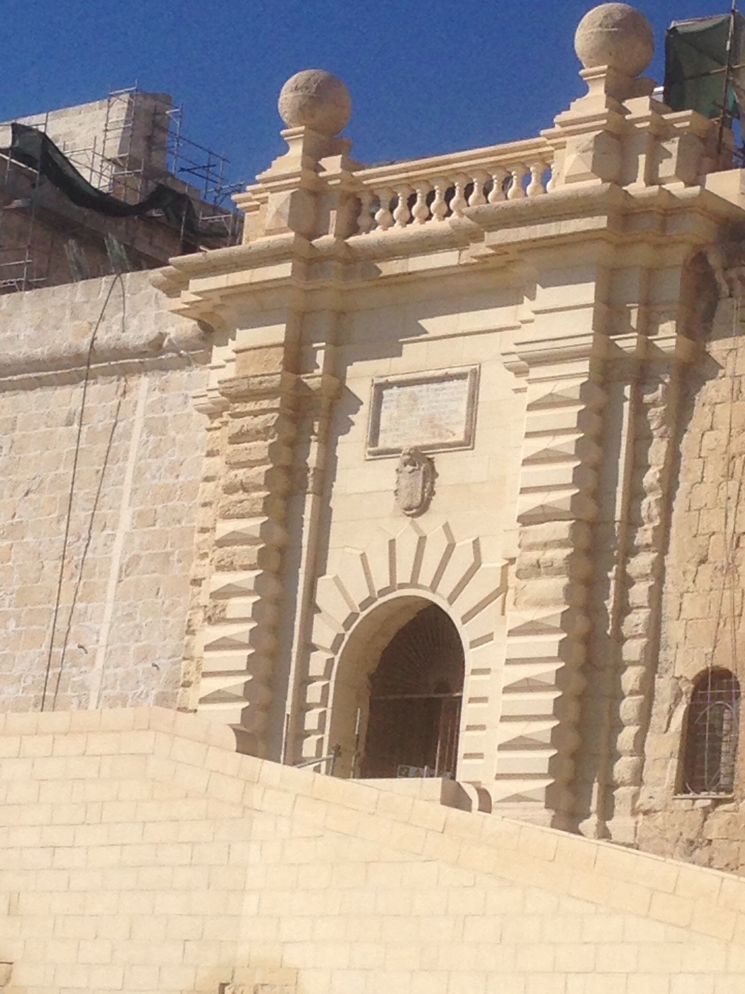
However, the impressive seaward bastions of the fort remain, heir to Fort St Michael’s original site and purpose, as does the Senglea Main Gate, which has recently been restored, after the post war reconstruction collapsed in the late 1960s due to heavy rainfall.
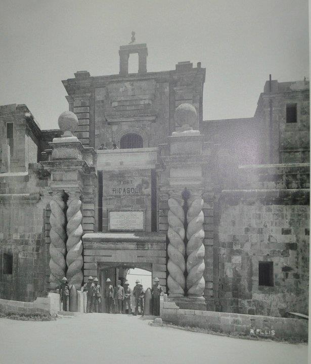
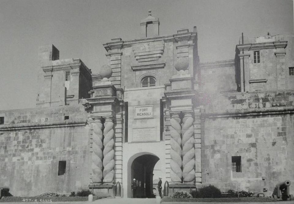
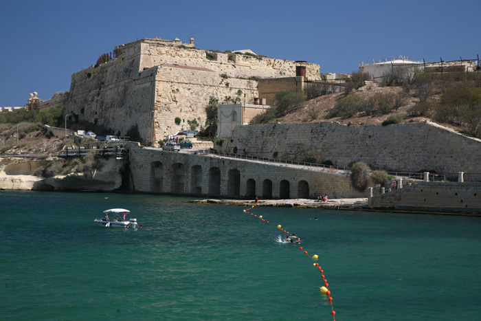
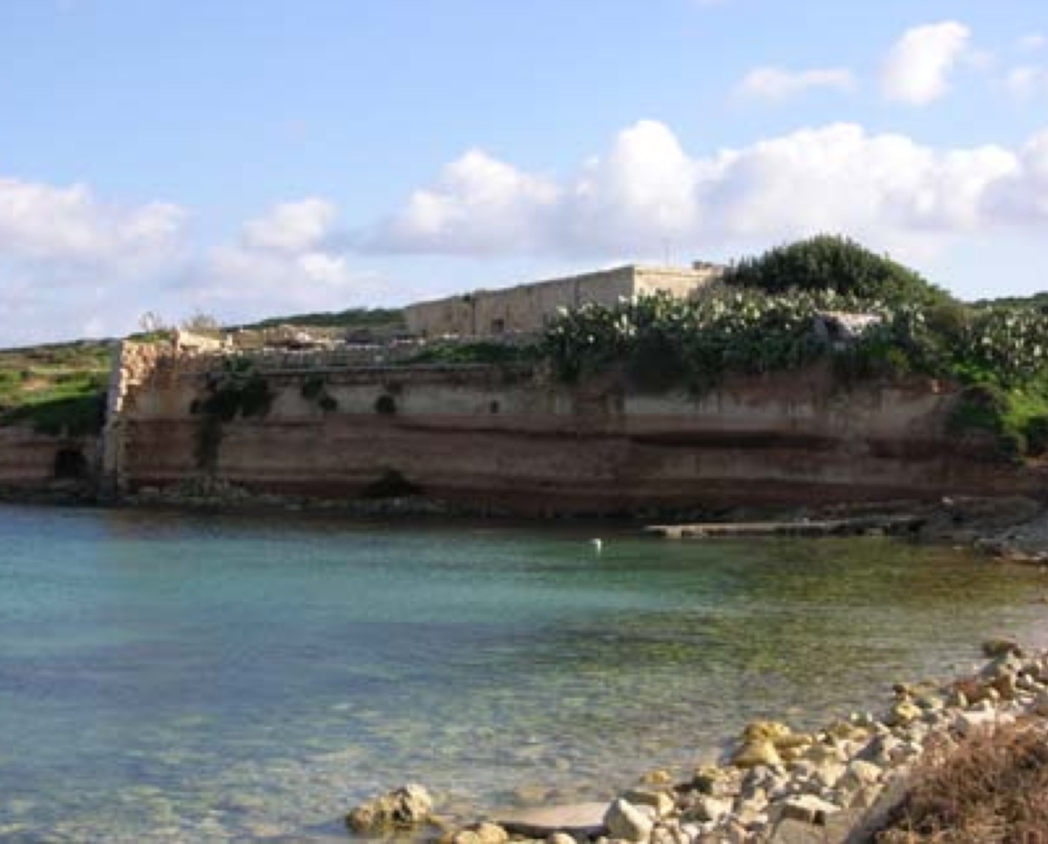
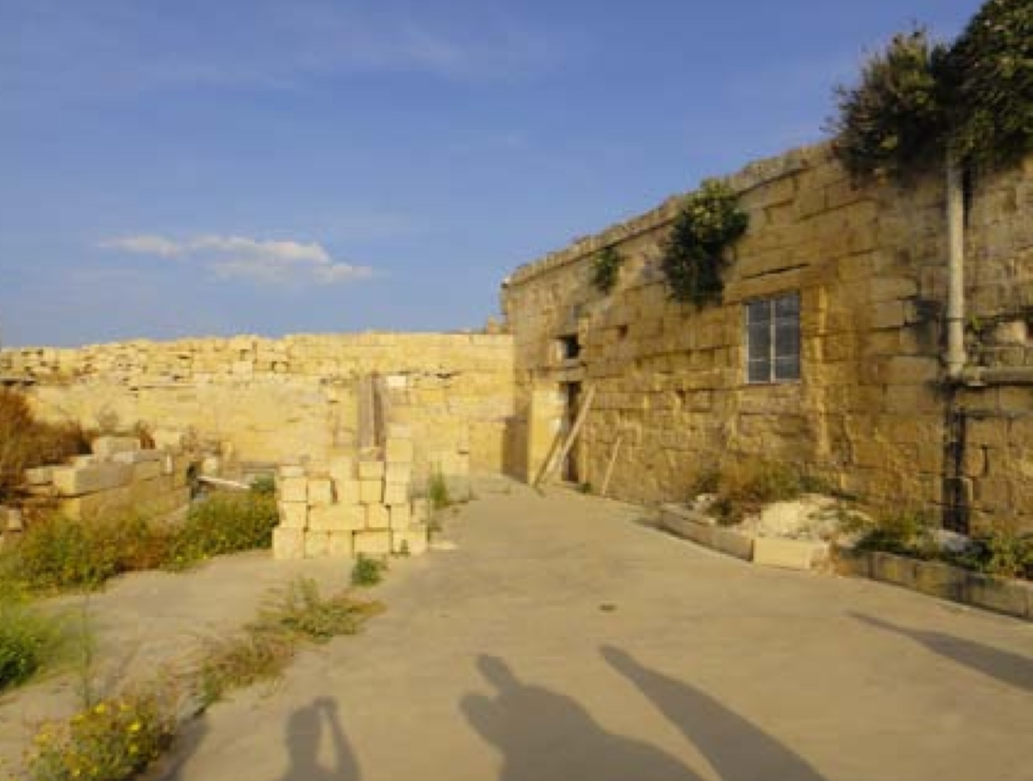
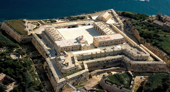
Fort Ricasoli
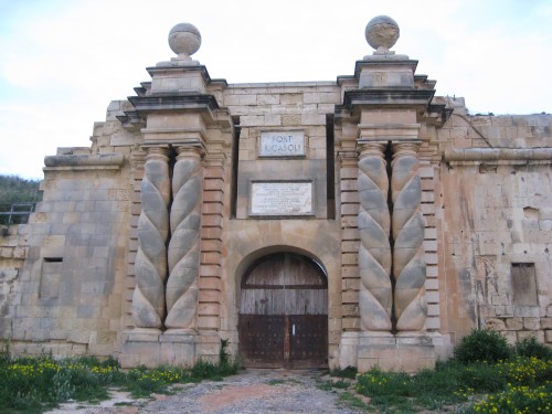 The fort was built by the Knights of Malta between 1670 and 1693.
It occupies the promontory known as Gallows Point that forms the eastern arm of Grand Harbour, and the north shore of Rinella Creek. Together with Fort St. Elmo and Fort Tigné it commands the approaches to Grand Harbour and Marsamxett Harbour.
History
It was designed by the Italian military engineer Antonio Maurizio Valperga, as part of Grand Master Nicholas Cottoner’s extensive fortifications around Grand Harbour. It is named for the knight who financed a large part of the works, Fra Giovanni Francesco Ricasoli.
The Fort continued to be an active military installation throughout the British period and was commissioned as HMS Ricasoli between 1947 and 1958, providing training for the Naval population..
It was the scene of a mutiny in 1807 when [Albanian] soldiers of the Froberg Regiment revolted and shut themselves up in Fort Ricasoli. Despite attempts at negotiation they eventually blew up the powder magazine. The mutiny was quashed by loyal troops, and 30 mutineers were condemned to death by court martial.
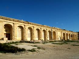
Fort Ricasoli was active in the defence of Malta during the second world war. Structural alterations and additional gun emplacements on the seaward bastion bear witness to its continued use and evolution as a military installation.
The fort has suffered significant damage from enemy action in the siege of Malta during World War II, when much of the internal structure was badly damaged. The gate has been rebuilt, but the internal buildings including the Governor’s House have been lost.
Present day
Today the fort faces a much bigger threat from the relentless onslaught of the sea. The fort is threatened by erosion from seaward, where a fault in the headland on which it stands is being eroded by the sea.
During the tenure of the British military, the bastion was substantially repaired, with the outer surface being cut back and new stone facing applied. This too is now eroding badly and in 2004 a section 100 metres long by 13 metres high was removed, restored and re-attached. Parts of the fort are still viewed as being in a dangerous condition.
Rihana Battery
Also known as Ducluseaux or Tal-Francis.
Rihana Battery was one of the original group of coastal fortifications erected by the knights of St John in the years 1714-16.
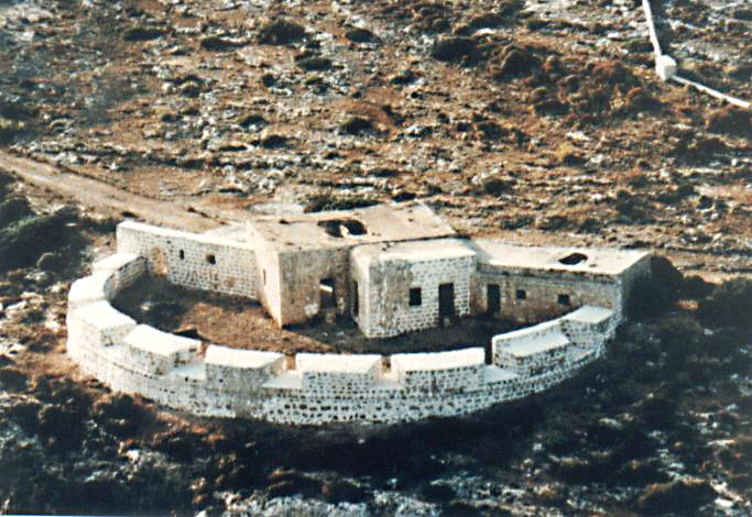
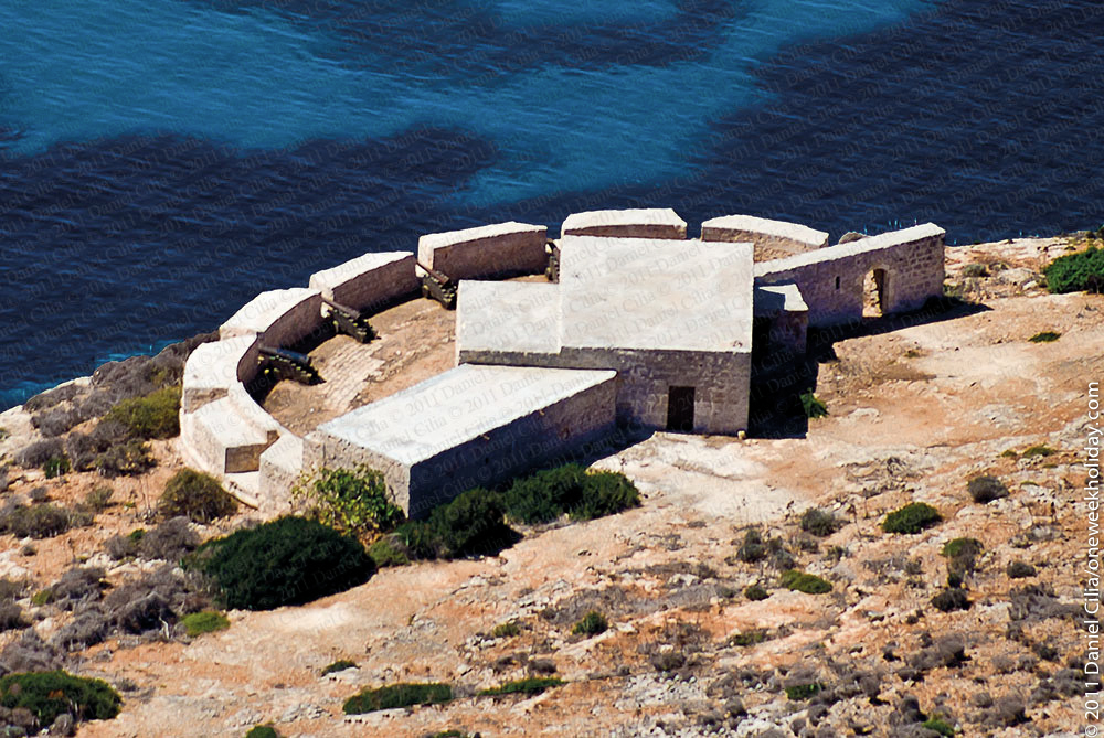
The structure originally consisted of a pentagonal platform with a large rectangular blockhouse sealing off the gorge. Today the structure is missing its left face, which collapsed over time into the sea.
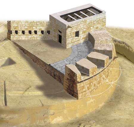
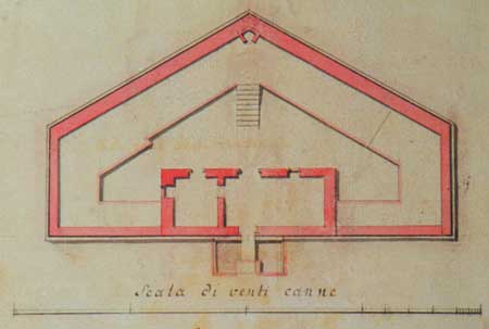
The blockhouse itself originally had a V-shaped redan protecting its entrance (now missing) and a drop-ditch This was one of the largest blockhouses constructed in a Hospitaller coastal battery and consists of three rooms, a large central one for the accommodation of troops, with two smaller ones on the sides serving for the storage of gunpowder and victuals; in all the blockhouse’s roof was supported on 17 diaphragm arches and two cross-walls. The blockhouse has its own cistern cut out into the rock immediately underneath the floor of the building. There was one main entrance from the exterior and a corresponding opening leading out onto the battery platform. Each of the two side rooms had a door opening to the gun platform while the central room also had two windows, likewise opening onto the battery.
Various 19th and early twentieth century alterations were made to the blockhouse
Santa Marija Battery, Comino
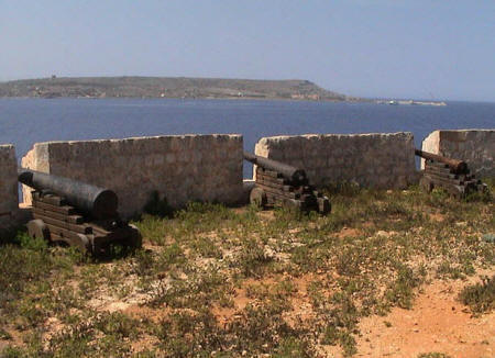
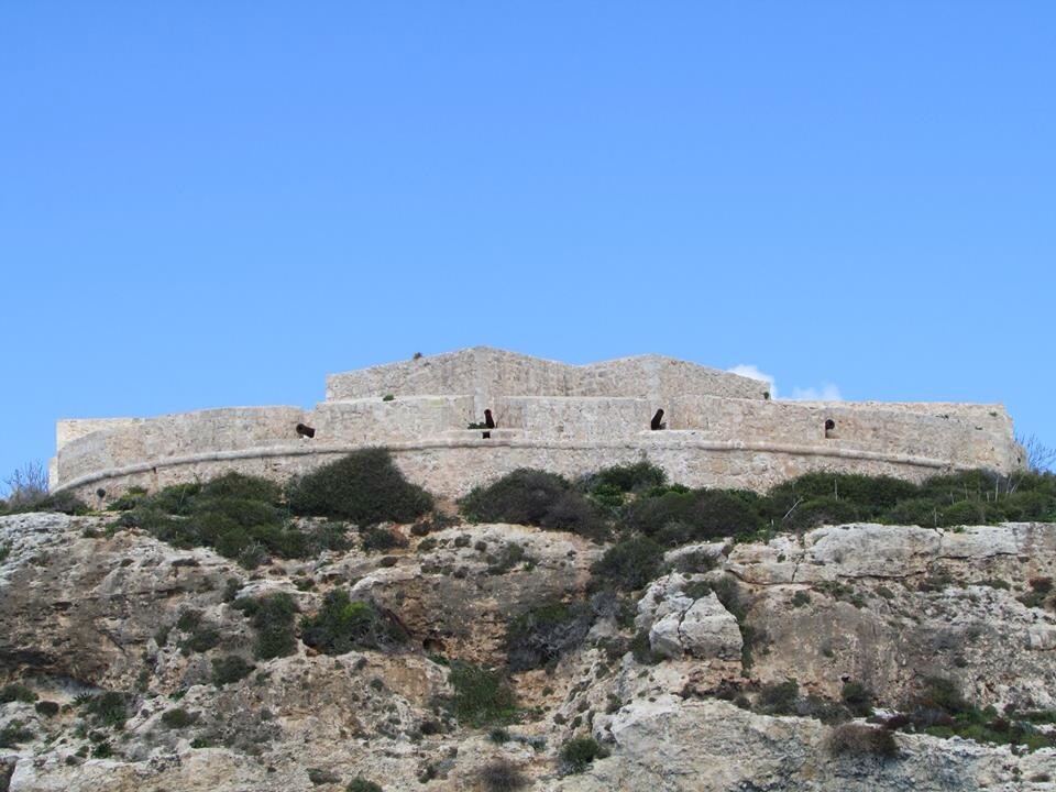
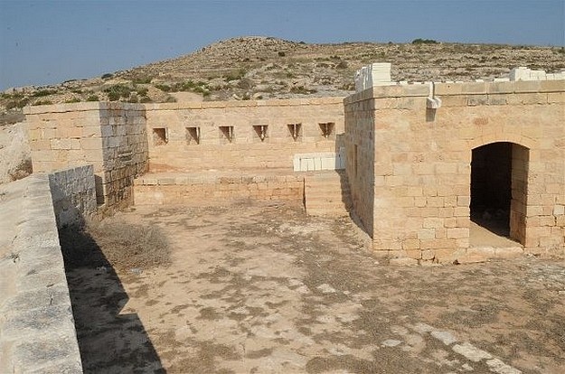
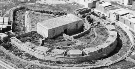
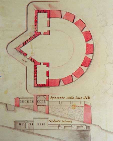
This battery was erected in 1715 to protect the south Comino channel, and is one of three surviving coastal batteries. It was equipped with two 24-pounder and four 6-pounder cannon. This type of coastal battery was built to resist the disembarkation of troops from an enemy fleet. It was fitted with a semi-circular enciente facing the entrance to the bay and contained eight embrasures as well as being enclosed by a wall that protected it from a landward attack. It also had a blockhouse to accommodate the garrison and to store ammunition and supplies.
Restoration of the Battery commenced in 1996. The project was completed with the installation of an iron gate to the main entrance, the blocking of six of the eight embrasures with an iron grill and the mounting of a 6-pounder cannon which was transferred from its location about four hundred metres away by helicopter in a joint operation between the Armed Forces of Malta and the Royal Navy. The original 24-pounder cannon were still on the island and have been mounted within the Battery. The stone in the embrasures and main entrance was badly deteriorated and the original pointing had suffered severe weathering. The roofs of the blockhouse need urgent repair and the entrance was about to collapse. Flagstones were laid in the three smaller rooms and the entire enciente was repointed.
Qolla il-Bajda Battery – Qbajjar Gozo
The battery on the promontory between Qbajjar and Xwejni is the last vestige of a chain of fortifications built early in the eighteenth century around Marsalforn bay to avoid landings of enemy craft in the area.
Known commonly, but wrongly, as Qbajjar Tower, this battery was raised between 1715 and 1716 under the direction of the military engineers Jacques de Camus D’ Arginy and Bernard de Fontet.
The battery is constructed in a semi-circle with two blocks to house the garrison and a defensive wall between them with musketry loopholes to provide enfiladed fire.
There is a ditch on the seaward side and access was from the landward side through a high stairway with a drawbridge.
The battery’s armament in 1770 was four 6-pdr. guns with 276 rounds of roundshot and 60 rounds of grapeshot.
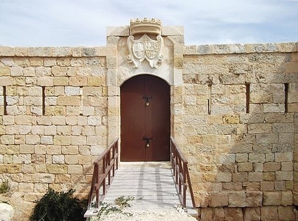
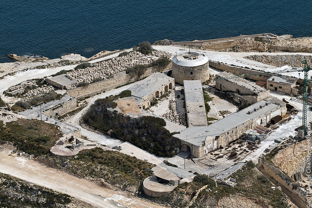
Fort Manoel
Fort Manoel stands on Manoel Island in Marsamxett Harbour to the north west of Valletta and commands the entrance to Marsamxett Harbour and the anchorage of Sliema Creek. Fort Manoel is a star fort with much of its ditches and walls formed from the native rock of Manoel Island.

History
The fort was built by the Knights of Malta between 1723 and 1755, under the patronage of Portuguese Grand Master Manoel de Vilhena.
 The original design work for a fort on the island, then known as Isolotto, was the work of the French engineer René Jacob de Tigné. The final design also incorporated the work of Charles François de Mondion, at that time the Knights of Malts’s resident military engineer in charge of works of fortification and defence. Mondion also supervised the construction, and was hypothetically buried in the fort’s chapel, St. Anthony’s Chapel.
The fort was an active military establishment initially under the Knights and later under British Military control from its construction through until 1906 when the British military finally decommissioned the forts guns.
During the Second World War, a battery of 3.7-inch heavy anti-aircraft guns was deployed in and around the fort. The guns were mounted in concrete gun emplacements and deployed in a semicircle around the fort. The fort suffered considerable damage to its ramparts, barracks and chapel as a result of aerial bombing during the war.
In 2010, the fort underwent major restoration work to repair the ravages of time and damage sustained during the Second World War.
It served as a location for the shooting of the climactic scene of the episode Baelor of the TV series Game of Thrones. This was one of the strongest fortifications.
St Anthony Battery – Qala Gozo
The first proposal for the fortification of the Qala location was put forward in 1730 and the work on the battery, named St Anthony Battery in honour of the then-reigning Grand Master, Antoine Manoel de Vilhena (reigned 1722-36), who had offered to build it out of his own expense, was began in 1731 and brought to completion in the following year, as recorded by the date and inscription which once stood above the small main gate into the fort.
The major structural work on St Anthony Battery seems to have been completed by early December of 1732 as evidenced by the fact that the remaining surplus quantities of pozzlana (a type of volcanic ash used in the mixture of lime mortar) were removed from the battery on 28 December 1732, and transported back to the Gozo citadel, a task which cost the Governor of Gozo 8 tari ( ‘per trasporto della puzzolana avvanzata in detto fortino, nel Castello’). Many of the finishing touches, however, were still under way during 1733 and continued as late as April 1734 when the escutcheons on the main gate were finally carved out. In August 1733, the master carpenter Antonio Mallia and the master blacksmith Saverio Dimech received payment for the manufacture and fitting of the doors and windows of the blockhouse while towards the end of that year Mastri Ferdinando Vella and Domenico Bigeni were paid for other unspecified works carried out at the battery. By this time, the battery was already in need of some repairs. Two large stones supporting the drawbridge had to be replaced, for the cost of 1 scudo, after being damaged during the transportation of the heavy cannon into the battery on 20 December 1732 (‘per rimetter due ballate al ponte di detta batteria (qala) quail furon rotte quando vi si trasporto l’artigliaria). The roof of the block house had to be repaired twice, in February and September 1733 respectively.
The Ras il-Qala battery was one of the largest coastal batteries constructed locally in terms of its typology and dimensions. Its design is also unique in many ways. To begin with, its polygonal plan departed from the standard semi-circular configuration which was nearly universally applied to most coastal batteries of the time, particularly those erected by the knights during the course of the 1700s. The platform has a demi-hexagonal plan with a large musketry wall and triangular redan closing off the gorge, complemented by a sizeable centrally-placed blockhouse occupying the rear of the platform. The design of the battery is attributed to the resident military engineer, the Frenchman Charles Francois de Mondion, which would make it one of his last works, given that he died in 1733. As resident military engineer, Mondion would have been responsible for all new works of fortification but the construction works would have been supervised by his assistant, the Italian second engineer Francesco Marandon, who would later go on to become the resident military engineer in his own right and see to the construction of the large fortress on Ras-e-tafal (Fort Chambrai) in 1749.
Initially, it was intended to arm the battery with a good number of heavy guns, including among others, two 36-pounders (then amongst the heavies pieces in the Order’s arsenal), together with other 24-pounders. Indeed, the ammunition for these guns had already been transported and deposited inside the battery by the end of 1731 when it was suddenly decided to arm the battery with guns of a smaller calibre. In December 1732, the extra sum of 9 scudi had, as a result, to be incurred ‘per portare palle di ferro nella batteria d Ras il Cala in lugo di quelle divenute inutile allorche furono mutate i cannoni’.
For most of its history, Qala Battery was to have an armament of eight guns. By 1785, these included five 8-pounder iron cannon with 420 rounds of roundshot and 58 rounds of grapeshot; and three 6-pounder guns with 175 rounds of roundshot and 61 rounds of grapeshot. The importance of the battery can be gauged by the fact that it was one of the few coastal works to have held its own supply of gunpowder permanently on site; which in turn also meant that the outpost was manned round the clock, all year round

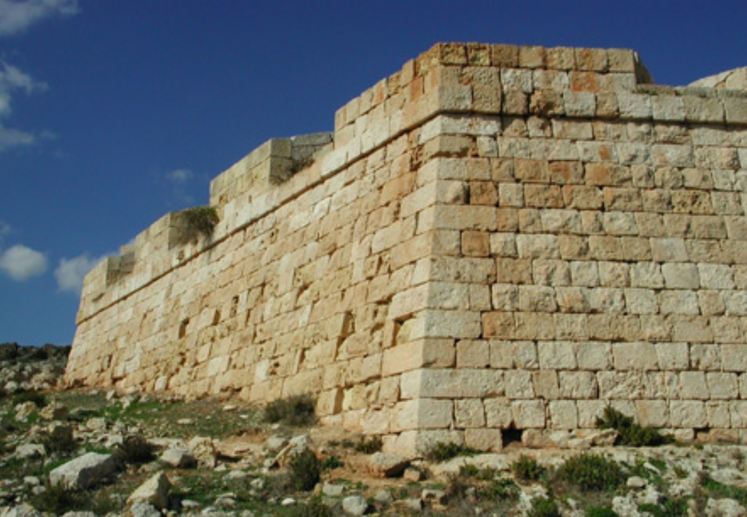
Mistra Battery
Although the building of a battery was mentioned in the report prepared by the commissioners of fortifications Fontet and D’Arginy, it seems that this battery was not built in 1714.
In fact Maigret’s report written in 1716 does not mention this battery.
Probably the battery was built in 1761 on the insistence of the military engineer Bourlamaque. During this period there was Grand Master Manoel Pinto de Fonseca and there was a revival in the building of new coastal fortifications. These were the coastal entrenchments.
Bourlamaque also emphasised on the building of new coastal batteries and Mistra Battery seems to be one of them.
Mistra battery consists of a large semi-circular artillery platform surrounded by a low parapet.
Originally there were three embrasures in this battery. The battery was surrounded with a ditch. At the rear of the battery there are two blockhouses and on the landward side of the walls there are a number of musketry loopholes to cover the inland approaches. The blockhouses are linked with a redan. It is interesting to note that the redan was fitted with an upper walkway for the sentinels stationed in this battery. One can immediately recognise that the idea of this walkway is similar to that of the bastions. In the redan there the door where was there was a small drawbridge over the ditch.
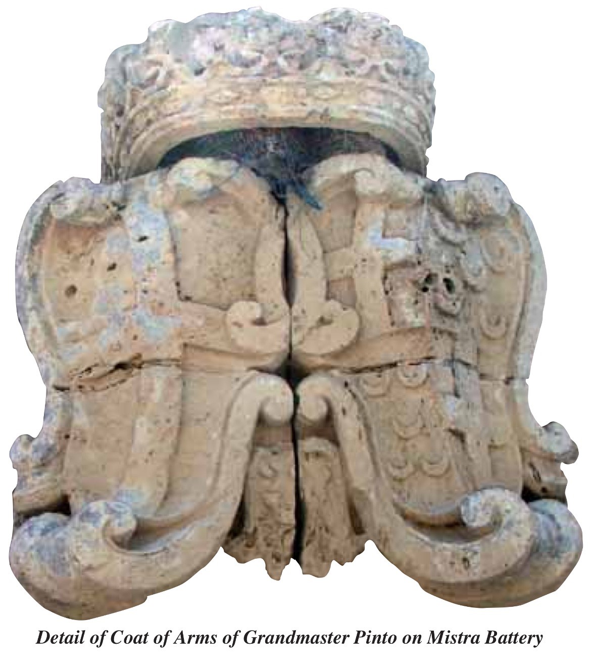
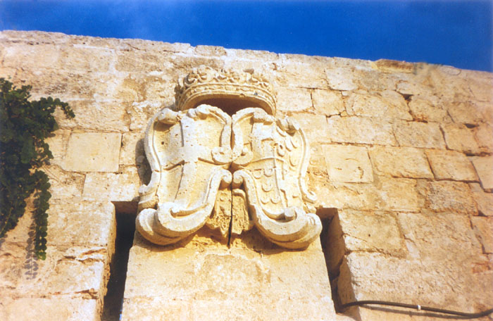
Over the door there is the coat-of-arms of Bailli de Montagnac and Grand Master Pinto, thus bringing one to the conclusion that this battery was built during his reign. In 1770 there was one 8-pdr as artillery in the battery.
From early 1990s till 2012 Mistra Battery was used as a fish-farm, where a number of alterations were made on it, destroying also parts of it. It was restored in 2012 after the fish farm was relocated.

Fort Tigne’
 Fort Tigné was begun in 1793 and was a very small work by eighteenth century standards, actually more of a large redoubt, but its design was probably the most revolutionary and influential of all the fortifications built by the knights in Malta.
Designed by the Order’s chief engineer, Stephan de Tousard, its most important features were the lack of bastions and the counterscarp musketry galleries. The design was heavily influenced by the writings of Montalembert and more particularly by the lunettes built by the French general, Jean-Claude Lemichaud D’Arçon.
By the end of the eighteenth century, the supremacy of the bastioned system was being challenged by the growing popularity of the tenaille trace. The new style of fortification known as the polygonal system, of which Fort Tigné is one of the earliest examples, was to dominate the art of military architecture through most of the following century.
Fort Tigné was the last major work of fortification built by the Order in Malta.
18th Century Coastal Batteries
Dr Stephen Spiteri
Coastal fortifications were an important component of the Order’s defensive strategy throughout the seventeenth and eighteenth centuries.
Initially, the Hospitaller defensive scheme was conceived as a sort of early-warning system intended to warn of approaching danger but this strategy was eventually augmented, by the end of the eighteenth century, with a wider network of defensive positions redesigned to serve as a series of physical obstacles against invasion.
When the knights took possession of the Maltese islands in 1530, they were unwilling to construct any but the most essential defensive works and, right up to the end of the cinquecento, the Order confined its attention primarily to the fortification of the harbour area. As far as the defence of the coastline was concerned, the Hospitallers continued to rely upon the same system of militia watch-posts that had long since been employed by the Maltese. Few military outposts were erected beyond the Harbour area until the turn of the seventeenth century when the knights embarked upon a spree of tower-building but it was the eighteenth century, however, which was to witness the heaviest and most widespread investment in coastal works of fortification. Between 1714 and 1716, the Order’s French military engineers designed and built a vast network of coastal defensive positions comprising a network batteries, redoubts, and entrenchments. Unlike the towers, however, these new elements were designed to actively resist invasion and provide solid barriers to attack, reflecting a deliberate change in strategy that was to remain the Hospitaller knights’ main concern throughout the course of the settecento.
Most of the coastal fortifications, particularly the batteries and redoubts, were built in the manner of permanent stone fortifications, along formal lines with revetments of carefully cut stone although, many others, particularly the coastal entrenchments, were built more hurriedly in the manner of field defences.
The first to materialize were the coastal batteries, or platforms, designed to mount guns intended to fire on approaching ships. Although many of the batteries which took root around the islands’ shores materialized in the years 1715–16, the idea for these French style coastal defences had been first mooted by the Commissioners Jacques de Camus d’Arginy and Bernard de Fontet and a French secondary engineer by the name of François Bachelieu in 1714. The coastal defence strategy found a great exponent in the Prior of France, the Balì de Vendôme, and it was mainly through the latter’s insistence, and a generous loan of 40,000 scudi which he presented to the Order, that the network of batteries and redoubts was made possible. A number of other knights too, made small financial donations toward this effort – as can be witnessed by the fact that a number were named after their benefactors, such as Arrias Battery, Crevelli Redoubt, Ferretti Battery, Gironda Battery, etc.
Initially, it appears that these were simply prepared positions for artillery, undefended and open to the rear but most soon began to acquire defensible perimeters and blockhouses to shelter troops and munitions. Most of these structures followed the French pattern, albeit on a smaller scale, and basically consisted of semi-circular or polygonal gun-platform, sometimes ringed by embrasured parapets, and having one or two small blockhouses. For protection from landward attack, the batteries were given loopholed walls and redans. In most cases the blockhouses were placed in such a manner as to seal off the gorge and their walls were pierced with musketry loopholes. The engineers experimented with various combinations of blockhouses and redans depending on the tactical requirements of the site. In two instances, at Mellieħa (Westreme Battery) and Comino, a single blockhouse was placed diagonally across the gorge so that its two outer faces functioned as a redan. Some batteries were also protected by rock-hewn ditches placed either on the landward or seaward sides, or both. Those batteries built very close to the sea, like Orsi, Qajjenza, and Buġibba had moats filled with water.
The entrance to all batteries was from the landward side. A drawbridge was usually fitted to the gateway but it seems that not all batteries were actually fitted with one since, in 1792, the Congregation of Fortification and War ordered that those still lacking a drawbridge were to be supplied instead with two wooden planks.
Design-wise, hardly any two batteries are the same. They all differed in some detail from one another, either in size, shape of the artillery platform, number of embrasures on the parapet, or the layout of the barrack blocks and landward defences. This variety may reflect the personal preferences of the relatively large number of military engineers who were present on the island in the years 1714–16.
A variant of the coastal battery, was the coastal redoubt. In shape and form, there was little to distinguish a Hospitaller coastal redoubt from a coastal battery other than that the former usually lacked embrasures and gun platforms for cannon, for both were equipped with blockhouses and ditches. Unlike the batteries, however, the majority of redoubts erected by the knights in Malta and Gozo followed a more or less standard pentagonal plan. The redoubts were not generally designed to mount cannon since they were intended to serve as infantry strongpoints. Tactically, they were designed to allow small detachments of militia equipped with muskets to hold out against landed troops and prevent them from establishing a beachhead. The defensive roles played by redoubts varied considerably, making it difficult to give a precise definition and any particular configuration to this form of fortification.
The pentagonal-plan redoubts were all fitted with a single blockhouse at the gorge and had low parapets and all-round shallow ditches. Eleven redoubts were built following this standard pattern. The majority are found along the northern shores of Malta from Baħar-iċ-Ċaghaq to Marfa, (Tal-Bir, Eskalar, Armier, Louvier, Mellieħa, Qalet Marku, and Baħar-iċ-Ċagħaq) together with two in Gozo (Marsalforn and Ramla). Only two were built in the south of Malta, namely at Marsascala and Marsaxlokk (Del Fango Redoubt). A few coastal redoubts were built with semicircular or rectangular platforms such as St George Bay Redoubt, Xwejni Redoubt in Gozo, St George Redoubt (Birżebbuġa), and the two Salina Bay redoubts. That known as the Perellos Redoubt, at Salina (now demolished), was particular in that one corner of its perimeter wall was fitted with a small bastion. Ximenes Redoubt, on the opposite side of the bay, on the other hand, had two blockhouses but these were later unceremoniously replaced by a large magazine designed to house salt from the nearby Saline Nuove. Both Salina redoubts were unique in that they were later also fitted with internally-placed fougasses. The most sophisticated redoubts, certainly, were the tower-like works pierced with rows of musketry loopholes. These were designed along the lines of blockhouses or tour-reduits, a type of fortification much favoured by the French throughout their colonies in the Americas, where most were built in wood. In all, three tour-reduits were built and these were confined to Marsaxlokk Bay, namely Fresnoy, Spinola, and Vendôme Redoubts. The Spinola and Vendôme tower-redoubts were squarish in plan but that at Kalafrana (Fresnoy), had a semicircular front and a redan to the rear facing the landward approaches. Only the Vendôme example survives to this day. A fourth tour-reduit was erected in 1720 at Marsalforn in Gozo, presumably by Mondion, but this too, has disappeared.
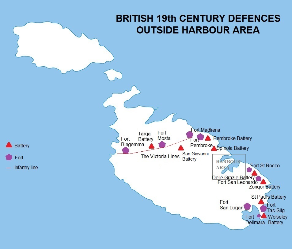
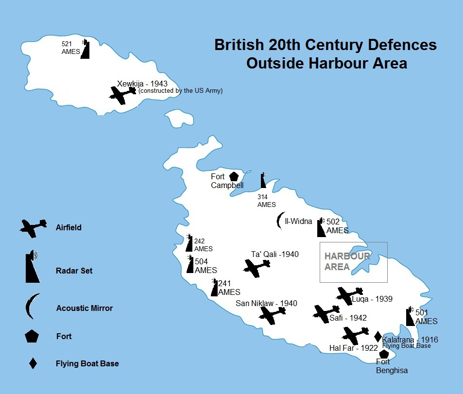
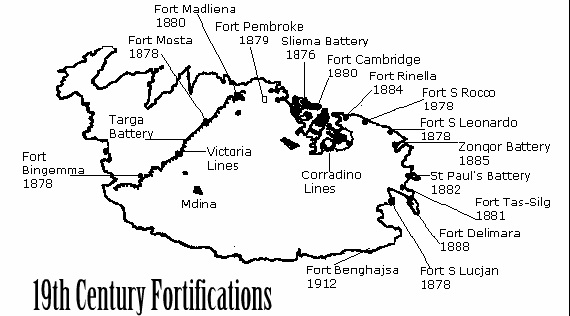
BRITISH ERA
Some Fortifications and Batteries
Fort Leonardo
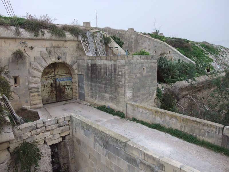 Fort Leonardo also known as Fort St Leonardo, Fort San Leonardo and Fort San Anard is a fortification that stands between Xghajra and Zonqor Point above the shore east of Grand Harbour.
It was built between 1872 and 1878 by the British.
Fort St Leonardo still exists, and is in reasonable repair, though a house has been built inside the ditch and the ditch in-filled to create an access. The seaward ditches are all in good repair. The fort is now used as a farm.
The layout of the fort is complicated, with a smaller inner fort forming one corner within the larger part of the fort that contains the gun emplacements.
A modern construction, possibly a reservoir, alongside the shoreward side of the fort detracts rather from its original appearance, and the approach to the main gate has been mined for rubble and is substantially damaged.
The fort inside the ditch is not open to the public.
Fort St. Rocco
Fort St Rocco, also known as Fort St Roca on some maps, is a fortification that stands east of the Rinella Battery and seaward of Xghajra, and forms part of the complex of shore batteries defending the coast east of the mouth of Grand Harbour.
Its construction was started in 1872 by the British, as part of a program of improvements to Malta’s fortifications recommended in Colonel Jervois’s Report of 1866 titled “Memorandum with reference to the improvements to the defences of Malta and Gibraltar, rendered necessary by the introduction of Iron Plated Ships and powerful rifled guns“.
It remained a functional military establishment until the 1950s.
Fort Sliema
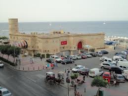 Sliema Point Battery, or as known by the Maltese “Il-Fortizza”, was completed in 1876 to the design of Colonel Jervois, who incorporated many Gothic features.
It was armed with four canons and the total cost was £12,000.
By 1903, the guns were removed and the fort became a searchlight position to illuminate any enemy vessels approaching the island, especially the Grand Harbour area.
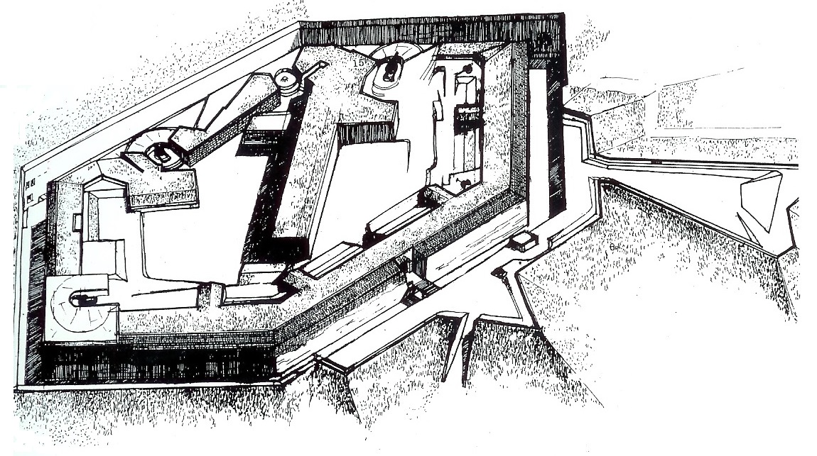
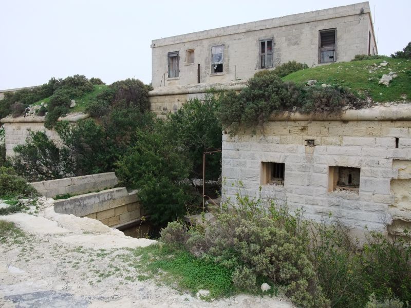
Fort Pembroke
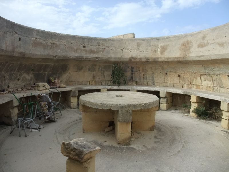
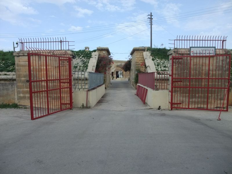 The largest British coastal defence in Pembroke is Fort Pembroke. It was built between 1875 and 1878 on the high ridge overlooking the northerly seaward approach to the Grand Harbour. Its main armaments were three 11-inch Rifle Muzzle Loading guns and one 64-pdr gun, all mounted ‘en barbette’ (a protective circular concrete emplacement around a gun that fired over the top of the parapet).
The fort was shaped like an elongated hexagon surrounded by a ditch and glacis and contains underground magazines and casemated quarters for the garrison.
By the mid-1890s, the fort’s armament were considered obsolete and required replacement but the change never materialized and the use of the fort became more of a depot and storage area, especially for small arms ammunition. Later, the gate was widened, it’s rolling Guthrie Bridge was dismantled and replaced by a fixed metal bridge.
Following the closure of the Pembroke military establishments in 1978, the fort remained unused for some time but later it was allocated for use as the Verdala International School which still operates from this historic site.
MEPA scheduled Fort Pembroke in 1996 as Grade 1 property of historic, architectural and contextual value as it forms part of a larger scheduled military complex. In 2009 its protection status was revised to also include its surviving glacis as republished in the Government Notice number 880/09 dated 30th October, 2009.
Fort Delimara
History
 The fort was built between 1876 and 1888 by the British. The main gate carries a date of 1881, but this is the date of completion of the gatehouse, not the commissioning of the fort.
Fort Delimara was a one of a ring of forts and batteries that protected Marsaxlokk harbour, along with Fort Tas-Silg at the shoreward end of Delimara point, Fort St Lucian on Kbira point in the middle of Marsaxlokk bay, Fort Benghisa on Benghisa Point, and the Pinto and Ferreti batteries on the shores of Marsaxlokk Bay.
In 1956 the fort was stripped of the majority of its artillery. Soon after, the fort was abandoned for a considerable period, and in 1975 it was leased by the Malta Government to a local farmer, who used it to raise pigs for fifteen years.
After protracted negotiations, ownership of Fort Delimara was transferred to Heritage Malta on August 11, 2005. Despite the pigs and a considerable amount of modern debris, the fort remains in decent condition, and still retains four of its original complement of fourteen Victorian 12.5-inch 38 ton rifled muzzle-loading guns.
Heritage Malta intends to restore the site to its former condition, and open it to the public as a museum and tourist site.
Details of the fort
Fort Delimara is mostly underground, with the fort’s main armament mounted in casemates set in the cliffs on the shoreward face of Delimara Point. At the surface it is a polygonal fort, rectangular in outline, with rock cut ditches on three sides, and the gently curving vertical cliff forming the convex fourth side. Ventilation apertures and access passageways are spread out across the face of the cliff, and even out onto the seaward face of Point Delimara.
Gatehouse
 The ditches are edged with revetting, with the upper scarp faced in earth and rubble. A stone parapet with rifle loops runs along the top of the north scarp. A square building above the gate may be a later addition from the early twentieth century, when the fort was used as a military base long after its surface fortifications were obsolete. A World War II vintage pillbox has been erected inside the Victorian fortification, and shows above the fort’s profile when viewed from the sea. The gatehouse faces toward the landward end of Delimara Point, reached by a tarmac road that runs outside the north ditch. The gatehouse is close to the seaward end of the north ditch.
Counterscarp battery
A counterscarp battery at the north end of the east ditch commands the north ditch and the gatehouse. Presumably there is a counterscarp battery at the south end of the east ditch covering the south ditch, since there are no caponniers visible in the ditch.
East and south ditches
The glacis in front of the gatehouse has probably been reduced at some time to make road access easier, and the rolling bridge that would originally have crossed the ditch has been replaced by a permanent bridge. The road to Delimara Lighthouse along the east ditch of the fort disrupts the glacis on this face as well. The glacis is more intact along the south ditch, giving a better impression of how the fort would have looked when originally built.
Seaward face and gun emplacements
The seaward face of the fort is dominated by the massive stone and concrete casemates that originally sheltered the fort’s 12.5 inch rifled muzzle loading guns. The casemates are grouped in pairs close to the cliff top, capped by an earth and rubble slope, and follow the natural curve of the cliff face, giving them a combined field of fire that covers the majority of Marsaxlokk harbour.
Present condition
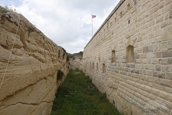
Externally the fort is in fair condition. Like all the polygonal forts in Malta, the limestone faces of the scarp and counterscarp have eroded substantially since they were originally cut, in places to a depth of as much as a metre. In some cases this erosion has reached the point that the revetting collapses into the ditch. Where the road to Delimara Lighthouse runs along the east ditch of the fort, directly above the counterscarp face of the ditch a section of perhaps ten metres the counterscarp has collapsed into the ditch, and threatens the stability of the road. The resulting rubble fall can be seen in the image of the east ditch. The ditch is also considerably overgrown, and polluted with general rubbish, unfortunately true of all the Victorian forts in Malta. There is currently no public access to the interior of the fort.
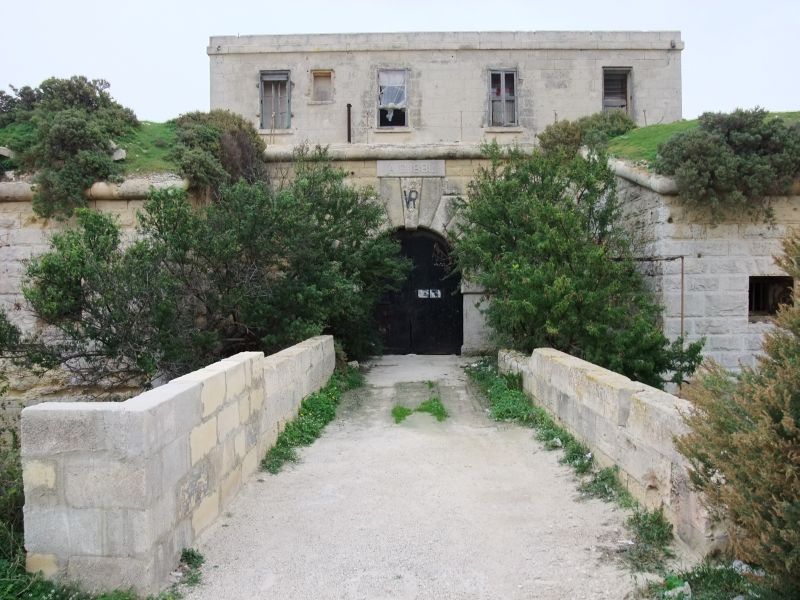
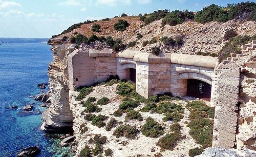
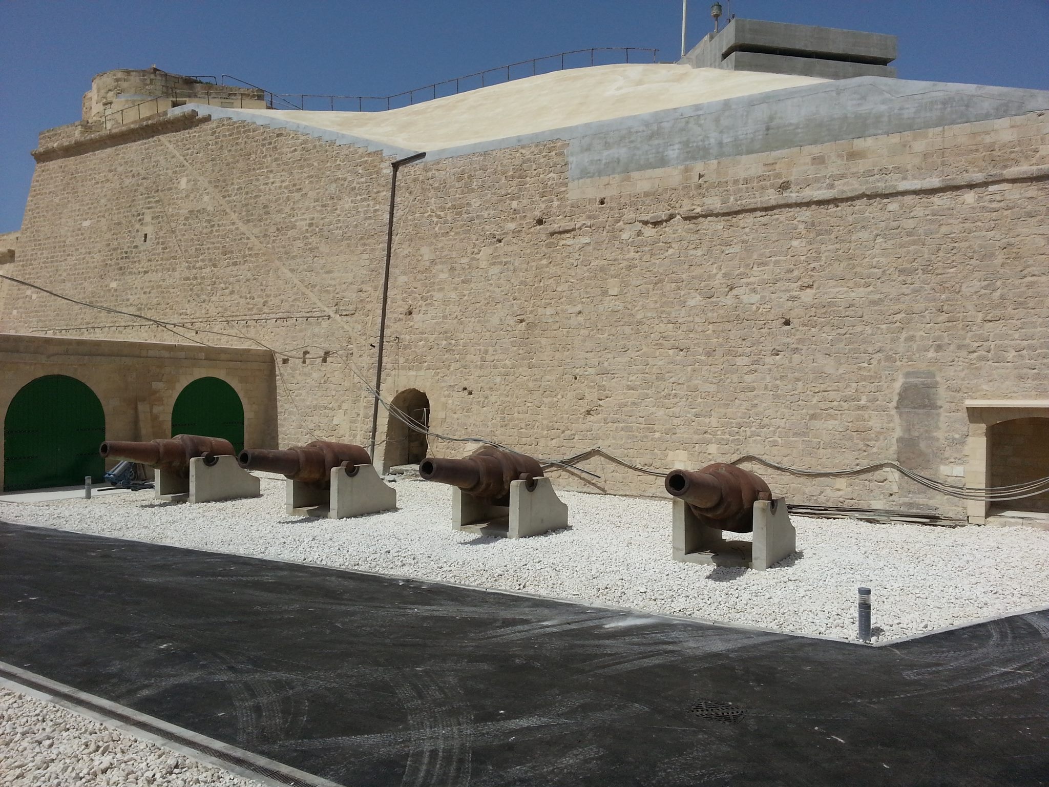
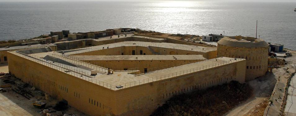
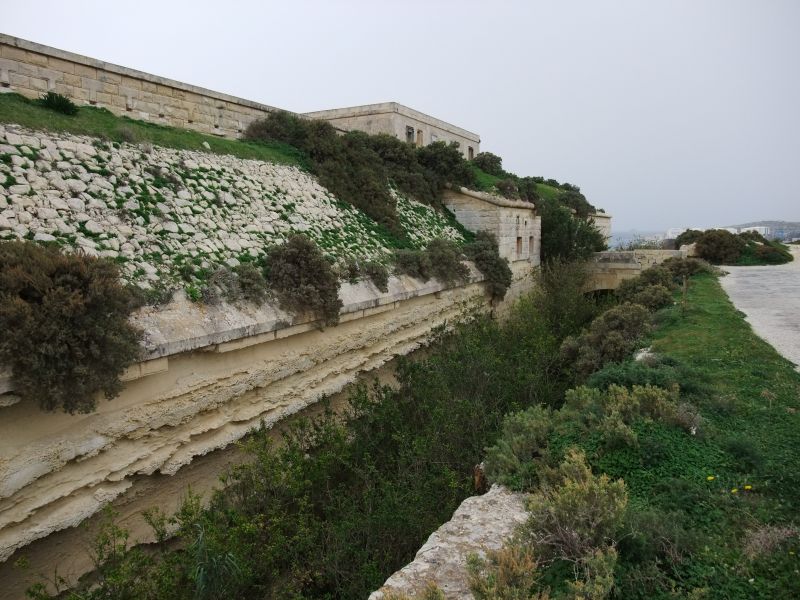
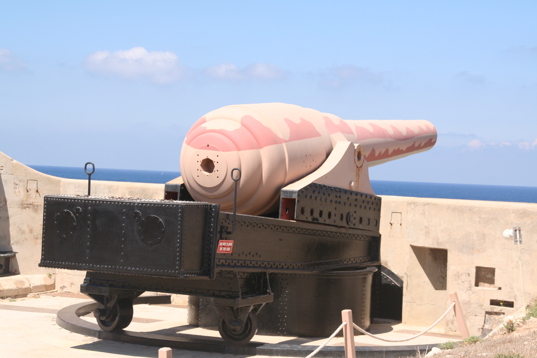
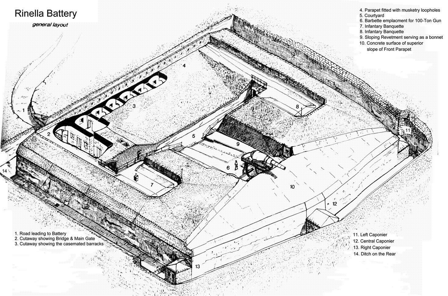
Fort Rinella
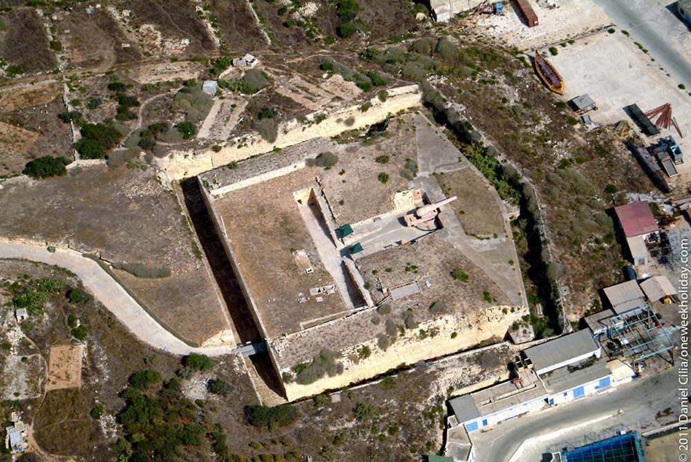 Fort Rinella is a Victorian fortification which is also referred to as the Rinella Battery in some maps and publications.
History
The British built the fort between 1878 and 1886, which stands above the shore east of the mouth of Grand Harbour, between Fort Ricassoli and Fort St. Rocco.
The fort was built to contain a single RML 17.72 inch gun: a rifled muzzle loading gun weighing 100 tons made by the Elswick Ordnance Company, which is still in place. The fort was originally one of a pair, however the paired Cambridge Battery near Tigne, west of Grand Harbour, no longer exists. The British installed a second pair of guns to defend Gibraltar, mounting one each in Victoria Battery (1879) and Napier of Magdala Battery (1883), which did not have Rinella’s self-defence capabilities. Today, only two of these guns survive, the one at Fort Rinella and the one at Napier of Magdala Battery.
The British felt the need for such large guns as a response to the Italians having, in 1873, built the battleships Duilio and Dandalo with 22 inches of steel armour and four similarly large 100-ton Armstrong guns per vessel. By arming both Gibraltar and Malta, the British were seeking to ensure the vital route to India through the Mediterranean and the Suez Canal, which had opened to traffic in 1869.
The fort is modest in size as it was designed to operate and protect the single large gun, with its associated gun crew, magazines, bunkers, support machinery and the detachment of troops stationed within the fort to defend the installation.
The gun was mounted en barbette on a wrought-iron sliding carriage and gun fired over the top of the parapet of the emplacement. This enabled the gun-crew to handle and fire the gun without exposing themselves to enemy fire. The fort was designed to engage enemy warships at ranges up to 7,000 yards. The low profile of the fort and the deeply buried machinery rooms and magazines were intended to enable it to survive counterfire from capital warships.
The fort has no secondary armament; its fortifications – simply ditches, caponiers, a counter-scarp gallery and firing points – were intended mostly for small arms fire and grenades.
The massive gun is far too heavy to be laid by hand, and the fort therefore contained a steam powered hydraulic system that traversed, elevated and depressed the gun, operated a pair of hydraulic powered loading and washing systems, and powered the shell lifts that moved the 2,000-pound shells and 450-pound black-powder charges from the magazines into the loading chambers.
 The gun was intended to operate at a rate of fire of a single shell every six minutes. The firing cycle was for the gun to be traversed and depressed until it aligned with one of loading casemates, with the barrel pushing aside an iron plate that normally closed the aperture in the casemate. The gun was then flushed with water to cool it, clean any debris and deposit from the barrel, and douse any remaining embers from the previous cartridge. The ramming mechanism then inserted and tamped a silk cartridge containing the propellant charge, which was followed by one of the range of shells the gun was adapted to fire. The loaded gun was then traversed and elevated using the hydraulic system, and fired by an electrical firing mechanism. The gun then slewed to the other casemate to repeat the loading process, while the first casemate was recharged from the deeper magazine.
The two separate loading casemates, each fed by an independent magazine, and the provision of man-powered backup pumps for the hydraulic system, such that a team of 40 men could maintain the hydraulic pressure to operate the gun, would have allowed the fort to continue firing even if substantially damaged.
 Originally the inner faces of the emplacement were revetted with masonry. Subsequent review of the fort’s defences after its completion identified this as a weakness, and the stone revetting was removed from most of the emplacement and replaced with plain earthworks, presumably to better absorb the energy of incoming shellfire. The revetting was retained around the loading casemates, as one can see in the image above.
The 100 ton guns were in active service for only 20 years, with all being withdrawn from active service by 1906, without ever firing a shot in anger. Because a single shell cost as much as the daily wage of 2600 soldiers, practice firing was limited to one shot every 3 months.
After the Armstrong gun was retired from service, Fort Rinella was used as an observation post for the guns of Ricasoli Fort, and unfortunately at some point the now obsolete steam engine and hydraulic system were removed. During World War II, the Navy used the Fort to store supplies, and it received seven bomb hits. The fort was ideal because from a plane’s view it blends into the fields as it was covered in moss and grass. The Navy gave up the site in 1956.
Emplacing the gun
The 100-ton gun arrived in Malta from Woolwich on 10 September 1882. There it sat at the dockyards for some months before it was ferried to Rinella Bay. One hundred men from the Royal Artillery manhandled it to the fort in a process that took some three months. The gun was finally in position and ready for use in January 1884.
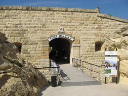
Fort Rinella today
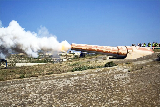
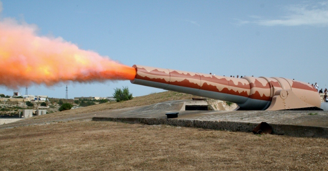
 Since 1991, the Fondazzjoni Wirt Artna has been restoring the fort, which is now open to the public as a Museum. Unfortunately, the steam engine and hydraulic machinery have not yet been replaced. Once a year, in May, a crew of volunteers fires the gun (using only black powder) to keep it active, and also to attract more visitors.
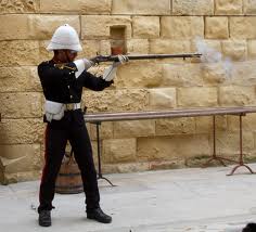
Throughout the year, at 13.00pm, re-enactors dressed as 19th Century British soldiers provide a tour of the fort that combines lecture, demonstration and live re-enactment. This includes the firing, without shot, of a Victorian-era muzzle-loading fieldpiece.
In the 1960/70s, the Fort was used as a location in the films, Zeppelin, Shout at the Devil, and Young Winston.
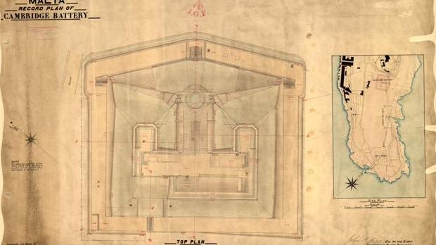
Fort Cambridge
The Cambridge Battery is a fortification in Malta . It was built from 1878 to 1880 at the time of British rule. It is located on the north east coast of the Dragut’s Point headland above the north entrance of Marsamxett Harbour immediately next to Fort Tigne’ . It was used to house the RML 17.72 inch gun.
When the British took over Malta in 1800 it was considered that the Fortifications left by the Knights of St John and the presence of the British Royal Navy in the Mediterranean was enough to defend the Maltese Islands.
However this scenario changed with the founding of the Regia Marina Italiana on 17 March 1861. The Regia Marina in 1873 inaugurated the battleships Caio Duilio and Dandolo Enrico. Equipped with four 450 mm cannon and heavily armoured, they were 15 knots faster than the British ships of that era.
The emerging development made it clear that the fortifications of Malta had to be reinforced. The construction of the Rinella and Cambridge Batteries together with the strengthening of fortifications in the area of the Grand Harbour were given the highest priority.
The first cannon was transferred to the Cambridge Battery on 16 September 1882. By 20 February 1884 it was operable . However because of outstanding works it could be used only in 1885. Between 1887 and 1888, the gun’s use was limited by problems of hydraulic systems. However, the weapons were judged to be quite reliable. The cannon was decommissioned in 1906, although the last time it was fired was in 1903 or 1904.
The Cambridge and the Rinella Batteries are identical. Both have the shape of a pentagon with a width of 71 m and a height of 66 m. The ramparts of the battery is about 6 m thick. The whole area was surrounded by a 5 m wide trench.
The system consisted of two storeys. The upper floor was the only protected by a relatively low parapet firing position. On the lower floor there were two ammunition bunkers and the steam engine to drive the hydraulic directional drives of the guns.
The crew consisted of 35 men, of whom 18 were needed to reload the gun.
The construction cost of the facility was 18,890 British pounds.
Fort Tas-Silġ
 This fort was built between 1879 and 1883 as a redoubt to command the higher ground of the Delimara Headland above Il-Ħofra-z-Zgħira. Its armament consisted of six 64pr RML guns on Moncrieff disappearing carriages.
It is a Polygonal fort and was built by the British. Its primary function was as a fire control point controlling the massed guns of Fort Delimara on the headland below.
The fort is a classic example of the type. The gatehouse, and the shoreward ditch are in fair repair, but there has been considerable collapse of the inner face of the north ditch.
Fort Tas-Silġ is one of a ring of forts and batteries that protected Marsaxlokk harbour, along with Fort Delimara seaward along Delimara point, Fort St Lucian on Kbira point in the middle of Marsaxlokk bay, Fort Benghisa on Bengħisa Point, and the Pinto and Ferreti batteries on the shores of Marsaxlokk Bay.
In the 50s the Fort was used by the RAF (100 Signals Unit). During this time the Camp mascot was a dog named Dodger. Later, Rusty, a dog and Scrubber a bitch were pets on the unit. Scrubber gave birth to 14 puppies, all of whom were found homes, elsewhere on Malta. One of the three Aerials on the camp was used in the film ‘The Malta Story’.
The fort is now used by “The Island Sanctuary” as a refuge for dogs.
Approximately 300 metres north of Fort Tas-Silg is the St Paul’s battery, a much smaller polygonal style fortification, that is in much worse repair.
St Paul’s Battery
St Paul’s Battery is a fortification that stands on high ground at the shoreward end of Delimara Point, above Il-Ħofra-z-Zgħira. It is a polygonal fort and was built by the British. It commands a field of fire northwards over St Thomas’ Bay and Marsaskala.
The fort is currently in very poor condition.
Approximately 300 m (980 ft) south is Fort Tas-Silg, a much larger polygonal style fortification.
Della Grazie Battery
Della Grazie Battery is a fortification by the British which stands above the shore to the east of Grand Harbour, close to Xghajra.
Construction started in 1888 and was completed in March 1893. The battery was constructed to take advantage of the improved breech loading guns then coming into service. It was equipped with two 6 inc and two 10 inch breech loading guns in disappearing mounts.
The installation takes the form of a polygonal fort, irregular hexagonal in plan, with two caponniers defending the forward ditches. Access to the fort is via a gatehouse and causeway across the rear ditch.
The battery takes its name from the much earlier Wignacourt tower, the Santa Maria delle Grazie Tower that stood close to the present battery. The original tower was demolished to clear the field of fire of the present battery.
The battery is now in the care of Xghajra council and is being restored to form the focal point for a public space, Battery Park.
The gallery below shows views on an anti-clockwise tour of the exterior of the fort. The rear section of the left hand ditch and the right half or the rear ditch are private property and inaccessible to photograph.
Fort Benghisa
Fort Benghisa is a fortification which stands on high ground on the seaward face of Benghisa point, the southern arm of Marsaxlokk Bay. It is a Polygonal fort and was built by the British.
The fort was the last polygonal fort built in Malta, built in 1909.
The gatehouse, and the shoreward ditch are in fair repair.
Fort Benghisa is one of a ring of forts and batteries that protected Marsaxlokk harbour, along with Fort Delimara and Fort Tas-Silg on Delimara point the north arm of Marsaxlokk Bay, Fort St Lucian on Kbira point in the middle of Marsaxlokk bay, and the Pinto and Ferreti batteries on the shores of Marsaxlokk Bay.
The fort is in private hands and the interior of the fort is inaccessible.
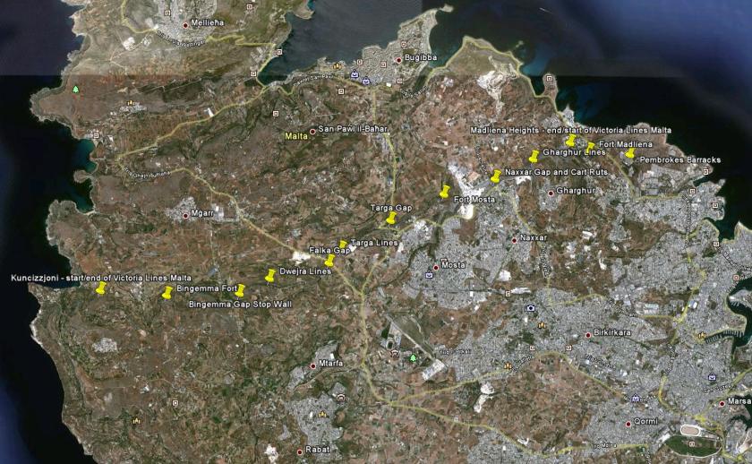
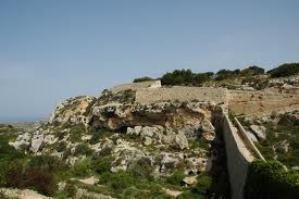
Victoria Lines
Including Fort Bingemma, Fort Mosta and Fort Madlena

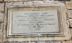 The Victoria Lines are a line of fortifications flanked by defensive towers, which spans 12 kilometres along the width of Malta, dividing the north of the island from the more heavily populated south.
Location
The Victoria Lines run along a natural geographical barrier known as the Great Fault, from Madliena in the east, through the limits of the town of Mosta in the centre of the island, to Binġemma and the limits of Rabat, on the west coast. The complex network of linear fortifications known collectively as the Victoria Lines that cut across the width of the island north of the old capital of Mdina was a unique monument of military architecture.
Background
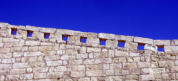
When built by the British military in the late 19th century, the line was designed to present a physical barrier to invading forces landing in the north of Malta, intent on attacking the harbour installations, so vital for the maintenance of the British fleet, their source of power in the Mediterranean. Although never tested in battle, this system of defences, spanning some 12 km of land and combining different types of fortifications – forts, batteries, entrenchments, stop-walls, infantry lines, searchlight emplacements and howitzer positions – consitituted a unique ensemble of varied military elements all brought together to enforce the strategy adopted by the British for the defence of Malta in the latter half of the 19th century. A singular solution which exploited the defensive advantages of geography and technology as no other work of fortifications does in the Maltese islands.
The Victoria Lines owe their origin to a combination of international events and the military realities of the time. The opening of the Suez Canal in 1869, highlighted the importance of the Maltese islands.
Beginnings
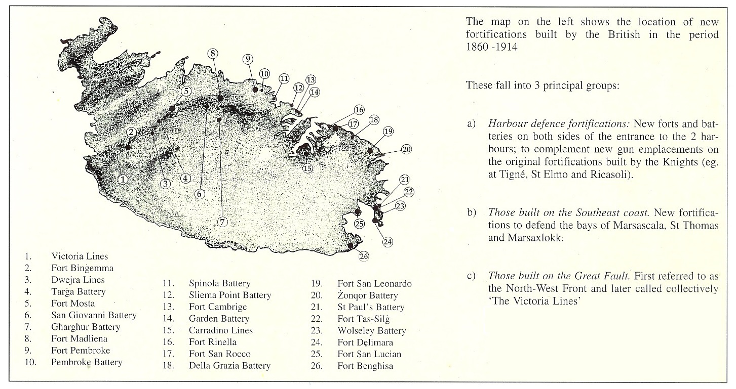
 By 1872, the coastal works had progressed considerably, but the question of landward defences remained unsettled. Although the girdle of forts proposed by Colonel Jervois in 1866 would have considerably enhanced the defence of the harbour area, other factors had cropped up that rendered the scheme particularly difficult to implement, particularly the creation of suburbs. Another proposal, put forward by Col. Mann RE, was to take up a position well forward of the original.
The chosen position was the ridge of commanding ground north of the old City of Mdina, cutting transversely across the width of the island at a distance varying from 4 to 7 miles from Valletta. There, it was believed that a few detached forts could cut off all the westerly portion of the island containing good bays and facilities for landing. At the same time, the proposed line of forts retained the resources of the greater part of the country and the water on the side of the defenders; whereas the ground required for the building of the fortifications could be had far more cheaply than that in the vicinity of Valletta. Col. Mann estimated that the entire cost of the land and works of the new project would amount to 200,000, much less than that which would have been required to implement Jervois’ scheme of detached forts.
 This new defensive strategy was one which sought to seal off all the area around the harbour within an extended box-like perimeter, with the detached forts on the line of the great fault forming the north west boundary, the cliffs to the south forming a natural, inaccessible barrier; while the north and east sides were to be defended by a line of coastal forts and batteries. In a way the use of the Great Fault for defensive purposes was not an altogether original idea for it had already been put forward by the Hospitaller knights in the early decades of the 18th century when they realised that they did not have the necessary manpower to defend the whole island. Then the Knights had erected a few infantry entrenchments at strategic places along the general line of the fault, namely, at Ta’ Falca and San Pawl tat-Targa, Naxxar. In fact, the use of parts of the natural escarpment for defensive purposes can be traced back even further, as illustrated by the Nadur watch-tower at Bingemma (mid-17th century), the Torri Falca (16th century) and the remains of a Bronze Age fortified citadel which once occupied the site of Fort Mosta (De Grognet).
Building
In 1873, the Defence Committee approved Adye’s defensive strategy and recommended the improvement of the already strong position between the Bingemma Hills and the Heights above St. George’s Bay. Work on what was originally to be called the North-West Front began in 1875 with construction of a string of isolated forts and batteries designed to stiffen the escarpment. Three forts were to be built along the position, at Bingemma, Madliena and Mosta, (designed to cover the western and eastern extremities and the centre of the front, respectively). The first to be built was Fort Bingemma. By 1878, work had still not commenced on the other two and the entrenched position at Dueira, all of which were to be completed on the vote of 200,000. General Simmons recommended that the old Knights’ entrenchments located along the line of the escarpment at Targa and Naxxar were to be restored and incorporated into the defences. Simmons also recommended that good communication roads were to be formed in the rear of the lines and those that already existed were to be improved. The fortifications of Mdina, the Island’s old capital, were to be considered as falling within the defensive system.
The forts on the defensive line were designed with a dual land/coastal defence role in mind, particularly the ones at the extremities. But due to the topography in the northern part of the island, there were areas of dead ground along the coast and inland approaches which could not be properly covered by the guns in the main forts. As a result it was decided that new works should be built between Forts Mosta and Benjemma and emplacements for guns placed in them. It was also considered advisable to have new emplacements for guns built to the left of Fort Madaliena and in the area between that fort and Fort Pembroke. The latter fort was built on the eastern littoral below and to the rear of Fort Madliena in order to control the gap caused by the accessible shoreline leading towards Valletta. Gun batteries were eventually proposed at Targa, Gharghur and San Giovanni. Plans for these works were drawn up but only that of San Giovanni, was actually built and armed, while the two at Gharghur were never constructed and that at tat-Targa, although actually built, was never permanent.
Limitations
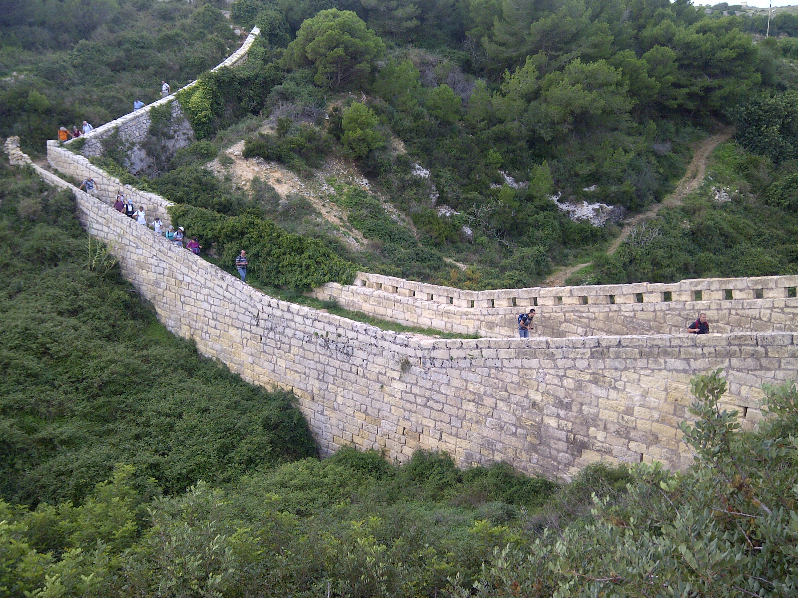 By 1888, the line of the cliffs formed by the great geological fault and the works which had been constructed along its length from Fort Bingemma on the left to Fort Madalena on the right, constituted, in the words of Nicholson and Goodenough, “a military position of great strength”. The main defects inherent in the defensive position were the extremities where the high ground descended towards the shore, leaving wide gaps through which enemy forces could by-pass the whole position. Particularly weak in this respect was the western extremity. There, a considerable interval existed between Fort Bingemma and the sea. Military manoeuvres held in the area revealed that it was possible for troops to land in Fomm er Rih Bay and gain the rear of the fortified line undetected from the existing works. To counter this threat, recommendations were made for the construction of two epaulements for a movable armament of quick-firing or field guns, the construction of blockhouses, the improvement of the wall which closed the head of the deep valley to the south of Benjemma Fort and the strengthening of the line of cliffs by scarping in places. It was also suggested that the existing farmhouses in the area be made defensible.
There were even suggestions for the reconstruction and re-utilisation of the old Hospitaller lines at Ta’ Falca and Naxxar but only the latter was put to use, particularly because these commanded the approaches to the village of Naxxar, described as a position of great importance,in the event of a landing in St. Paul’s Bay.
A serious shortcoming of the North West Front defences was the lack of barrack accommodation for the troops which were required to man and defend the works. The lines extended six miles and the accommodation provided in the forts was rather scanty. Consequently, it was considered necessary that new barracks capable of accommodating a regiment (PRO MPH 234) and later a full battalion of infantry were to be built and a new site was chosen to the rear of the Dwejra Lines, at Mtarfa. Although initially designed as a series of detached strongpoints, the fortifications along the North West Front were eventually linked together by a continuous infantry line and the whole complex, by then nearing completion, was christened the Victoria Lines in order to commemorate the Diamond Jubilee of Queen Victoria in 1897. The long stretches of infantry lines linking the various strongpoints, consisting in most places of a simple masonry parapet, were completed on 6 November 1899.
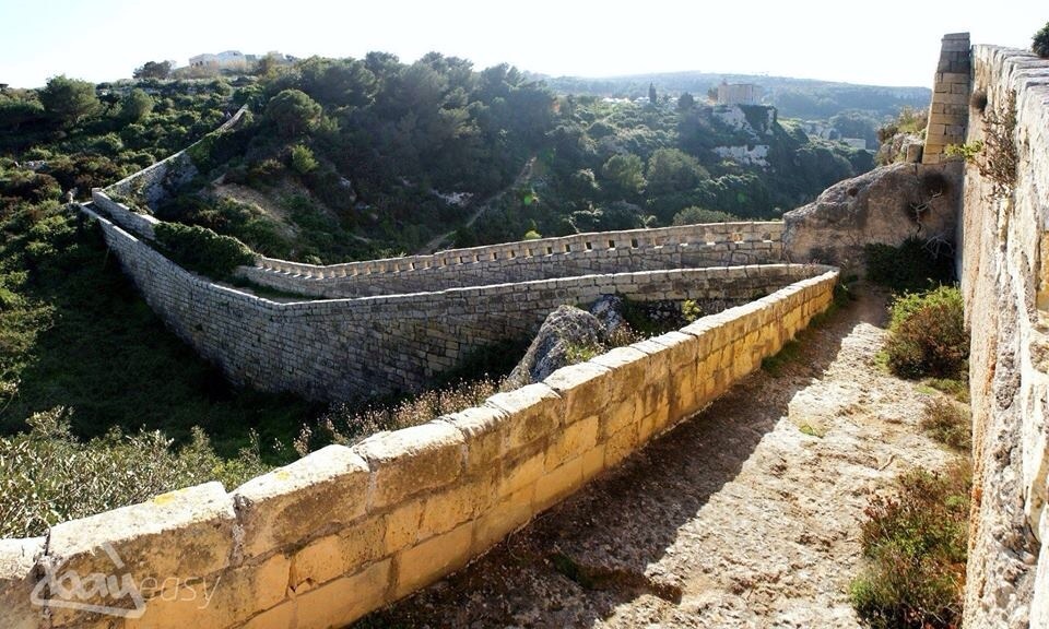
Other changes
The trace of the intervening stretches followed the configuration of the crest of the ridge along the contours of the escarpment. The nature of the wall, varied greatly along its length but basically consisted of a sandwich type construction, with an outer and inner revetment bonded at regular intervals and filled in with terreplein. The average height of the parapet was about five feet, (1.5 metres). Frequently, the walls were topped by loopholes of which only a very few sections have survived. In places, the debris from scarping was dumped in front of the wall to help create a glacis and ditch. In places, the rocky ground immediately behind the parapet was carved out to provide a walkway or patrol path along the length of the line. A number of valleys interrupted the line of the natural fault, and at such places, the continuation of the defensive perimeter was only permitted with the construction of shallow defensible masonry bridges; as can be still seen today at Wied il-Faham near Fort Madliena, Wied Anglu and Bingemma Gap. Other bridges, now demolished, existed at Mosta Ravine and Wied Filip.
During the last phase of their development, the Victoria Lines were stiffened with a number of batteries and additional fortifications. An infantry redoubt was built at the western extremity of the front at Fomm ir-Rih and equipped with emplacements for Maxim machine guns. In 1897 a High Angle Battery was built well to the rear of the defensive lines at Gharghur and another seven howitzer batteries, each consisting of four emplacements for field guns protected by earthen traverses, were built close to the rear of the defensive line. Searchlight emplacements were built at il-Kuncizzjoni and Wied il-Faham.
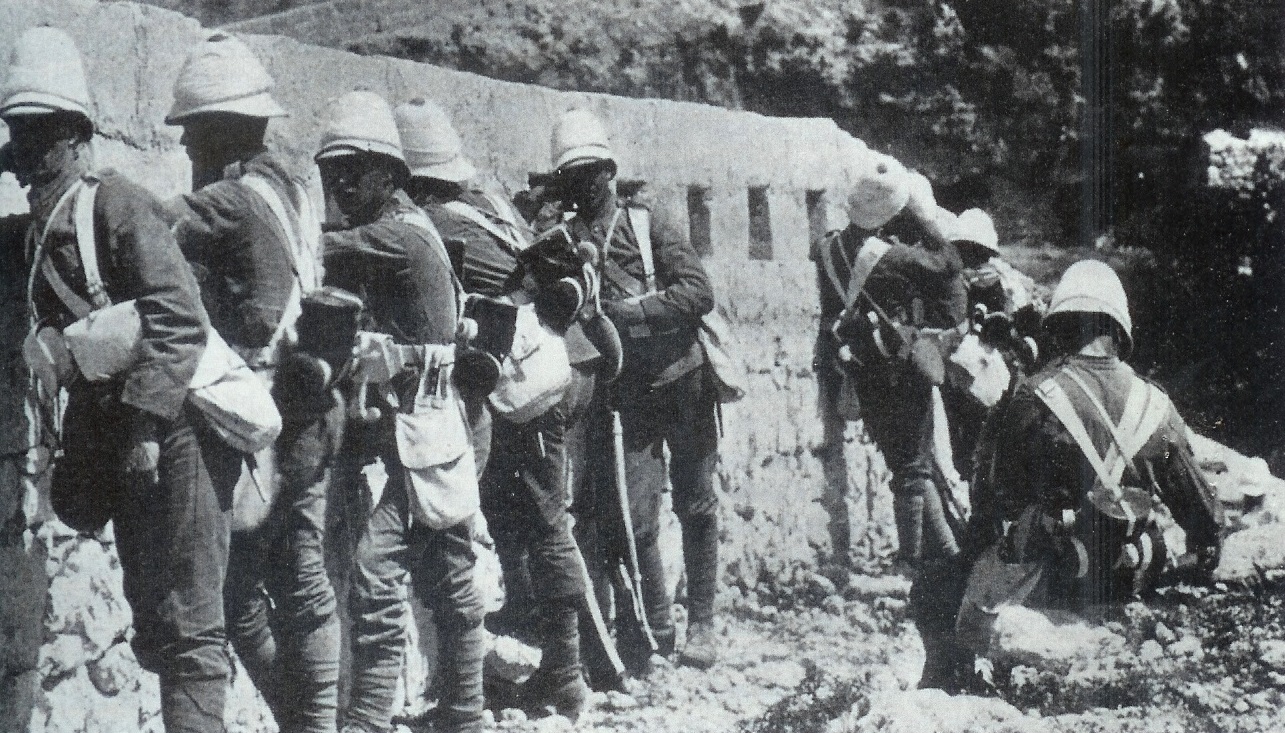
Aftermath
Military training exercises staged in May 1900 revealed that the Victoria Lines were of dubious defensive value; by 1907, with the exception of the coastal towers, they were abandoned altogether.
In 1988 the Government of Malta submitted the Victoria Lines to UNESCO for consideration as a World Heritage Site.
Large parts of the fortification walls have collapsed, although some parts in the countryside remain intact.
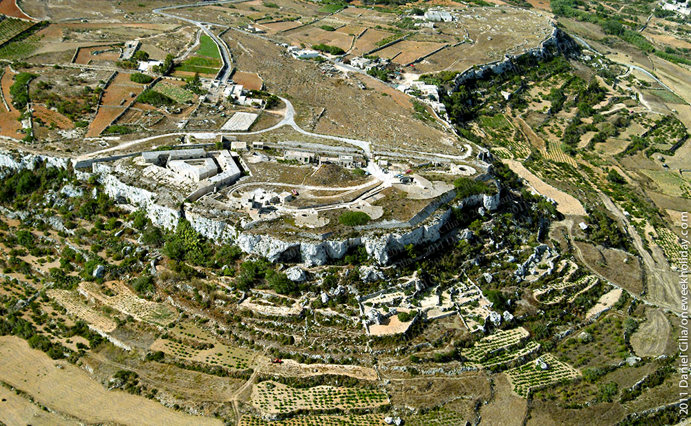
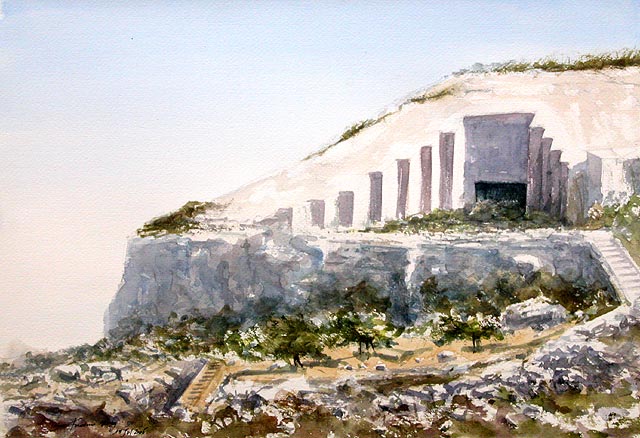
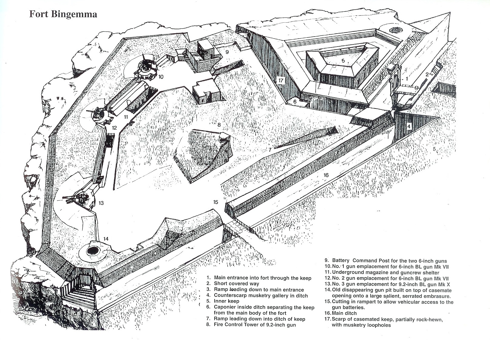
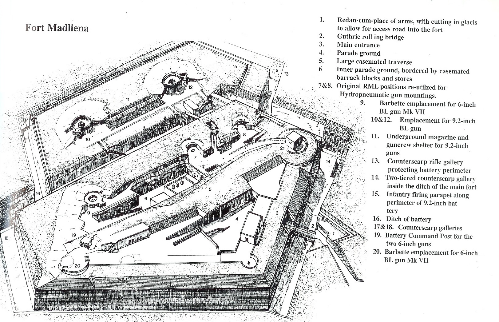
Fort Mosta
Few British-period works of military architecture manage to exert such a commanding presence,as well as a sense of solidity and domineering invincibility, as Fort Mosta (or Musta as it was officially referred to by the British military).
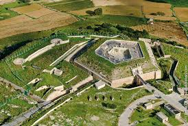 Occupying a central position along the escarpment of the Great Fault, Fort Mosta was the most strategically-placed land fort on the system of inland defences known collectively as the Victoria Lines. The Fort’s designation as a ‘land fort’, its strategic location roughly in the centre of the North-West front (later renamed the Victoria Lines), and the topography of the site on which it was built, were all to dictate both its structural shape and form and its defensive role (and, hence the nature of its armaments with which it was to be equipped).
Today, this important example of late nineteenth-century British military architecture is currently used by the Armed Forces of Malta as a storage depot. It state of preservation, despite the Army’s many effort to keep it in good condition, is such that it requires, and deserves, specialized attention and interventions to counter the damage that is being inflicted to the structure as a result of the particular geological conditions of the site. Furthermore, a military architecture entity of such calibre, effectively a strategic nodal point in the extensive system of fortification known as the Victoria Lines, deserves to be integrated more productively into the broader cultural and tourism sectors for the greater common good.
 Fort Mosta was originally designed as one of three isolated strongholds on the North-West Front. This was a defensive position adopted by the British military and intended to divide Malta into two parts, concentrating the fortified assets along the line of a natural fault cutting across the width of the island – for more information go to our article. Fort Mosta’s construction was approved in I873, but, in actual fact, the first of these strongholds to be initiated was Fort Bingemma, begun in I875. This was then followed by Fort Madalena in I878, and by the time of General Lintorn Simmons’ visit to Malta in February I878, work on Fort Mosta had not yet commenced.
Simmons visit, however, seems to have put the wheels in motion for the construction of the structure was commenced some time after. The new work of fortification, designed as a hill fort, came to consist of two main component parts – a casemated keep of pentagonal plan, surrounded by a defended ditch, and an external battery. Owing to the fact that no initial, or even period, record plans of the fort have survived, it is difficult for historians of British military architecture in Malta to determine the configuration of the original design, particularly where it involved the annexed battery. The present structure provides various hints of an incremental development. The addition of two disappearing gun emplacements in the 1890s, for example, would have witnessed the replacement of earlier barbette emplacements (as is known, and documented, to have happened at Fort Bingemma).
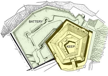
Ancient Strategic Site
Fort Mosta occupied the cliff face on the spur of land at the mouth of Wied il-Ghasel and was apparently built (according to available documentation and some archaeological evidence) on the site of a Bronze Age citadel and village which was recorded by George Grognet de Vasse (1773-1862), a French Architect resident in Mosta who designed and built the Rotunda church of St Marija Assunta in Mosta. If any such remains had existed at all (and this is debatable) the British military certainly showed no concern for the antiquity of the site, and simply requisitioned the whole area for defence purposes.
Like most of the forts of this period, late in the history of fortification, the design of Fort Mosta was tailored around its perceived role, and the armament considered suitable for the task. Initially, this was to consist of seven 64-pdr smooth-bore muzzle loading guns mounted inside protective vaulted casemates. Seven other guns proposed to be installed on disappearing carriages were, however, never mounted. Presumably these were to be mounted within the outer battery. Two other casemates, conceived and built in Haxo style, were situated on the west side of the outer enceinte and were designed to enfilade that part of the escarpment overlooking Targa Battery.
Gun embrasures opening from the casemates, had serrated cheeks and surfaces, designed to help deflect incoming cannon shot, while buttresses on the east north east face acted as traverses. Unlike most of its sister defences, Fort Mosta was not intended to be armed with the heavy RML guns, mainly because it was conceived primarily as an inland fort with no coastal defence role.
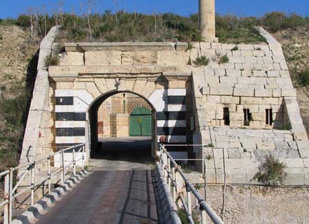
The Pentagonal Keep
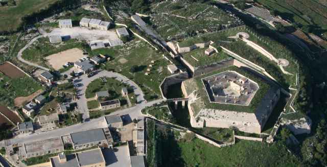 Undeniable, the most structurally imposing and defining feature of Fort Mosta is its keep. Like most other British forts from the period, it is not known who actually designed the structure. The Commanding Royal Engineers at the time was Col. T. Murrey, but more likely than not the whole design and construction process involved the whole engineering staff and cannot be attributed to any one individual. The only two other contemporary forts that were given a polygonal type of keep were those of Bingemma (1875-78) and San Leonardo (1875-78). The latter bears some similarity in the form of its diamond-shape plan, and the shape of its parapets, but this lacks both the scale and the towering command of the Fort Mosta keep. Furthermore the Fort Mosta keep is more than just a place-of-last-resort, as employed in the two earlier forts mentioned above. Indeed, considering its comparatively large size and its many casemated gun emplacements, the keep at Fort Mosta can easily pass off as a veritable fortress in its own right. In this regard, its design may, as a matter of fact, have been directly influenced by the plan of Fort Tombrell, a hexagonal work of fortification (shown below) which was proposed for the defence of the Delimara peninsula in the south of Malta but never built, its place eventually taken by another larger land fort, Fort Tas-Silg built in 1879-83 (a special article on Fort Tombrell is scheduled to be featured on MilitaryArchitecture.com in the coming months). Therefore, rather than being simply a keep, the structure was actually the original fort and only became a ‘keep’ at a later stage in the design process when the outer detached ward, or battery, was thought necessary and grafted onto the position to give it its present shape. Further research, however, is necessary before any conclusions can be drawn on this matter.
The main defensive elements of the Fort Mosta keep were its enveloping ditch, which isolated the keep from the outer enceinte and also from the mainland to the rear, and three counterscarp musketry galleries which provided the necessary enfilading fire, and were linked to the keep by means of an underground tunnel. One of the counterscarp galleries occupies two faces of the counterscarp wall, creating, in effect, a total of four sets of firing positions, each containing a central embrasure for a 24-pdr S.B. B.L. carronade and six musketry loopholes. All the galleries were protected, externally, by a shallow drop pit revetted in concrete. Entrance into the keep was through a main gateway situated in the middle of the south face and this led directly into a spacious central courtyard. The gate was served by a Guthrie rolling drawbridge, which hasn’t survived, and was flanked by a small defensive musketry position containing three loopholes.
A secondary gateway, more of a sally-port really, lead down into the ditch of the keep and was designed to provide communication between the keep and the adjoining battery. This may, in fact be a later addition, given that the masonry facade with its four adjoining loopholes, are fitted within a projecting concrete slab that buttresses the whole west side of the keep. The secondary gate was served by what appears to have been a chain-and-tackle type of drawbridge.
This heavy buttressing, as a matter of fact, is present throughout various parts of the forts and reveals that very early in its service, the original structure erected in 1878 had to be stiffened to counter the instability created by the largely clayish terrain on which the fort was built.
A walk through the ditch quickly reveals that, in some areas of the fort, the foundations were laid upon a thick concrete raft resting on a layer of clay. According to Hyde, the fort was built over a very yielding layer of Blue Clay whilst the solid lower Coralline Limestone was so very near that it formed part of the adjoining ditches. Indeed the fort bears many marks of structural instability as can be attested by the large number of buttresses reinforcing the revetment of both the keep and the outer battery.

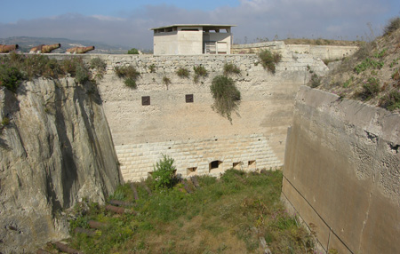
Upgraded armament
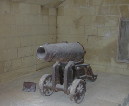 In I866, it was recommended that two 6-inch breech loading guns be mounted within the fort, one on the western outerwork and the other on the site then occupied by the useless Haxo casemate (0’Callaghan & Clarke, I886). The two 64-pdrs in the right casemates overlooking Madliena were proposed to be replaced by two 6-pdr QF guns, while the counterscarp flanking galleries were to be armed with 32-pdr SB, B.L. guns.
Despite these alterations, Generals Nicholson and Goodenough, in 1888, remarked that Fort Mosta was not a satisfactory defensive work for the important strategic position that it occupied:
“Fort Musta is not a satisfactory work, but the position is a commanding one, and when re-armed, as proposed, it will fulfil its object. It would not be worthwhile to incur the expense of reconstructing it. We think that the 5- 32pr. S.B. B.L. guns proposed to be supplied for flanking ditches might be omitted, and 3-pr. Q.F. guns on field carriages substituted for 6-prs’
However, it would seem that the counterscarp galleries never received their smooth-bore 32-pdr breech loading guns. Two gun emplacements for 6-inch BL guns on hydro-pneumatic disappearing carriages, on the other hand, were constructed on the outer ward of the fort accompanied by their underground magazines, stores, and guncrew shelters.
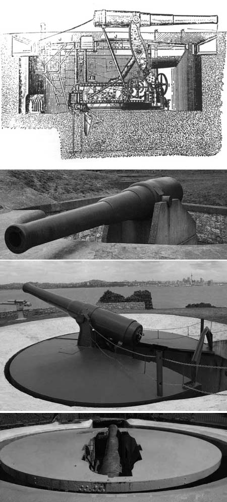
Construction Materials
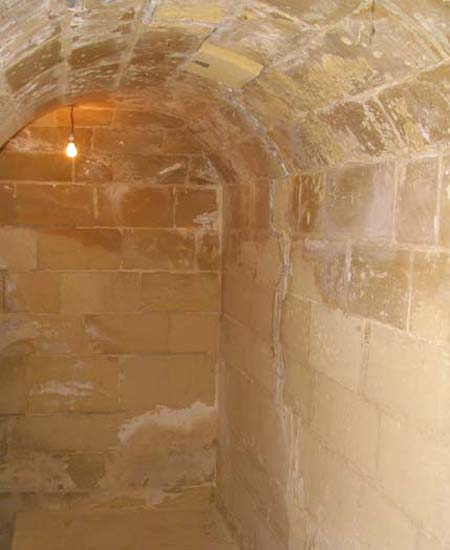 Like most of the first-generation British forts of the 1870s, Fort Mosta was constructed from a hybrid combination of masonry, hewn rock, earth, and cast-in-place mass concrete elements.
The initial concrete was employed largely in the revetments along the scarp and counterscarp walls, and in the formation of a raft foundation over which various elements of the structure were built (in parts of the battery). The other elements which were built in concrete were the two gun emplacements for the 6-inch BL guns, but these were added later in the 1890s and use a more compact mixture. The casemated gun emplacements, vaults, gateway, and various underground magazines, on the other hand, were constructed in masonry and covered over with a thick layer of protective earth.
At Fort Mosta the original concrete was used un-reinforced and cast in lifts of approximately the same height. The concrete walls do not display any expansion joints although, in various places, and at somewhat irregular intervals, these are perforated with small rectangular holes, particularly at the horizontal interface of the concrete wall and the underlying masonry or bedrock. This seems to suggest that the openings served as weep-holes rather than as anchor points for formwork ties. Most of the concrete revetments in the Malta fortifications from the 1880s, the revetments at Fort Mosta have lost their smooth cement surface finish (owing to deterioration), to reveal cast layers of hardstone aggregate of non-uniform grading. A significant proportion of this aggregate is quite elongated and the proportion of the aggregate appears rather low. Similar method of concrete construction can be found in the walls or ditch revetments of Fort Bingemma (1875), Fort San Leonardo (1878) and the Dwejra lines (1881) and the 100-ton gun batteries at Cambridge and Rinella.
An important element in the design of Fort Mosta comprises the thick earthen mounds which form the large parapets covering the keep and adjoining battery. This terreplein was formed from a rather coarse, dry mixture of stone chippings (varying considerably in size and often obtained during the excavation of the ditch), combined with earth and soil. Along most of the revetments (except for two of the rear faces of the keep, the thick earthen parapets are revetted with a masonry skin of hardstone capstones laid in an inclined plane on the exterior slopes, a technique which was first employed in Malta on the Corradino Lines in 1872. Such a covering helped hold the earthen fill in place, and prevented it from being carried down into the ditch below by torrential downpours.
Where employed as a surface finish, particularly on the external elements of the fort’s walls, the masonry used was of the drafted type, with flat bossing in low relief (known in Maltese as ’bunja’), creating an overall rusticated feel that was popular with the Royal Engineers and was employed in most military buildings of the period. In most cases, the softer Globigerina Limestone was employed while a harder quality stone, the Coralline Limestone, greyish-white in colour, was often employed in capstones of the exterior slopes of revetments and in various secondary features. Amongst those features built in hardstone one finds the revetted cheeks of the embrasures of the Haxo-type casemates and its rear walls, and the various buttresses which were added to stiffen various parts of the enceinte.
Change of Role
With the abandonment of the Victoria Lines as an inland defensive position during the early years of the 20th century, Fort Mosta lost most of its military value, unlike the other two forts on the Victoria Lines, which were retained in use in a coastal defence role. By 1940, the fort was being used simply as a munitions depot, a role which it has continued to fulfil up to the present day.
Fort Campbell
For Campbell denotes one of the final stages of the long process of fortification. It is the last of the British forts to be built in Malta prior to the commencement of the Second World War. At this point in time, static defences had to contend with another major weapon that was then being brought to bear against them – the airplane, or better still, the aerial bomber – a weapon that would ultimately deliver the coup de grace to the whole notion of fixed and permanent defences.
Up until the First World War, the main threat to the Maltese Isles came from the sea. The forts and fortifications built in the nineteenth century, and before, were constructed to resist and repel a naval invasion and bombardment. Although called forts, most of the British works were actually little more than coastal batteries with their main armaments pointing out to sea, arranged in a manner so as to prevent enemy warships form approaching and entering the Grand Harbour. By the Second World War, the sea was still the major preoccupation facing the military authorities but now fixed defences also had to counter the threat posed by aircraft. When seen from above, the formal outlines of major works of fortifications, with their polygonal trace and ditches, thick parapets, and fixed emplacements, became obvious and vulnerable targets. The modern fort, as a result, now had to shield itself from aerial bombardment and hide from view to avoid detection.
It is here that Fort Campbell becomes interesting. For in their attempts to achieve thist, the British military engineers departed from the rigid manner of fortress construction employed in all the other forts at Malta and created a work of fortification that sought to integrate itself, rather than impose itself, on the landscape
The Anatomy of Fort Campbell
Fort Campbell was the last major British fort to be built in Malta. Like many of its sister forts its main function was to protect the island from the sea. As a matter of fact, its specific purpose was that of an ‘Examination Battery, which meant, that it was designed to challenge enemy ships approaching the Grand Harbour from the north. To do this, it was armed with two 6-inch BL (breech-loading) coastal guns.
In this aspect there was nothing new. The novelty at Fort Campbell lies not in its armament or function, but in its design – in the manner in which both the defensive perimeter and the interior elements of the fort were laid out to blend in with the natural surroundings in order to escape the attention from the air. This was achieved by means of an irregular plan and the dispersal of the main structures within the enceinte. The perimeter defences, rather than the usual rigid and thick parapets were constructed in the manner of a high boundary wall that was built in such a way so as to mimic the surrounding rubble walls that characterize most of Mellieħa’s countryside. The trace of perimeter wall, planned out in a large irregular enclosure, was laid out to blend into the surrounding terrain of terraced fields.
Defensive Features
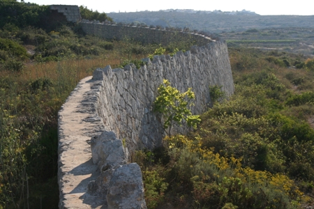 To defend the perimeter against assault, Fort Campbell was given a number of fixed perimeter defence posts, some of which were actually concrete bunkers not much unlike the concrete pillboxes which also began to appear around the bays and beaches at the time. The concrete machine gun bunkers were incorporated within the perimeter wall at irregular intervals dictated by the change in direction of the trace of walls. The majority occupied salient or re-entrant angles but one of these projected outwards from the main wall in the form of a caponier to provide enfilading fire across a relatively long and straight stretch of the perimeter. As stated earlier, the structure of these concrete machine gun bunkers resembles that of the pillboxes and beach posts built from around the time of the Abyssinian Crisis of 1935 onwards. The entrance to most of these concrete machine gun bunkers was through a small, thick metal, two-flap door. Inside the machine gun bunkers, there were the machine gun tables in which the defensive armament was mounted. In other areas of the perimeter, defence was provided by means of a series of rifle loop-holes
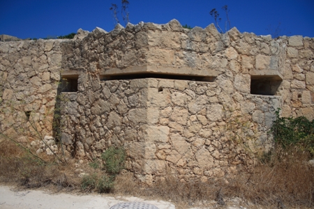
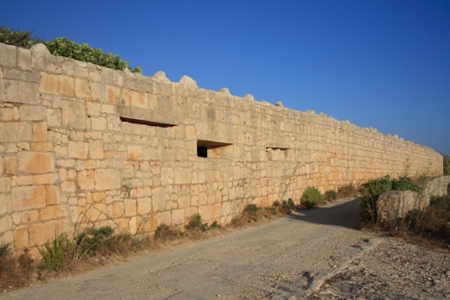
The Gun Emplacements
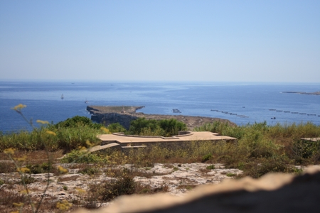 The offensive element of Fort Campbell was provided by its battery of two 6-inch coastal guns. These were housed in two concrete barbette gun emplacements. The main advantages of mounting guns above the parapet (i.e., en barbette) was that it provided them with wider fields of fire but this advantage usually came at a price as the gunners were more exposed and thus more vulnerable to enemy fire. To counter this, most such guns were fitted with protective metal turrets or overhead covers, as were the ones at Fort Campbell. Each of the two concrete emplacements had a covered loading chamber just behind the gun pit, an underground magazine, and a partially underground accommodation for the gun crew. The loading chamber basically consisted of a single large room hugging the shallow gun pit. The loading chamber contained various cubicles whereby shells and cartridges where stored separately. Each loading chamber had a fire station close to one of the entrances to the gun emplacement.
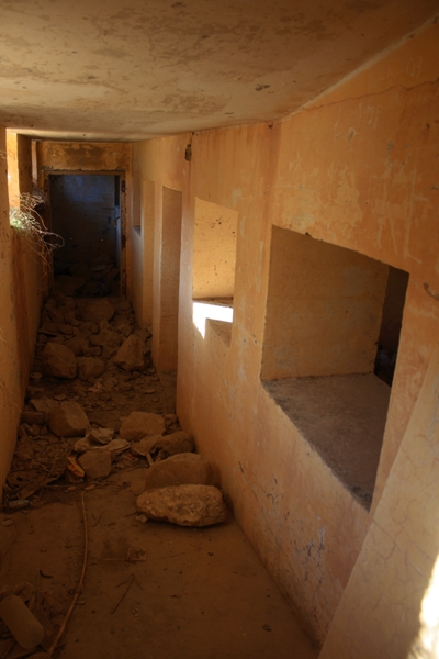 On the left hand side of the loading chamber, lies the passageway that led to the underground gun crew accommodation. The gun crew accommodation consisted of three separate rooms each with its own doorway and one or two windows. The passageway was also fitted with three windows in order to light up the three submerged rooms. Joining the loading chamber on the right, stood the opening to the large underground magazine. The underground magazine was connected to a number of underground passages that led to the surface via vertical channels fitted with metal rungs. Nowadays due to vandalism and neglect, these vertical channels are filled with rubble and rubbish and thus entry into the magazine is dangerous. The gun emplacement had two entrances. One of these was protected by a thick blast protection wall in front of it whereas the other had a bent entrance in an attempt to contain the blast within the emplacement if an explosion took place.
A third gun emplacement in Fort Campbell, apparently built to house another 6-inch BL gun (No.3 emplacement) may have housed a heavy anti-aircraft gun. At its rear, this gun pit was surrounded by a small ammunition magazine containing several cubicles just like those of the 6-inch coastal gun emplacements. Although this emplacement, lacked space for gun crew accommodation, a few metres away the British constructed two underground rooms to serve this purpose.
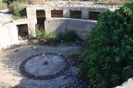
The Battery Observation Post and Fortress Plotting Room
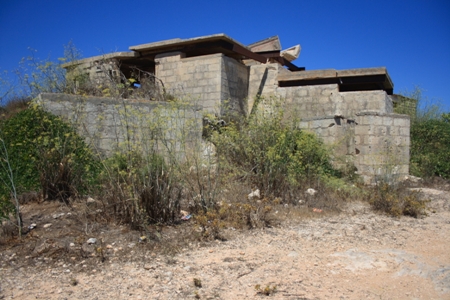 Directing and co-ordinating the fire of the 6-inch guns was the work of the Battery Observation Post (BOP). This structure was roughly situated in the centre of the Fort, immediately to the rear of the gun emplacements and faced northwards out to sea. The BOP was a long stepped building that contained the position finding cell and the gun control room. The gun control room lay above the position finding cell and both of these rooms had a cantilevered flat roof. This building was the nerve centre, or command post, of Fort Campbell. The position finding cell inside the BOP served to detect and record information regarding any enemy sightings, target ranges and bearings, as well as the fall of shots of the coastal guns of the Fort. This information was then transmitted to the Fortress Plotting Room adjacent to the BOP by means of a MAGSLIP arrangement (electrical transmission). In the plotting room, enemy sightings were accurately tracked and recorded on a plotting table. These plots were then relayed to the gun control room in the BOP so as to work out the coordinates required to direct the fort’s coastal guns to fire and possibly hit the enemy targets. In 1943, the BOP was modified in order to support a roof-mounted Coastal Artillery (CA) Number 1 Mark 2 Radar. The Fortress Plotting Room was a rock-hewn chamber located very close to the BOP. Entrance to this underground room was by means of two passages. A few metres away from the Battery Observation Post lies a downward ramp that used to lead to another underground concrete chamber. The floor of this underground chamber had two raised concrete bases onto which the electricity generators were mounted to supply electrical energy to the roof mounted radar on the BOP. Apart from this, the roof also had three large openings for ventilation for the chamber underneath. The downward slope also led to an underground rock-hewn shelter that could have provided some protection to soldiers during air raids.
The Main Gate and the Guard Room
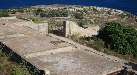
Fort Campbell was designed as a purely functional military outpost. Unlike the earlier forts of the Victorian era, no concern was given to any aesthetic architectural considerations.
Even the limited architectural decoration that was often applied to the main gateway is missing. Indeed at Fort Campbell the main gate was simply a wide cutting in the perimeter wall which was closed off by means of a metal palisade gate. Accompanying the gate was a nearby guard room.
Underground Water Tank and Generator Room
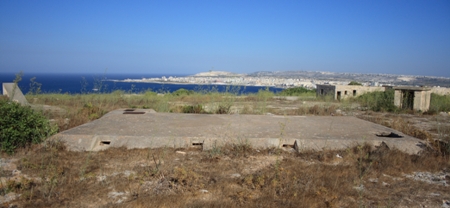 Fort Campbell was equipped with an underground shallow concrete chamber capable of storing 10,000 gallons of water. This shallow chamber was accessible by means of two sets of metal rungs located on either side of the chamber. The pipes that carried water into this underground tank were positioned next to the metal rungs. The tank is surrounded by a set of small rectangular shaped openings. Most probably these were used to allow any excess water to overflow as otherwise it could damage the structural integrity of the concrete tank. Next to the water tank, where the pipes entered there are vertical passages fitted with metal rungs as well. Unfortunately, nowadays these passages are filled with rubble and rubbish so their exact function is unknown.
Rock-hewn underground shelters were dug up both inside and outside Fort Campbell. These could not have been used by the inhabitants of Mellieħa as this area was closed off and they had no access to it. In fact in order to prevent any strangers from gaining entrance into Fort Campbell, most of the area behind Selmun Palace was closed off to the inhabitants of Mellieħa.
Other structures within the fort included an artificers’ workshop and storage area and the Coastal Artillery Searchlight engine room. Fort Campbell had three coastal artillery searchlights placed in fixed protective emplaces (with steel shutter opening) located outside the fort along the coastline overlooking the St Paul’s islands.
Interior layout
With such a small number of buildings inside the perimeter, Fort Campbell’s relatively walled enclosure is rather barren. Furthermore these few buildings were scattered throughout the fort in such a way so as to prevent clusters and identifiable patterns that could be picked up by enemy aircraft flying overhead. Another interesting feature of this fort was the large number of underground passages and chambers. In Fort Campbell only those buildings that were essential to the fighting capability of the fort were built above ground, whereas others such as the generator room, the gun crew accommodations etc where built beneath ground level. Building underground not only helped to protect the British troops from enemy fire, but it also helped to reduce the concentration of buildings inside the fort, thus making Fort Campbell more invisible from the skies. In this manner, Fort Campbell resembles similar arrangements adopted by the British military in the defence of other important outpost around their empire, such as Fort Stanley in Hong King (likewise built in 1936/37), Good Head Battery in New Zealand, and Brownstone Battery in Kingswear, Devon (1940), and Fort South Sutor in Scotland (1939).
Outside the Perimeter Wall
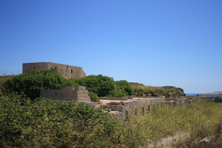
Barrack accommodation for the garrison was not located within the defensible perimeter. Instead a long range of blocks situated immediately outside the fort contained the barrack blocks, dining room, cook house, officer’s mess, ablution room and other services.
These structures were not built as part of the original fort but were constructed at a later stage during the War (around 1942-43) to house a force of infantry, that was stationed in the area in order to patrol Selmun and its surroundings as well as man the several beach posts and pillboxes. Various areas of the fort and its immediate external perimeter were also fitted with prefabricated Rimney and Nissen huts.
Coast Artillery Search Lights
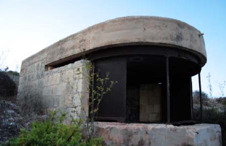 Important adjuncts to Fort Campbell’s night-fighting capabilities were its electrical searchlights. Known as the Coastal Artillery Search Lights (CASL – formerly referred to as Defence Electric Lights -DEL) these fixtures were generally housed outside the fort and placed at strategic points along the coastline. Fort Campbell had three such CASLs. These served to light up the entrance to Mellieħa Bay, St. Paul’s Bay and the channel between Selmun and St. Paul’s Isles. The Fort Campbell search lights were sheltered inside special concrete emplacements. When not in use, the apertures of the concrete emplacement were closed off by means of steel shutters so as to protect the search light inside. The search lights were powered by electrical energy coming from generators inside Fort Campbell. These electric generators and their respective engines were housed in two barrel vaulted rooms unlike all the other structures inside the Fort which had roofs supported by iron beams. The cables that used to serve these Defence Electric Lights were placed and protected in shallow rock-hewn trenches.
A need for restoration and rehabilitation
As can be clearly seen from the photographs accompanying this brief descriptive article, Fort Campbell, despite retaining many of its original features, lies in a derelict, neglected and abandoned state. It has been in this state for many, many decades. Sadly, ever since it was decommissioned by the British military, Fort Campbell has lain open to the destructive elements of both nature and man. Some of its features have suffered more than others. Particularly impressive are the efforts that various unknown vandals have gone to in order to remove the iron beams that supported the roof of barrack blocks, many of which have either collapsed or are caving in under their own weight. It is sincerely hoped that this interesting fort will one day, before it is too late, benefit from a thorough restoration and rehabilitation intervention. True, the site is an extensive one and the resources required for such a task cannot but be considerable. Money (or more precisely, a lack of it) is always a critical factor. However, the fort and its surrounding area are highly popular picnic and camping sites with the Maltese public and in this, perhaps, may lie the secret of the Fort Campbell’s salvation – its rehabilitation and sensitive and sympathetic reuse as a soft camping site.
Pillboxes
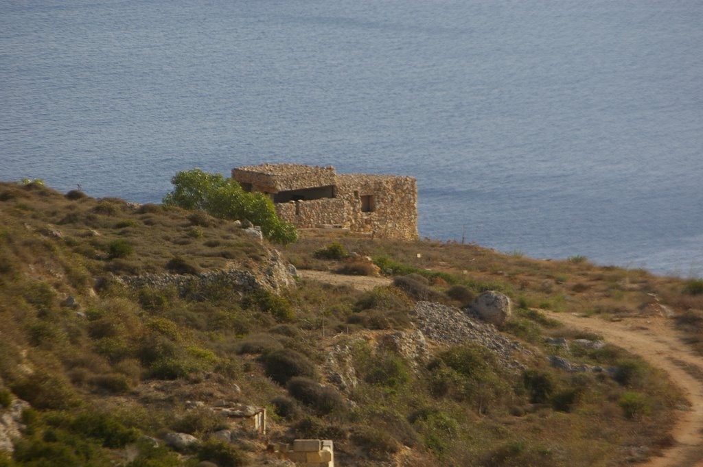
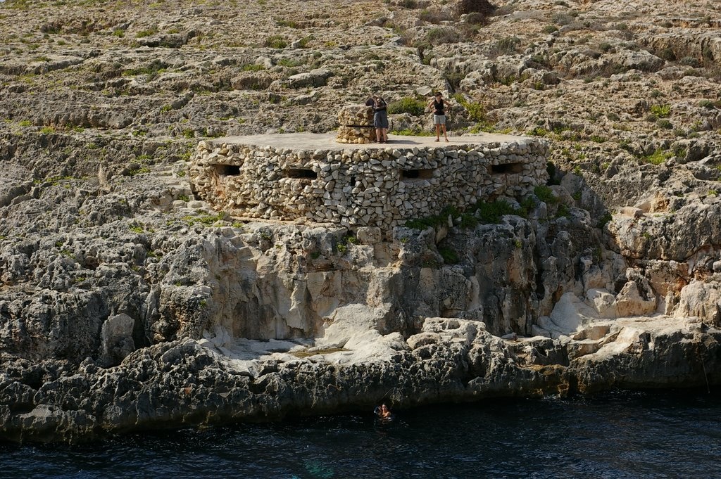
Pillboxes were the last type of fortification to be built in Malta. These types of military structures were constructed in nearly every part of the Island.
The rise of Fascist Italy with its expansionist policies forced the British to reconsider the Island’s defensive situation. The process of building pillboxes set in motion by the threat of invasion caused by the Abyssinian Crises in 1935. However, the real concentrated scheme of pillbox building began in August 1938.
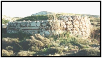 The first type of defences consisted of trenches dug out and fitted with one or two emplacements for the Vickers machine-guns. Accompanying these positions were small stone-clad concrete observation posts. A number of these positions were built on Mellieħa Ridge. It appears that it was these field defences which were first constructed during the Abyssinian Crises. Military exercises were carried out from 1935 onwards in preparation for an Italian invasion.
The first building programme of pillboxes occurred in 1935. 53 pillboxes were built in Malta, 27 of them in Mellieħa alone. By 1942 there were around 130 pillboxes in Malta, 46 were in the district of Mellieħa alone. The first type of pillboxes erected were those which were distinguished by their neat and elaborate camouflage of rubble stone cladding.
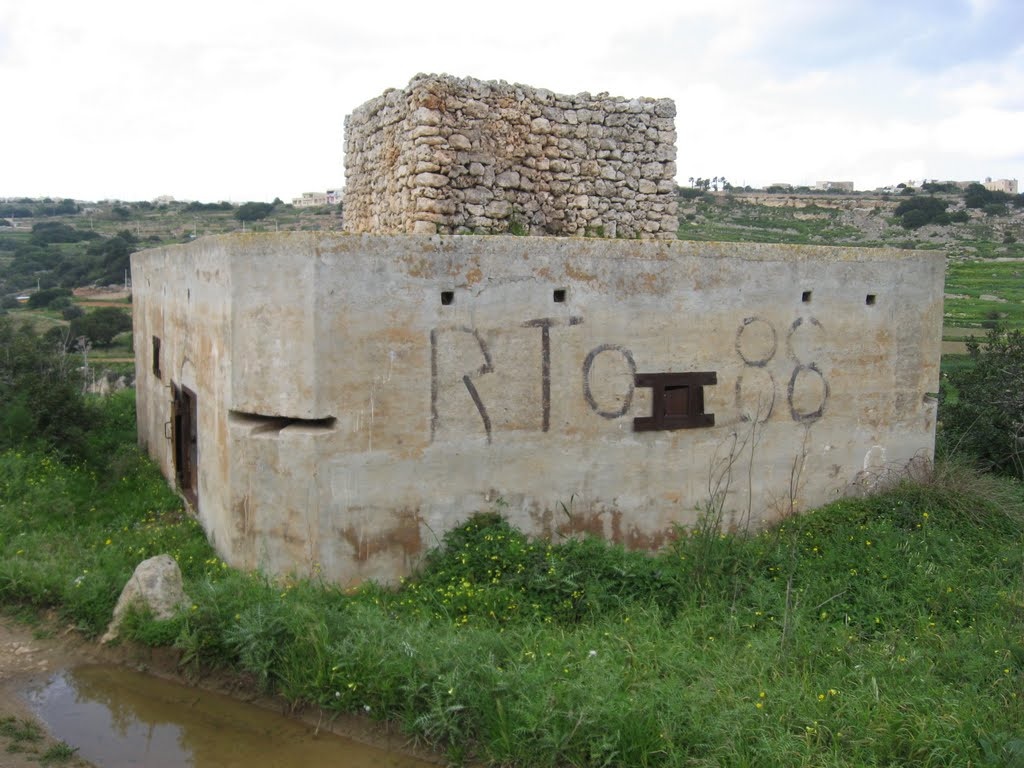 Meanwhile, as a result of the growing threat of war and invasion, after the occupation of the whole of Czechoslovakia in March 1939 in the same year a new type of pillbox, more box-like in shape, began to appear. The second group of pillboxes, of which there were three basic types, retained their bare concrete finish. As the pillboxes became more box-like in form, the only practical form of camouflage was to disguise them as rural building and farm houses. Camouflage was mainly applied in the form of paint work. Pillboxes continued to be built till the siege was lifted in mid 1942.
The pillboxes were not scattered for nothing. In fact they formed part of a number of stop lines in order to stop an enemy invasion and penetration in the defences of the island.
Each stop line was to report to the one in its rear the movements and approximate number of enemy soldiers and vehicles, tanks and artillery. Each stop line was built on natural obstacles, beginning from the coastline and falling back inland following the geography of the land. All the pillboxes were given a code number consisting mainly of letters and numbers.
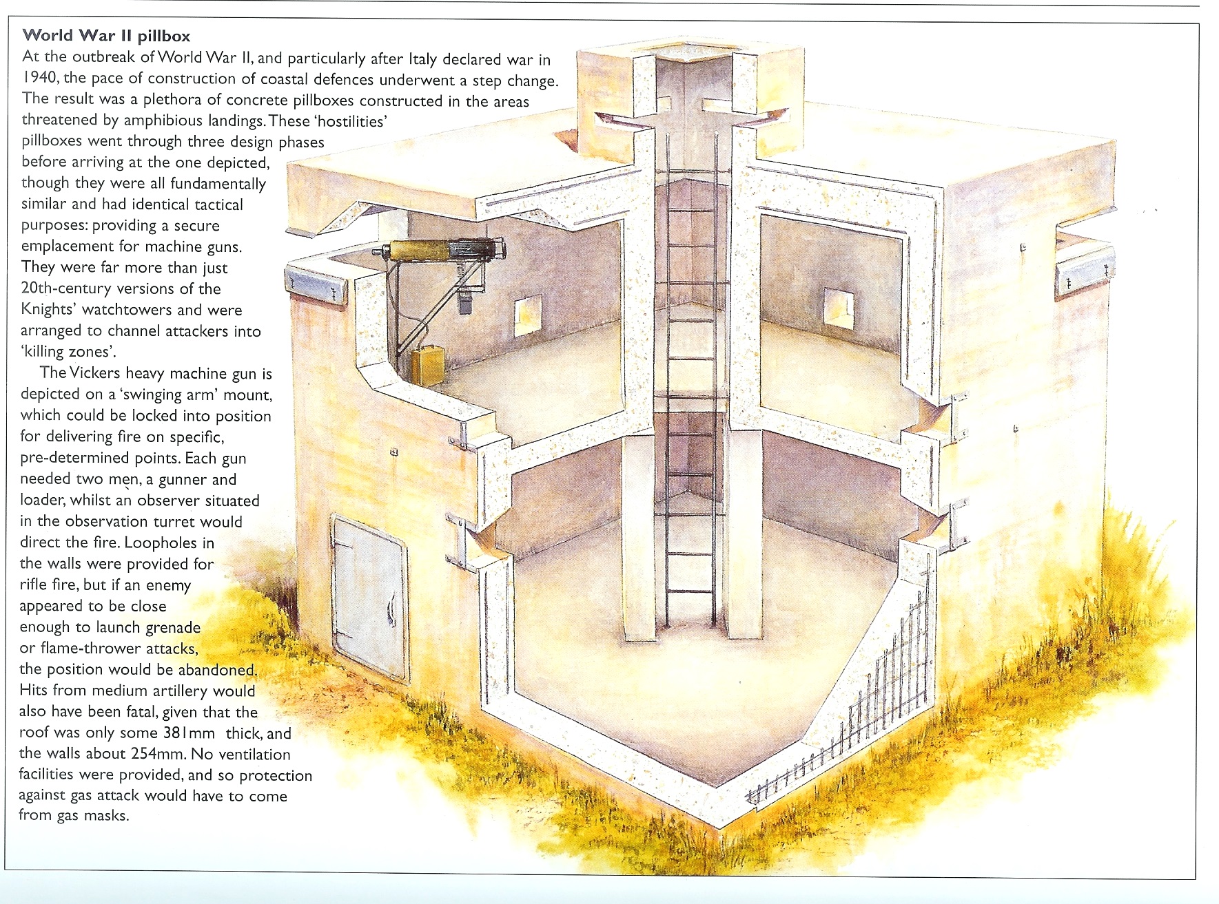
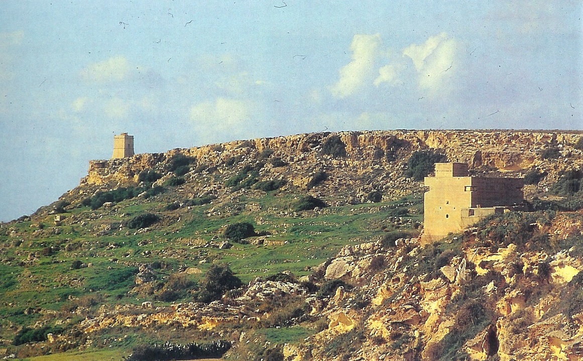
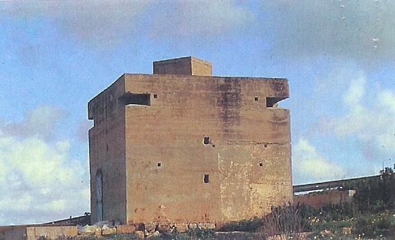
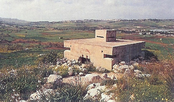
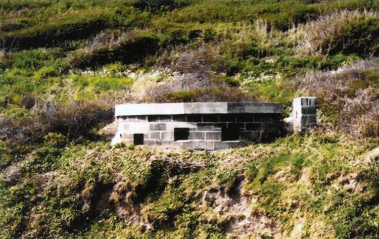
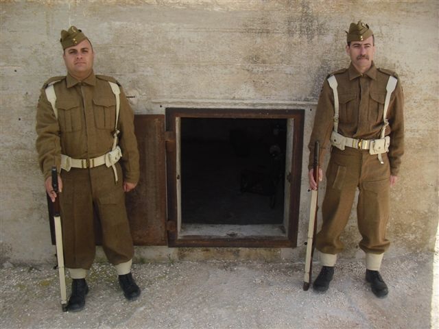
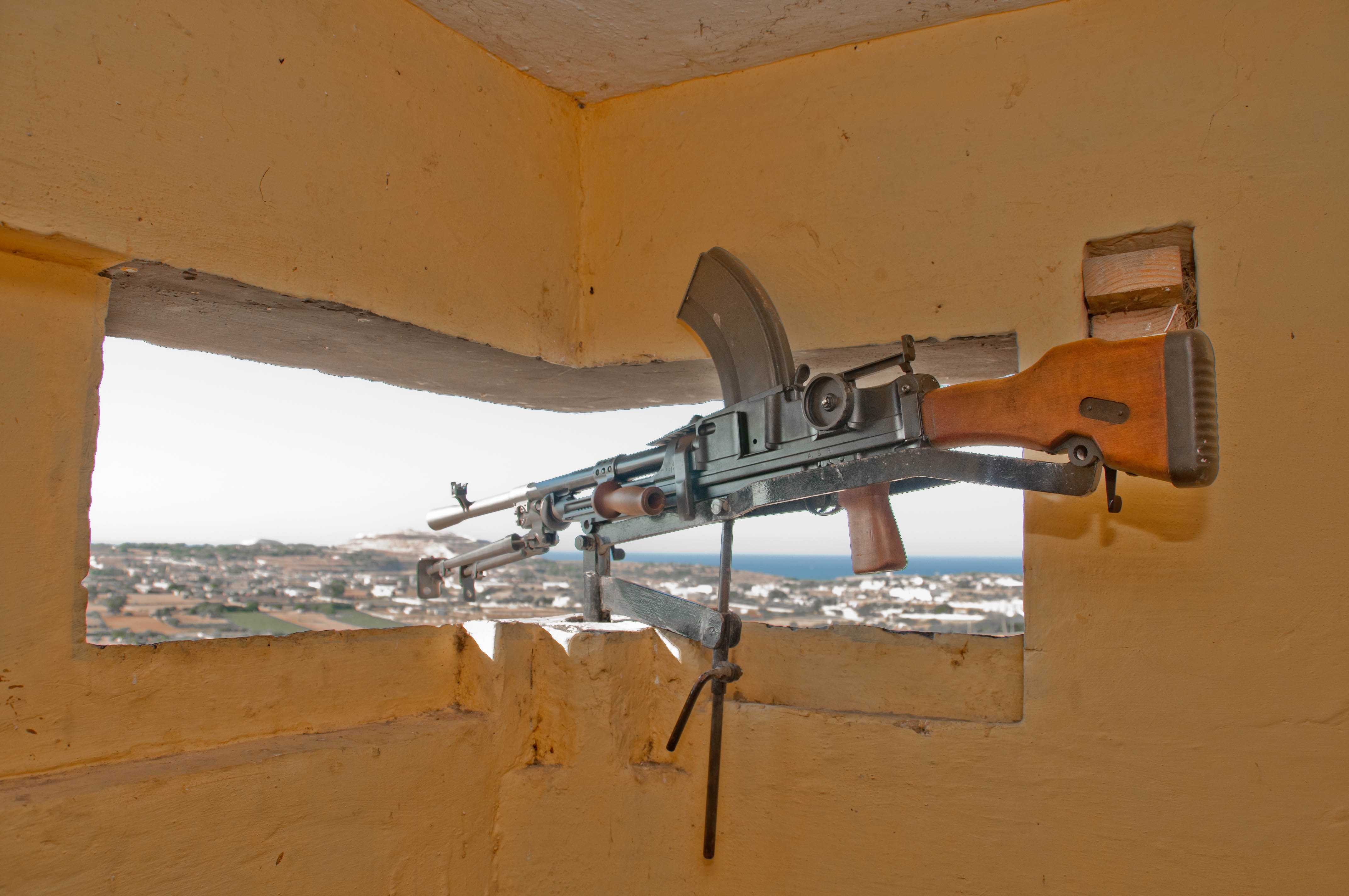
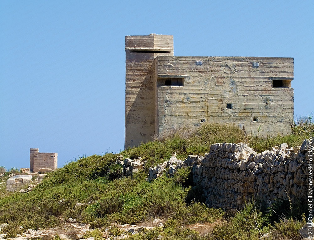
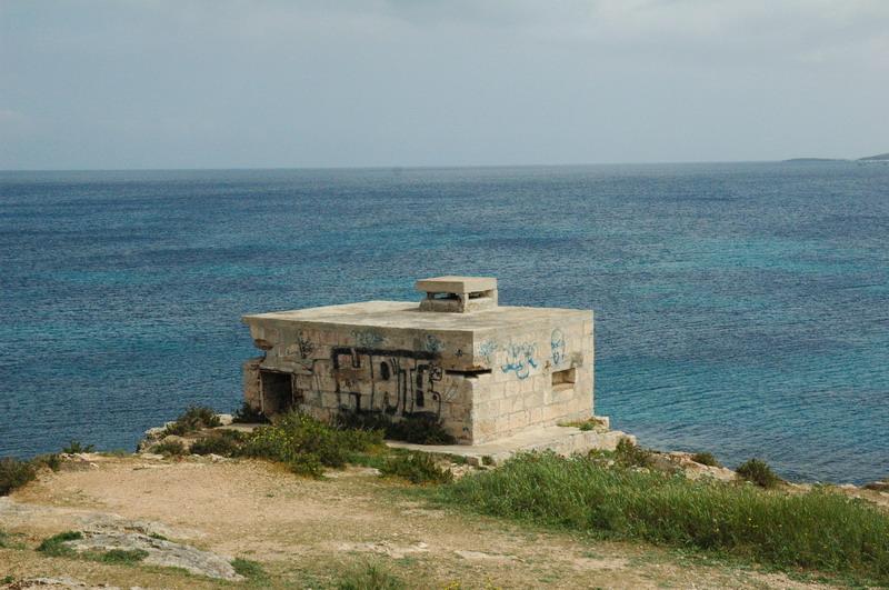
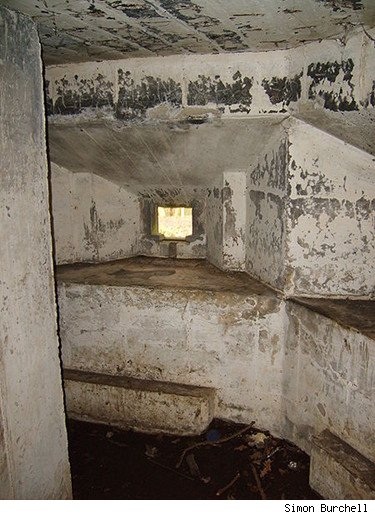

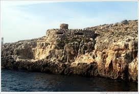
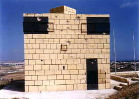
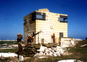
Radar stations during wartime Malta
After several experiments, in December 1935, the British Government decided to install a five-station system called Chain Home (CH), covering approaches to the Thames Estuary. However, the name was immediately changed to RDF, meaning Radio Directing Finding.
In the meantime, as radar technology was in its infancy, in Malta, the British authorities decided to build an early-warning system, the Parabolic Acoustic Mirror known as Il-Widna (ear), constructed at Ta’ San Pietru, Magħtab.
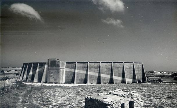
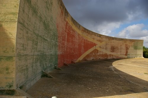
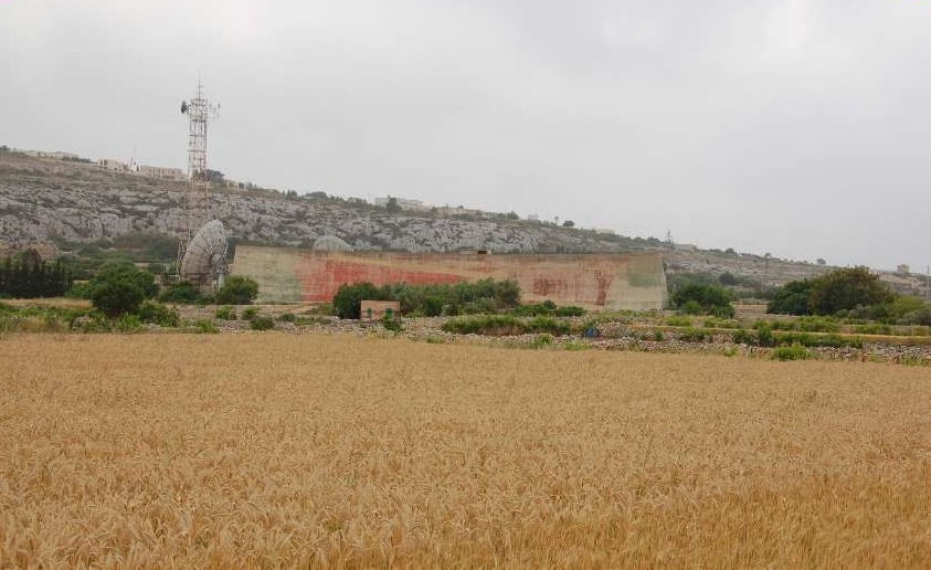
Il-Widna became outdated when the British government decided to install the first RDF in Malta. It is important to say that this was to be the first RDF installed outside the UK.
So, in March 1939 the first Air Ministry Experimental Station (AMES) No. 242 was mounted at Dingli Cliffs. By mid-July 1941 the number of stations was increased by three: No. 501 AMES at Tas-Silġ, No. 502 AMES at Madliena and No. 504 AMES at Dingli too (since Dingli is one of the highest points in Malta). The early RDF stations were Type GL. Mk. I and Mk. II
At this time the name was changed to COL (Chain Overseas Low) stations which had the role of plotting medium to low-flying aircraft, while No. 242 AMES at Dingli was a COH (Chain Overseas High) station which had the capacity of plotting high-flying aircraft.
The information received by the stations, which consisted of the approximate number of approaching aircraft (both Allied and Axis) and their height was passed to the Filter Room at Lascaris War Rooms.
The Filter Room would then pass the information to the plotters in the Operations Room where, on instruction, they would place counters on the grid references on a large map of the Central Mediterranean with Malta in the centre. This information would then pass to the RAF fighter to intercept enemy formations.
For an exact control of RAF fighters intercepting enemy aircraft, a GCI (Ground Control Interception) station was also mounted at Qawra Point as 314 AMES.
More radar stations were afterwards set up: No. 241 AMES at Għar Lapsi (previously installed at Dingli in 1939), 841 AMES at Wardija and at No. 521 at Gozo Giordan Lighthouse. These RDFs consisted of AM.13/14 units.
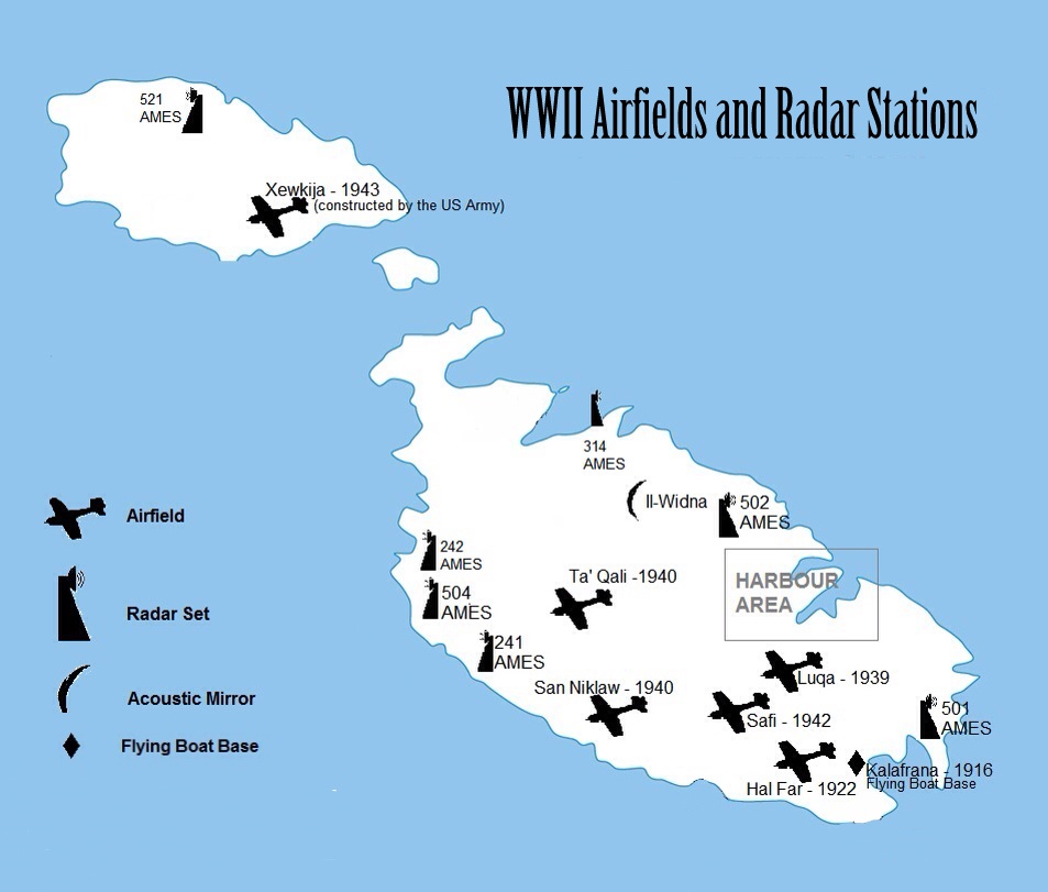
.
 .
.

this page really helped me with my school project. Thank you so much 😀